12/15/2012
Caves and Birds -Brewer Lake
NY
1
5.00
This was supposed to be an easy trip with my buddy Ian last weekend. Due to circumstances beyond our control we postponed it to this weekend. I got an early start and headed in to brewer Lake. It is a relatively short hike in... a gradual uphill the entire way except for the last quarter mile. Easy trail which doubles as a snowmobile trail in winter. I wonder where I will park in the winter. Once at the lake, I began the bushwhack around to the secret campsite. The rocks here make some great caves and overhangs. The firepit has been meticulously maintained as well as the rest of the site. While waiting for Ian to arrive I heard a knocking on the other side of the boulders. I inched closer to see what was making the noise when a decent sized bird flew out towards the lake. I only caught a glimpse until he rotated around the tree trunk from where he landed. His profile was unmistakable as was his color. It was a pileated woodpecker! I have seen them more and more often the last few years. This site must not be used by many as there is plenty of downed firewood close by. The trailhead register shows most people only day hike to the lake. few probably even know about this campsite. My bet is just the locals who use the hidden canoe to get to it. The canoe is gone now, either hidden in a new spot or brought home for the winter. I am certain to carry in my canoe next summer. With a fire going, I began to cook up some bratwurst. I received a text from Ian. Work has delayed him for too long and he won't make it. He was quite disappointed. I finished my dinner and relaxed by the fire. The sun was setting and the air was cooling down quickly. As the day turned to night, the sliver of moon appeared as did the stars. I was hoping to catch a few remnants of the Geminids in the early AM. I went to be early and awoke while it was dark. the sky had turned cloudy and no meteors would be seen. Back in my cocoon, I fell back asleep. The glow of the AM was my sign to arise. A quick cup of cocoa and I packed up.
11/25/2012
Thanksgiving Weekend -Moss Lake and Queer Lake
NY
2
11.00
Thanksgiving is typically experienced traveling across the town, state or country and sometimes to multiple locations. Often people are invited and no one knows who will show up or when, if ever. Some will have to leave early... plans change. Food is incredible. People bring dishes to share, there are often many different libations and in general, there is a lot of food and drink.
Well this Thanksgiving weekend trip had all the above. Starting Thursday AM, George (from hf.com) and I met at the Moss Lake trailhead and hiked around the lake to find a good site for the day. After setting up camp and eating some lunch we decided to scrampble up the rocky North side ridge. This was steep, real steep. The leaf litter made it quite slippery and also hid the broken-ankle-pockets between boulders. After climbing up a few hundered feet and looking over Moss Lake (and catching our breath) we headed back to camp. Dead and down firewood was plentiful and we started a small fire. I heated up some packets of thanskgiving dinner (leftovers from my Wed night turkey dinner) and we drank our own libations. The sun set and the stars appeared as did the bright moon. In an area which gets much summer traffic we had the place to ourselves except for the few day hikers which passed by seemingly unaware of our presence. Morning broke to a blazing red sunrise over the lake. George toyed with his new camera, the shots will certainly come out nicely. We packed up camp and headed out to the Queer Lake trailhead.
The plan was to meet Ian here and then we would hike in to Queer Lake with possibly Erik arriving later. A message from Ian indicating car trouble and letting us know that he wouyld meet us at the campsite. So george and I began our hike in. In not to long we were removing some layers since the day was beginning to warm ... as were we. We stopped and chatted for a while and soon heard voices. Not far behind us was Ian and Erik. We saddled up our unusually heavy packs and all 4 continued on the everchanging terrain of this trail We crossed numerous creeks and hiked up and down ridges for apparently no reason. We soon made it to Queer lake. But as its name suggests, the lake is strange. We needed to hike another mile to get to a point only a few hundred feet away. This was due to the odd shaped shoreline of the lake. At camp we set up, relaxed and the reasons for our heavy packs soon appeared. Erik with a gallon and a half of a good german beer, Ian with turkey, mashed potatoes and gravy along with a few dozen hot dogs and rolls, George with a few bottles of a nice whiskey and enough summer sausage for a small army, and myself with enough steaks that we would have to carry out at least 2 pounds of uneaten beef the next day. Wood here is scarce as the campsite is in a grove of hemlock, so we had to travel a bit to gather some good stuff. We soon had a fire going, beer was flowing and food was being consumed. We barely even noticed the weather had turned sour. It was raining and windy, but we were smiling and joking around. Most likely alcohol induced. At some point in time, no one really knew we were in bed. Erik in the leanto and the other three of us in our hammocks. The overnight weather was a mix of everything mother nature could throw at us. We awoke to a few inches of snow and a chilly temp.
It wasn't until after george and I got a fire going did Erik decide to extricate himself from the warmth of his sleeping bag (either that or his bladder won out) and we heard Ian rustling about. It was later int he AM than we had expected and we discussed the plans for the day. Ian had had a rough night due to his back, so we decided to spend the day and then head out. We cooked up a bunch more of the food and looked at he remaining beer. Concern that we would have to carry out unfinished beer was a depressing thought which vanished when a a couple of day hikers showed up. They were impressed with the steaks cooking on the rocks and although they didn't take advantage of our generosity in that area, they did accept a beer. I suppose they heard our pleadings that we didn't want to carry it out. With full stomachs and the snow again beginning to fall we headed back. It took us quite a bit longer to get out even with our now much lighter packs due to Ian's back injury. But we did eventually make it. Thus ended my annual thanskgiving trip to Queer Lake and my first snow trip of the season. Between the snow, the bright moon, the winds, and Ian's injury it all reminded me of my favorite writer, Robert Service and his well known story the Cremation of Sam McGee.
There are strange things done in the midnight sun
By the men who moil for gold;
The Arctic trails have their secret tales
That would make your blood run cold;
The Northern Lights have seen queer sights,
But the queerest they ever did see
Was that night on the marge of Lake Lebarge
I cremated Sam McGee.
10/21/2012
The Queen of the Woods -East Pine Pond
NY
1
19.00
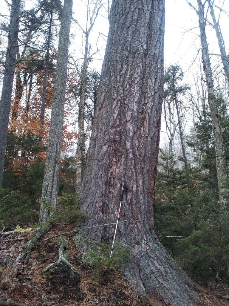
Looking at the 1910 USGS map of the HaDeRondah wilderness shows a "road" which cut through the major "trail" section of the northern zone. Trail is in quotes due to this being a minimal maintenance area so it is not your typical trail. The DEC even posts that significant orienteering skill may be necessary to navigate the area. So I contacted my friend justin who, like me, enjoys bushwhacking and trying to find old trails, and camps. I sent him a simple message, "Look at the 1910 USGS Map for Thendara, do you see what I see?" He replied immediately, "When are we going?" This past weekend would be past peak for the leaves, so it would be easier bushwhacking as all the hobblebush would be clear and out visibility would be at a maximum. We met at the TH at 8:30 and hiked into East Pond where I stayed a few weeks ago. We then continued on to Blackfoot Pond to check it out. It really should be called Blackfoot pondS as there are a couplee small ponds all in the one area. We didn't find a spot to camp that was better than East pond (though we did find a neat waterfall cascading down from the ridgeline towards one of the ponds. Back at East, we setup camp and had lunch. With daybacks we hiked back to the junction and made our way down the little used trail. Recent rains had made the trail quite sloppy and the beavers don't help either. After a mile or so, we looked for any signs of where an old "road" would be. Not seeing anything, and not really expecting to, we took a bearing and headed along the contour of an unnamed hill which the "road" hugged. We moved up and down the contours attempting to find any terrain which a road would have used. A few times we thought we might be on it, but the thought quickly dissipated. we held our bearing for a while and then realized we needed to be a bit farther East, so we took a bearing and headed "down" the contours from which we then recalibrated and followed the contour around the hill. We kept our eye on our compass as we knew our heading would be slowing shifting from south to west. Once we were heading west along the southern shoulder of the hill, we could see the next hill in the distance. At the notch netween the two, the countour would be heading almost due north and this would be our aid to head down the contours to the marshy area. At the notch, a small stream was flowing, which really wasn;t a surprise for this area. We followed it down to the just above the marsh and then stayed the ridge just above the marsh. This was the area in which the old maps showed the camps. Seeing a few promising places, but nothing significant we continued to the next rivulet and crossed it to catch a view of the meadow here. At a high point just above the meadow was a nice vantage point so we climbed up the few feet. One could quickly see why hunters of old would travel and camp here. At this vantage point was also a single old growth White Pine. She majestically stood watch over the meadow. I dubbed her the queen of the woods. We sat beneath her and had a snack. We wondered aloud whether the old hunters also sat here gazing over the meadow awaiting a prized buck and what stories the Queen held.
 We decided to head back as we had less than two hours of sunlight left. We slowly retraced our steps along the area of the old camps looking for any signs. we discovered a cliff face in the area which I am sure the old hunters would have also explored. Back at the notch, we decided to use it as a handrail to the North and back to the "marked" trail. The terrain wasn't easy, but it would be much shorter than our original approach. We hit our mark right where the topo said we would and quickly made our way back to camp. We were both tired and Jenny's (the dog) pads were getting tender. At camp we started a fire, got dinner going and reminisced about our off trail adventure. While we didn't find any signs of manmade history, the cliff and majestic white pine made the trip all worth it.
As the fire slowly burned down, my eyes began to fall and I retired to my hammock. We were hoping to get up before dawn to see the Orionid meteor shower (as the Earth passes through the debris from Halley's comet.) During the night, the sky clouded over and rains came dashing our hopes. On the positive side, we could sleep more. In the AM, we packed up ate and headed out. It was a sunny morning until the last mile and then we encountered a misty rain. Just enough to keep us cool. We had expected rain a significant portion of the trip, but were fortunate in that regard. Back at the car we discussed future trips and headed home.
10/08/2012
There's a fungus amongus -HaDeRonDah Loop North
NY
2
19.50
Original plans for my annual Columbus Day Adventure were cancelled due to my hiking partner bailing due to the weather forecast. Next on my list was the northern portion of the HaDeRonDah Wilderness area near Old Forge, NY. This area is considered a "minimal maintenance area" which means any trail work will only be conducted on a 5 year cycle and will be limited to provide for a more remote wilderness experience. As it turns out, my new plans coincided with another friends plans. So he, his daughter and myself met at the trailhead at 11 Saturday AM. We started out on the old truck trail (it was decomissioned in the 1970's when the firetower was removed). The forecast called for rain, so we had our gear ready. After the first mile we came to a hunter's camp who was out looking for coyotes. we had met him earlier in the parking lot. Soon after we passed by the trail junction which we would be passing through in 2 more days. This trail is to the northern section of the wilderness. After another mile or so we came to an unmarked path. A quick exploration showed it led to another hunter's camp, with a woodpile and canvas wall tent. we continued on to the junction with the trail to Middle Branch lake, which would be our destination for the night.
 Soon after turning off the truck trail, the rain started. Slowly at first, and then heavier. We only had about a mile to the lake though the trail was much rougher than the old rd. Arriving at the leanto, the rain stopped as if on cue. There were 3 gentleman who had day hiked in from the southern trailhead. There were waiting for the rain to stop and after exchanging hellos they were on their way. We set up camp, collected wood and relaxed. A nice fire was built and dinner was made. The fall colors were ablaze across the lake, though we were probably a week or two past the prime as the deep red of the sugar maples were all but gone. They did make for a pretty path to walk upon. I retired early and slept well even through the midnight rain.
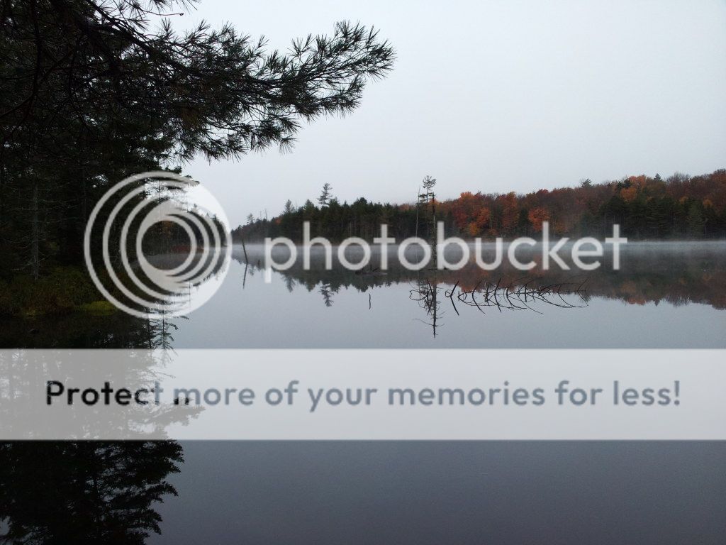
I slept in and waited for my hiking partners to stir as i did not want to disturb them. It wasn't too long before they were up as was I. The mist was rising from the calm lake and there was a crsipness in the air. Roger restarted the fire and we gathered around to enjoy its warmth. A slow breakfast and packing up was met with blue skies and the sun, a harbinger for the weather of the day. We hiked back to the truck trail and then continued on towards Big Otter Lake at which point we would head north into the minimal maintenance area. We soon passed a clearing near which an old road (from 100 years ago) used to traverse.
 I was looking for signs of it; there were none. About a mile and half due north along the banks of the South Inlet creek there were 4 or 5 structures according to the 1910 USGS topographic map. This would be a future off trail adventure. The South Inlet creek was audible at this point, and an old guidebook wrote of a waterfall nearby. We took notice of our location and some landmarks and bushwhacked towards the roar. After 5 minutes we came upon a flume which ended with a 7 foot drop into a pool.
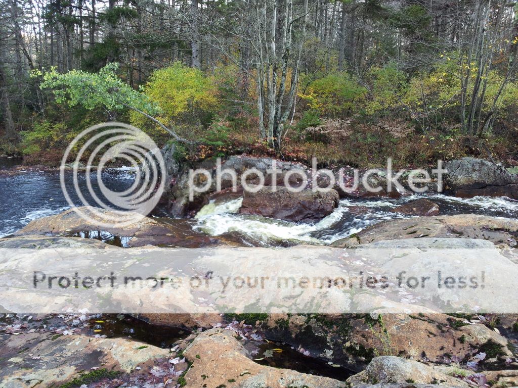 A pile beer cans was visible on the other side of the creek, evidence of others visiting the area; although not as considerate. A few pictures and agreeing nods glad we took the detour prefaced our return to the trail. We continued on until we reached the junction with the Lost Creek Trail. We would now be heading into the great wild. At first it appeared the trail maintenance was recent as fresh clippings were visible as we paralleled the creek (after crossing on the bridge). This maintenance would soon lapse as the trail became difficult to follow in places. we made slow and stead progress enjoying the woods. Also looking for side trails which might lead to the Lake. These were never found, but the view through the woods was good enough this time of year. The wet weather of the past few days in conjunction with the fall season had really erupted the fungal growth in the forest.
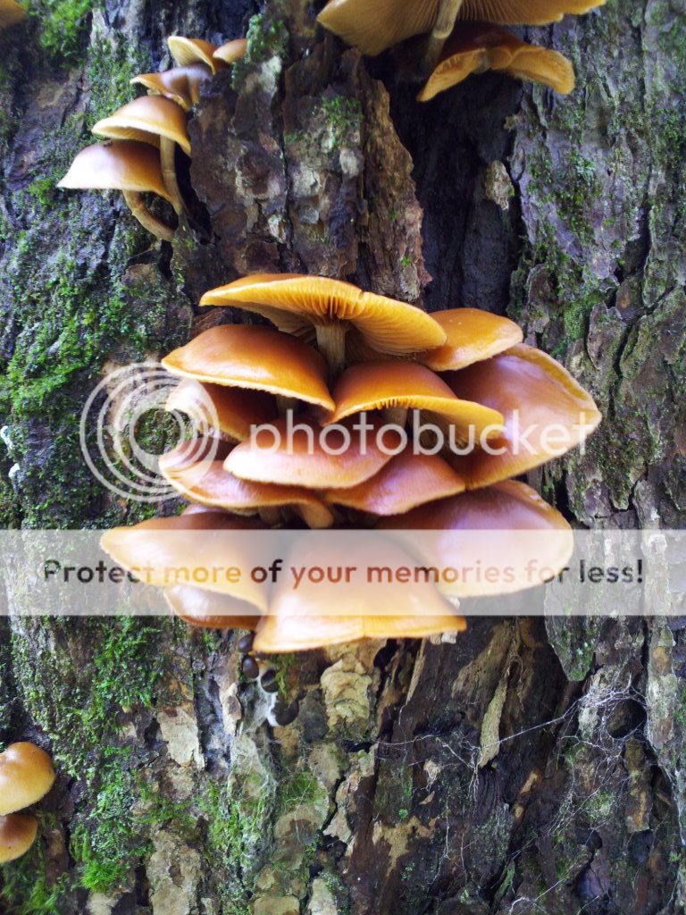
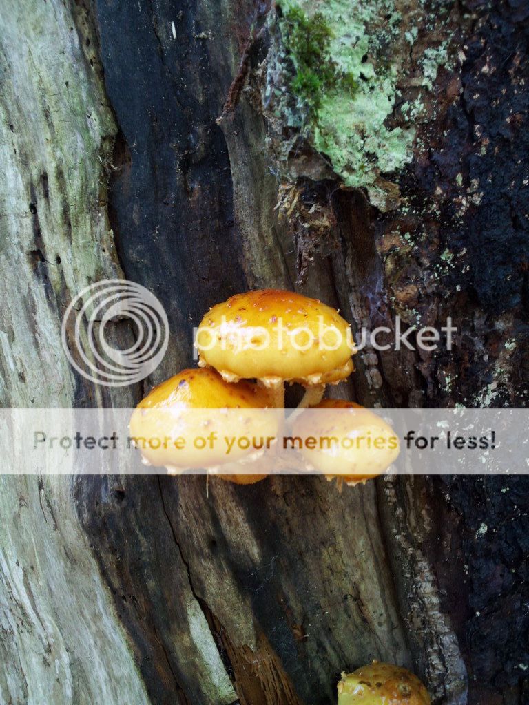
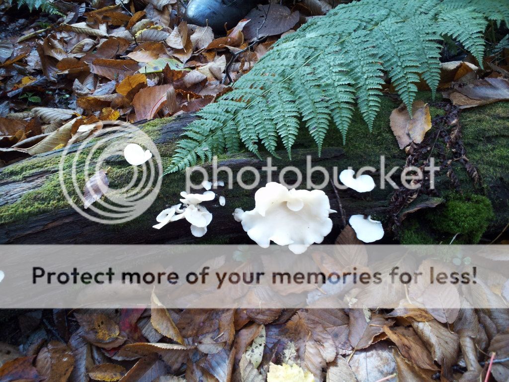 Many species with different colors and shapes added to the dying foliage of the trees. The dichotomy of simultaneous new growth and dying growth was not lost on me. I saw orange and yellow slime molds. Many different gelatinous shelf fungi and others which I know nothing about. We lost the trail a few times due to blowdown but it was soon refound. The junction was missed, we think due to blowdown but we continued on the link trail. I am almost certain i know exactly where the turnoff should have been due to the sound of Lost Creek which the other trail would have crossed soon after the junction. Our new trail soon climbed from the lake's contour and we paralleled the outlet of East Lake. A few rumblings led us to some rapids to explore but nothing as spectacular as the earlier flume we saw. We soon approached the junction for East Pond. We chatted a bit about our itinerary and decided to go to East and check it out as it was only a half mile away. The campsite here was quite nice so we made camp. Soon after the sky turned dark and a gentle but steady rain ensued. This would not cease until about midnight. This area gets little use so wood was plentiful. This area was once used as an outpost for logging operations and some remnants were still visible. other junk was also left behind which we would carry out. someone had stacked some spruce logs into the shape of a platform bench upon which we sat to enjoy our fire. The gentle rain upon the tarps would soon lull us to sleep.
The next morning was met with gray skies but not as nippy as the previous day.
 We had expected temps as low as freezing. The forecast had predicted possible snow, but the temperature made that an impossibility. We packed up our wet things and were soon on our way. At Little Simon Pond, there was no sign of any campsites, but the beaver activity was very apparent. The busy little guy had raised the water level at least 4 feet and below the dam, was a flume over which we would have to jump. This reminded me of the flume near Sand Lake int he 5 ponds wilderness, though not as big of a drop. A fallen tree allowed us a handhold as we made our way over the gushing water. After passing through some scenic vly's, we then climbed to the height of land along which some other new fungi were emerging. Down the backside of the hill, we entered a wetland in which the bog bridging was almost non-existent. A short climb borought us back to the truck trail junction which we had passed two days prior. I asked Claire if she wanted to take the lead. So far all trip she had declined, but since we were back on the "highway" and some encouragement from her dad, she smiled and agreed. We quickly traversed the last 1.5 miles back to our awaiting cars and our trip was complete. Glad I could finally get to this area and also glad to have shared it with others.
addendum: Roger sent me a photo book he had printed of our trip.
09/09/2012
Log Haul to Spruce Lake
ny
1
8.00
Spruce Lake is along the NPT in the southern portion of the West Canada Lakes wilderness. My first time here was with Alanna and we hiked in from the south, about 11 miles. The next few times were during my NPT trips. This one would be quite different. First, we hiked in via the Jessup River rd trailhead making it only 3 miles to the southern leanto. Second difference was we were hauling in a new deacon seat for the second leanto which needed to be moved (else the DEC was going to eliminate it). This log weighed around 350 pounds. We had 10 of us to pull, push, sweat and curse it the distance. At the southern lean2, we loaded it onto the hidden rowboat and then keith and I paddled it to the second leanto site while most of the crew hiked the additional mile to meet us there. We then carried the log up to the new location. A privy hole was dug, a trail cleared to the privy site and the open box privy was put together.A this time, the sky opened up and the expected storm hit. Winds and rain so strong we could hardly see as the ran to the old leanto. We waited out the brunt of the storm and then headed back to the southern leanto. Since I was the only one spending the night, I knew this meant that I would have to come back the next am to return the rowboat to its hiding spot. Back at the first leanto we found a group of 3 women. Two of which had spent the last few days in the interior and this was their final night, the other was a solo hiker just starting on her NPT northbound hike. The rest of the crew headed out and I hung out with the 3. We chatted for a while, made dinner and I crashed early. A few more brief winds came through, but since I set up my hammock on the leward side of a large glacial erratic, I only heard it flap my tarp as it blew over with nary a sway in the hammock. The next morning came quickly as i slept through the night. A quick gulp of water and I headed up the trail to retrieve the rowboat. I paddled it to its hiding spot and then made my way back around from the outlet to camp. Both the paddle across the lake and the hike back were quiet and peaceful; a sharp contrast to the previous day. As I passed close to shore, I spied two of my camp mates filtering water across the cove. Back at camp we all were packing up and preparing to head out in our respective directions. The hike out sure was easier than the hike in. First it was mostly downhill, and second all I had was my pack and wasn't hauling timber.
08/23/2012
Multiple trips in the Adks -Brewer Lake, Gull Lake, and Cedar River
NY
5
28.00
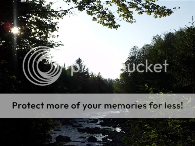
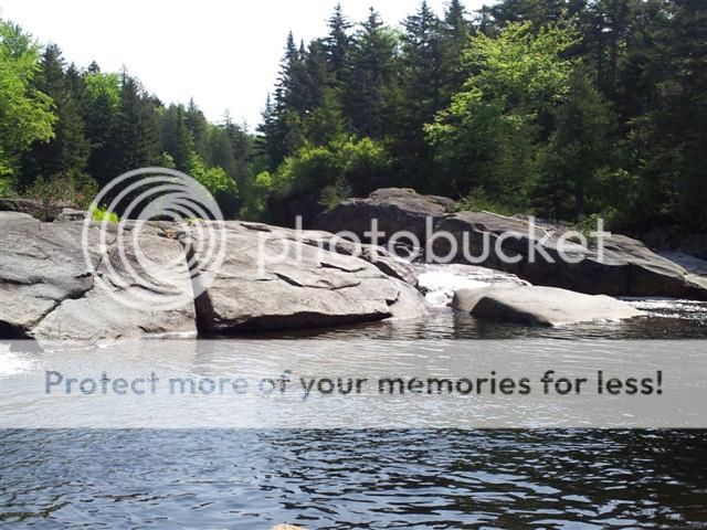
So I left Fri at noon for the Adirondacks. The late start was due to the storm passing through. I wanted to give it a chance to get ahead of me. I don't mind hiking in the rain, I just hate starting in it. At the trailhead, I loaded up with one days rations as I would just be spending the night before returning to the car to head to a different trail. The trail was well worn and wide, much more so than expected. It winded up the hill and then doubled back before making the turn towards Brewer Lake, my destination. I brought in fishing gear as this is a populr spot for locals and who knows the better fishing spots than the locals. As the lake came into view, I could see a few aluminum rowboats stacked upon each other. Stashed boats in the adirondacks were very common many years ago but seem to be either less common or more hidden as they are technically illegal (either considered trash or storage of property on State land.) Some people also seem to get a kick out of shooting holes into them, making them useless as was the case for one of the boats. a small fire ring also indicated the spot was used for camping. I hiked around the west side of the lake to explore. As I neared a swampy bay, a rock outcropping made a nice sunny spot which appeared to be a popular place (noted by some trash) for swimming. Back at the campsite, I set up my hammock and began to collect some wood. During which, I stumbled across a hidden canoe in the bush. Using the broken paddle I made a quick circle near the campsite and cast my line a few times with no luck. Back at camp, I made dinner and darkness soon came. The fire crackled as I fell asleep.
Morning was met with a fog covered lake. A quick cup of coffee and I was back in the canoe. Some fishing and some exploring. The rocks on the other side of the lake looked inviting for both. I fished first with no luck and then spotted what appeared to be a nice landing spot. A very nice campsite appeared in the woods above the lake. will have to visit again. Not sure if the canoe will still be there though. It was only 2.5 miles in so bringing in my own wouldn't be much trouble especially with the easy trail. Back at camp, I packed up as I was meeting the meetup group at a different trailhead at noon.
I stopped for a real breakfast on my way at the White Lake Inn. Noting I would be early, I didn't rush. I figured I could also explore the area right around the trailhead as well. As I approached the parking lot, it was full. I have only see this on lean2rescue trips. Fortunately my crew was already there waiting for me. I was early but they were even earlier. After some introductions (2 of them were new to the meetup), Kim passed along salutations from a mutual friend, another hiker. Strange coincidence. The hike in would be along the footpath instead of the jeep road so we could stop and look at Bear Creek on the way in. We made a stop at the site of the old bridge and I reminded myself (again) that I need to check out where this old trail used to go. We soon recrossed the jeep trail and made the ascent to the lake. The trail register showed a few people also had our destination so we were surprised when we arrived to a vacant campsite. Noise from across the lake at the private inholding soon gave away the destination of the others who preceded us. We made camp and just relaxed. A few casts into the water yielded no results though a few minnows were interested in my lure. Since the lake was only 4.5 miles in, we slept in. A relaxing, slow hike out on the Chub pond trail would complete the loop. While we made our way around the western side of the lake I remembered the last time I was here bushwhacking almost the entire circumference. Back at the car, we decided to lunch at the diner. After lunch, we said our farewells and I headed up to the next trailhead where I would meet ian the next AM.
On the way I stopped to check out a few trailheads for future exploration. After a hellish drive along a dirst road I finally arrived at Wakely Dam. I left a note on my car for Ian and I headed up the NorthVille Placid Trail. After a brief 2.5 miles I reached the Cedar River Flow campsite where I have lunched almost every time I have hiked the trail. This time, it would be my bed for the night. Setting up the hammock and gathering wood and water took no time at all and soon I was relaxing by the fire. A dead spruce provided some wood to be carved and I soon had a wooden arrowhead which I fastened some spruce root to make a necklace of sorts. The night came and went and I found myself again whittling another piece of wood as I waited for my hiking partner for the next few days. I soon heard the sound of a paddle and a red canoe with a friendly couple made shore. After some pleasant introductions, we chatted for a while as we watched the clouds moving in. They set up their tarp and I re-attached mine. The rains soon came as expected. Not hard, but steady. A few hikers came by and asked how far to Wakely Dam. My answer of 2.5 miles was accentuated by a crack of thunder. The two ladies commented to each other they had better make haste. The storm soon subsided and the sun poked through the clouds. Like is said in many areas, if you don't like the weather in the adirondacks, wait 5 minutes. About an hour later, Ian showed up. He was grumpy due to car issues. The woods would cheer him up I hoped.
I packed up my things as he got some water from the flow. We headed down the NPT towards the Carry Leanto. We noted the side trails to Little Moose Lake which was a possible destination on our agenda as we made the loop around the W.Canada Lakes. At the leanto, a thru hiker named Travis was there. He had been on the trail for a few days and had not seen many others. He was greatful for the company, though disappointed neither of us had a cigarette. Hiking the trail was supposed to help him quit. As it was approaching dinner time, Ian and I headed off to the Colvin Brook leanto which was still about 2 miles away. The trail was still wet from the rain and this section pushed through some weedy meadow areas, reminders of the days when logging camps and hunting camps dotted the area. The meadows were interrupted by tunnels of small spruce growing tightly together. When the trail is cut through these stands it is quite pretty and an enjoyable walk. Not so much when bushwhacking and trying to push through. We soon emerged from one of these tunnels to the sound of the Cedar River across which was our destination. We rock hopped across the shallows and made camp. We started a fire to dry out our feet and pant legs and made dinner. As it was getting late, cleanup was in the dark. Ian turned on his phone to check the time and then he saw the text from his wife requesting he get home asap. Well Ian had been getting into a better mood while hiking, but this put him over the edge and his headlamp became multiple pieces as it hit the back of the leanto. After he calmed down a bit, I said lets just enjoy the night and tomorrows hike as nothing can be done right now. Accept the things you cannot change and whatnot.
Since the hike out would be short, we slept in. After a relaxing breakfast and slow packing up, my two friends from the red canoe showed up. They took a day hike and happened upon us. Some more conversation ensued and we exchanged emails as Rupert (WoodTroll) was interested in joining lean2rescue. His wife also doesn't let him hike/camp solo so I now have another potential trail partner. We left them to explore the area and we headed out. Since it was still early, we took one of the side trails to Little Moose, we both had veto power to turn around at any point. The trail gave way to an old road used by the private club before the land was deeded to the State. Easy hiking and the wildflowers which were filling in the road and old driveways were stunning. Blackberries and red raspberries lined the path. we reached the point where the trail was interrupted by a beaver dam and we turned back to find a path to the lake. At a clearing, we found the remains of old tread which headed in the direction of the lake. We pushed through some blowdown and a few fern fields, a piece of surveyors tape caught our eye and we followed the direction it pointed until the lake came into view. We were quite high above it in a dense spruce forest and the climb down would take time, not too mention the climb up. We decided that we had seen the lake and we would have to return when we had time to properly explore. Heading back out went quick enough and we soon were back to our cars. I decided to camp that night near the dam at one of the driveup campsites. Ian headed back home and I walked across the dam. At the first site was Travis, the thru-hiker we met the previous day at the Carry leanto. He hadn't made it too far and was obviously hurting and morale was low. I joined him at the site and we had dinner and chatted until sundown. I offered him a ride into town to resupply and get a motel to rest up. He was planning on quitting the trail, but by the time we finally found him a motel he was reconsidering and would re-evaluate how he felt the next day. I wished him well and when he offered to compensate me for the ride, I told him to pay it forward. We bid farewell and I was on my way home.
07/07/2012
Up the Oswegatchie and back.
NY
2
33.00
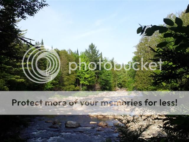
Departed at 6;30 am to reach the put-in by 11. Paddled hard for the first hour; chris seemed to be on a mission. By noon, we had reached high rock and had a snack (me, I had lunch). We soon were on our way on the winding river. We passed by a few other paddlers, all coming downstream. Except for them, the river seemed empty. We stopped at the Cage Lake Springhole leanto for a rest and stretch of our legs. A few rapids to navigate and a couple of beaver dams later we got to High Falls and made camp. A nice smokey fire to rid the bugs and a hearty vegetable stew as the sun set closed the book for a great first day.
I awoke at 5, as did Chris, but I decided to get a few more winks in. I finally emerged from my hammock at 6:30 and we readied breakfast. Sausage, French toast, coffee and juice. By nine we had made the portage above the falls and went to the other side to check out the other leanto on the west side of the river. After a brief visit, we headed upstream. Local intel revealed this section would be a mass of blowdown and beaver dams. The intel was spot on. We laughed at campsite #10 was also the same as the number of beaver dams we had to climb over to get there. We also had logs to paddle under, climb over, lift over, drag through, etc... We lost count of the beaver dams by then. We stopped for a late lunch on a weedy island in the middle of the river. Two hours later and countless more beaver dams, 15 miles on the river from where we put in but only 7 miles as the crow flies we turned to head back to camp at site #11, known as Camp Johnny a former lumber camp site which also has an old trail from it running northeast to Nicks Pond and then to cowhorn junction. A remnant of this trail was still visible as it headed out of camp into the marsh. We made camp and having paddled close to 20 miles in the last two days we were oddly not hungy. We decided to forego our planned dinner and just eat our leftover lunch fixins. I was in the hammock soon after sunset and fell alseep listening to the skeeters buzzing just outside the netting.
With a 10 mile downstream paddle, and having navigated most of the beaver dams and blowdown the last 5 miles (for the second time) we had about 7 beaver dams, and at least on major log jam left to cross before we reached high falls. We figured we would make it back to the car by 3pm. The sky was overcast and a slight drizzle was hardly noticeable but at least we weren't being baked by the sun like the previous 2 days. We got to high falls rather quickly, made the portage and then began to fly through what was relative open water. A few scarce dams, and rapids to navigate and line but compared to abpove the falls, this was a walk in the park. We actually stayed in the canoe for over 3 miles at one point. At Griffins rapids leanto we decided to cook dinner from the previous night and take long break. A few canoes made there way upstream as we ate and we were soon on our way ourselves. Less than a hour later we passed high rock and waved to the gentleman enjoying the view. A little more than a hour later we were back at the car. It was 3:15pm. We spent 22 hours paddling (including breaks) to cover 33 miles, passing by 4 leantos and 32 other marked campsites, and dragged over more beaver dams than there are stars in the sky both up and back.
From Chris' notes:
Thursday total was 12.3 miles in 7 hours. 1.1 mile of which was accumulated at High Falls with my walking around, our going out to look for the other lean to, and just general picking up of distance when sitting still. And between lunch at High Rock and the time at High Falls before I turned off the GPS, it was about 65 min. So the net paddling for Thursday was about 11.2 miles in 5:55.
Friday total was 7 miles in 7:50. 0.2 of which was accumulated at High Falls looking at the other Lean To and when stopped for lunch. And the time for those things was about 60 min. So the net paddling for Friday was about 6.8 miles in 6:50.
Saturday total was 13.2 miles in 7:15. 0.2 miles were accumulated portaging around High Falls, and 0.4 miles were accumulated when we stopped for lunch. And between portaging around High Falls, and stoping for lunch we were not paddling for 90 min. So the net paddling for Saturday was about 12.6 miles in 5:45.
I think we were within a mile of the headwaters carry when we turned around. But, based on our speed for the previous 0.6 mile (from where we stopped for lunch), it would have taken us about 75 min to get there, and another 75 min to get back. (For reference purposes, it took us almost that same amount of time to get back to site 11 from where we turned around. (2:20)
07/02/2012
BushWhackin' thru spruce he!! -Cedar Lakes
NY
2
12.60
All of my journal entries list trail miles while backpacking and do not include the exploring miles during the days. This one is no different in that respect. The biggest difference is in regards to a another aspect. This time our exploring took us off trail for a number of miles. First in search of French Louie's cave (again). While we knew the location, getting there is half the fun since it is a bushwhack though the bogs, woods and cliffs. depending on wetness and growth, one must take different routes. since this was a drier time of year and the witchhopple hadn't grown in to full size yet, we took the due western approach. Unfortunately the terrain pulled us to the North and we ended up on the summit of cobble Hill which was directly above the caves. This meant either a technical rappel down, or pushing through the spruce growth. Since we had no climbing gear with us, and being somewhat smart we chose the more painful option. After a quarter mile of spruce hell we finally got below the growth and and cliffs and then made our way around the ridge to the cave. After a relaxing lunch and a visit to the spring (which was dry), we headed out. This time taking a bearing of 130* and going straight out of the cave to the NPT. This time we only had a short section of spruce hell to navigate through. We said our farewells to Brandon, the AFR whom Ian and I met last summer. The DEC intern radioed in to Brandon to let him know we were int he area and to meet us at the wgon wheel campsite to go visit the cave. I found it odd that Brandon never went there at all last summer having spent at least 40 nights out in the west canada lakes wilderness. Anyway, so Glenn, Ian, Sheldon and I headed back to camp and stopped at the good spring on the way. Ian made himself dinner while we all chatted. Ian headed home, Glenn and I decided we didn't have enough torture through the spruce so we decided to bushwhack around beaver Pond in search of canoe landing spots. we first took the Lost Pond trail for a bit and then floowed a drainage into Beaver Pond. Around the shoreline it was not possible to walk, so we pushed through the forest just off the shoreline. it was thick spruce. we covered about a mile through this until we came to a bog which we crossed and then re-entered spruce hell again. As it was starting to get late and we didn't want to be stuck in this mess after dark, we took a compass heading and went due east until we hit the trail. We explored to the North a bit more until we hit the beaver dam and then headed back to camp along the trail. we figure the better way to explore that shoreline would be by canoe. I guess we will save that for s future trip.
Back at camp, we ate a late dinner and then crashed. A lazy morning and we packed up. bid farewell to Glenn as he headed towards wakely dam and us towards pillsbury mt. a few hours later we were back at the car.
06/24/2012
Hail! to the trail -Chub Pond via Stone Dam Trail
NY
1
14.50
Typical June in the Adirondacks; hot, humid and buggy. We started down the Stone Dam Trail late Saturday AM. Chris and I have been talking about this trail for years. In the past, hence its name, an old lumber camp existed on Stone Dam Pond. One of our goals was to bushwhack to the former site to see what we could see. In the future, this trail will likely become part of the NCT as the first portion which enters the Adirondack Preserve.
The trail began as a well maintained footpath, complete with small bridges spanning the common streams running through the adks. We soon came upon Little Woodhull creek and the bridge crossing it. While enjoying the view, the breeze and the sounds of the rushing water we noticed the tannins in the water giving it a light tea like hue. Memories of other lakes, ponds and streams stained brown came flooding back.
Back on the trail we eventually could see Stone Dam Pond through the trees. we would be soon descending and then trying to find a way through the marshy areas surrounding the pond to the old camp. As we circled around a marshy area, having left the marked trail a few hundred feet back we soon we pushing through some thick growth, After a while we discovered we chose the wrong point of entry and doubled back to find a new one. The second was not much easier to move through than the first, but after navigating a wetter section we were much closer to our target so pushing through the gnarly spruce was obviously a necessity. we hugged the shore of the peninsula as it seemed easier to get through, though wetter. Soon we came upon thr old camp. A trash pile of old glassware, some rusty stove pieces and cans. Slightly above this spot we found pots and pans in the tree and the remains of an ice-box. The area had since grown in so thick, no one could possible camp here anymore. While I was glad we finally checked this one of our list, I knew it would be unlikely I would ever return.
We pushed back through the growth, this time heading straight back towards the trail. Back on the trail we checked our water and made plans to stop and eat lunch at the next good spot. At the top of a rise, we found some logs which would make a good spot to sit and eat. No sooner had we finished eating, the sky turned dark and we could heard thunder in the distance. A pop-up thunderstorm had arrived. We knew it was a possibility but were hoping for the best. A light rain turned heavy as we contemplated pushing through the next mile to our campsite, or hunker down and wait. When the hail stones began to pelt us, our decision was made. We readied the tarp, and sat underneath watching the rain and hail make puddles and pile below the drip edge of the tarp. It wasn't too long before the sun began to peek through and the birds (and bugs) returned. Knowing it was a possibility for another storm to hit us, we figured we should at least move a bit before that happens.
While it did rain a bit more, no storms would come through until much later. However, just s I crested rise in the trail I startled (and was startled by) a young bear. He scampered into the woods and out of sight without making any fuss or sound. Within half an hour we came to the flooded beaver section typical of the adks. It always humors me to see trail markers in the middle of a beaver pond. We followed the reroute alongside the flow until we reached camp. We set up, relaxed. And watched the wildlife in the area: hare, pheseant, chipmunks and numerous birds. The hare was enamored with both my hammock and Chris' tent. he only sniffed at my suspension straps, but decided to wander inside Chris' vestibule. A curious little bugger. More rains came and went. A small fire and dinner capped off the day.
We all slept well and the uneventful morning continued as we hiked back out the way we came, skipping the off trail portion this time. I am always happy to be out in the woods. The hail and the bear made this adventure more unique. However, it is unlikely I will ever return to this trail except to rehike it when the NCT uses a portion of it.
05/26/2012
Circumnavigating the Seward Range
NY
2
30.00
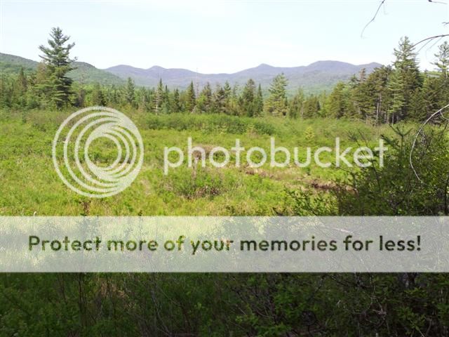
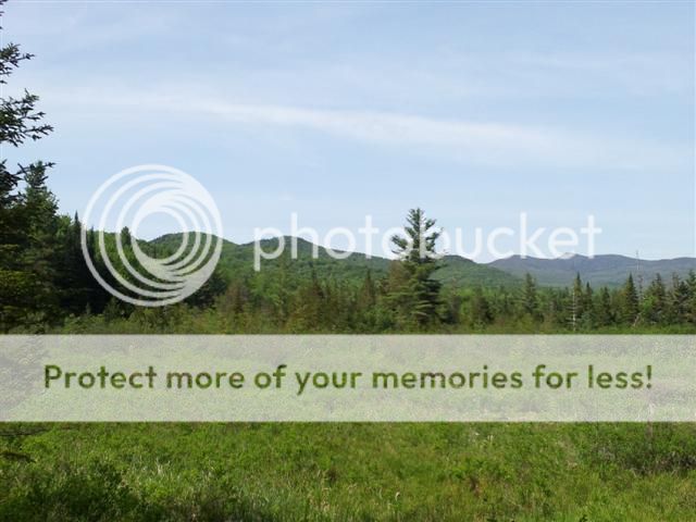
Many people hike up mountains to see the views from the top. I am more of a backpacker than a peakpagger so this trip while in the high peaks region of the the Adirondacks did not involve bagging any peaks. Instead we hiked around the range, a 30 mile loop. While there were no views from the top, we still had views. Some of which the many day trippers bagging the peaks would miss, one of whom in the parking lot said once he bagged these he wasn't ever coming back. Too bad; he is missing out on the Cold River, one of the most spectacular rivers in NY. It is designated a Scenic Wild river and was also the home to the famous hermit of the Adirondacks, Noah Rondeaux whose hermitage was on the Cold River.
The hike started in the late morning of the Saturday before memorial day. the plan was to hike from the Seward lot on Coreys Rd to Cold River #3 leanto by way of Calkins Brook. This would be an easy 10.5 miles as it was almost entirely downhill and on a horse trail. The trail had seen its share of wear from the horses, but most noticeable was the damage from Hurricane Irene (the storm which destroyed the dam at Duck Hole and severely damaged Marcy Dam). The damage to the trail was seen at the bridges of which many were knocked off their abutments, the earth having washed away in the massive water surge. While the bridges were still passable by hikers, no horse would be able to climb down and over the damage to reach the other side. The horse drawn carts would definitely be turned back.
We soon arrived the Calkins Brook leantos which are often used for equestrian gatherings. This was the site of an old logging camp, common in this area. Rusty pieces of iron and graded areas are the few remnants of these historic sites (as are the trails which were once roads a hundred years ago). After a snack we continued south paralleling the Raquette River to the west. we approached a large beaver meadow from which we could the see the range to the east. By tomorrow evening, we would be on the other side of this range.
We passed by the trail to Latham Pond and noticed some scuff marks along the rocks. These were new scrapings from someone's royalex canoe (or kayak). We reminded ourselves that a future trip should take extra days just for time to explore these other gems. At the junction for the horse ford over the river, we turned to point upstream of the river (we were still a quarter mile from the actual river). We soon reached our destination for the night, Cold River #3 leanto. This spot is where I had stayed while hiking south on the Northville Placid Trail last summer.
We set up camp and had dinner. The sun set as did our eyes.
Sunday, I awoke like usual at 5am. Daylight had returned but I was warm and comfy in my hammock. The sound of the river rapids soon had me back asleep. I next stirred at 7 at which time my bladder would not let me enjoy the confines of my bed. Ian like to sleep in and we had the entire day ahead of us so I make some tea and enjoyed the serenity of the river.
I noticed some movement in the trees and when I stood to look, a deer snorted and lept away brandishing his white tail as he disappeared. Ian arose soon after and we were then on our way.
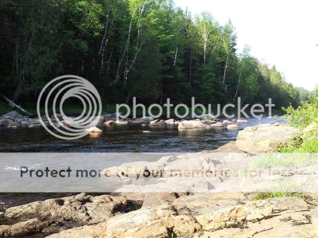
This day would be walking upstream of the cold river with it in view for almost 8 miles. With a careful eye, we would notice signs of old logging operations. Nothing more than graded areas which have now since overgrown. We startled a bird and her chicks. The young went one way, and mom the other. She was obviously distraught being separated so we quickly passed through. At the Seward Leanto, we took in the view of Miller's Falls.
This is a popular spot for NPT hikers to take a break and swim in the cold River. The past two times I had been here I had breakfast on the rocks while soaking my feet. I recalled exactly what I had eaten on those trips as the other memories also returned. It is amazing how a location can conjure up old memories so vividly. Next would be Ouluska Pass leanto and then the hermitage. The trail now had become a series of small ups and downs as we crossed numerous feeder streams which originated on the mountains to the north. Crossing one of the few named ones, Seward Brook signified we were at the Ouluska pass leanto. Every time I am here the bugs are horrid, this time would be no exception. Ian was hungry so while he made himself a snack, I made a smudge fire to keep the skeeters at bay. A twiggy fire with a rotting chunk did nicely. After filling up our water bottles (and Ians stomach) we were pressed on to the hermitage. At the time, the self-proclaimed "Mayor of Cold River", Noah Rondeaux had some structures here, one of which is in the Adirondack Museum. Now all that remains is a grown in clearing, a plaque and old metal pieces piled up by hikers who explored the area. There is also quite a large "trash pile" behind on the large rocks which was apparently Noah's landfill from the time he lived at the sire (1912-1950 according to the plaque). We humans sure do create a lot of garbage. As it was just a little bit past noon, we decided to make the planned shorter day into the longer one and continue all the way to Camp #4 which would leave us 6.5 miles from our waiting cars. From here we needed to hike a little more east and then turn north to the lee side of the range which viewed the previous day. This would also be almost exclusively uphill (as was the entire morning since we were hiking upstream).
Simply gaining elevation wasn't the only obstacle. The entire trip so far was on either the horse trail or the Northville Placid Trail, both of which are well maintained albeit for an Adirondack trail in a wilderness area. This portion was also in quite good shape excapt for the part where a beaver had decided to dam up a stream and create a nice swimming hole for himself. But by so doing flooded the trail.
Ironically, this is a typical view of the NPT but while on the NPT it was gloriously dry. I am sure the W. Canada Lake Wilderness is its typical self though. I will find out at the end of next month when i go visit French Louies Cave again.
Anyway, back to the old truck trail up to Camp #4. while we climbing, we could see the Seward Range through the trees. of course this was the opposite side of the range from yesterday. Upon reaching the maximum height of the trail we began our descent. By this time I was running on fumes and looking forward to dinner. We passed the spring which the forest ranged had showed me a few years ago. it has since been marked. A quarter mile left to camp. As we approached we smelled smoke and saw the flicker of a flame. Not a surprise as many use this a base camp for climbing the range. There were three groups of twos scattered around. Being a former lumber camp, there was plenty of room. I hung my hammock and Ian wavered on whether to continue on. Since his kids were in the parade the next day he decided to eat dinner and then hike out. It was only another 6.5 miles. After dinner Ian took his leave and I chatted with Joy and Todd? from Albany. I went to bed before the sun and was awake at 5am. A quick change of clothes, packing and water fill up and I was on the trail by 5:30. Nice hiking with the temp in the 50's as opposed to the heat of the middle of the day. No bugs out yet either. The hike out reminded me of those early morning sections on the NPT when I would punch out 5+ miles before breakfast. Arrived at the car at 7:38. Emily would be glad I would get home at a decent hour.
05/06/2012
Supermoon on the Oswegatchie
ny
1
11.00
The weekend was expected to be super weather, with super friends and a super moon. (A full moon at its perigee.) There were 4 distinct "groups" on this trip. Rich and Todd would be hiking the Cranberry Lake 50 trail clockwise spending the first night at the "High Rock campsite". Jerry, Toby, Lindy, Shawn, and Laura would be starting in Wanakena and taking the High Falls Trail to the campsite. Glen, who started clockwise on the Cranberry Lake 50 trail Wednesday was planning to meet us at High Rock for his final night. And myself who would paddling the Oswegatchie River upstream to meet all at High Rock. Friday night we received an email from Glen, he finished early. Good for him, though the fresh fruit I packed as a surprise would be eaten by others. Jerry et al decided to hike in the same way as Rich and Todd even though it meant going back the way they came. Saturday we converged on High rock in the early afternoon. Rich and Todd relaxed for a bit and then decided to do a few more miles as they had another 38 to complete by monday. The rest of us relaxed and enjoyed the day and view. The black flies were around but they weren't biting. Next week will likely be brutal. Tobey and Lindy took my canoe out for paddle while we collected firewood. Though this is a high use area, we were early in the season and the dead wood from the winter snows had not yet been collected in the nearby area. A smoky fire soon dispersed the bugs and dinner was cooked. We chatted until sunsent awaiting the much anticipated moonrise. As a harbinger for the celestial show we would soon appreciate, Venus made herself visible. The moon on the other horizon soon followed. As the sky darkened the moon cast its light over us. The brightness caused significant shadows in the woods. A few sang a line or two of Cat Stevens "Moonshadow". As more stars (and planets) appeared our eyes began to hang heavy. We soon retired to our respective shelters. while no rain was expected, I had the tarp for my hammock in the ready to deploy position so i could enjoy the sky from my place of slumber. I was soon fast alseep and my next moment of consciousness was when the moon had shifted from the east to the west and now shone brightly directly on me. I waved to the supermoon and was soon again fast alseep. I awoke just after sunrise before the rest and made tea down by the river. The brookies were rising for the next hour. Soon the others were awake and the slow steady progression of packing up and breakfast commenced. The paddle downstream took me half the time and I shuttled the others to the other car.
We were sad to have to leave, but we knew we would return.
04/14/2012
Bushwhack 'round BRWF day 2 and 3
NY
1
9.80
It got cold last night. I love my warm down quilt. I am carrying two of them because my friend Ian is considering getting one and wants to try it out. So tonight I will be using my summer weight quilt (JRB Stealth) I should be pushing it beyond the lower limits of its design capabilities. Ian will be using my 3 season (JRB Hudson River) which I used last night. After a long breakfast, ventured down the trail to the jeep rd. This 1.4 miles was almost all downhill so it went quickly. I paused at the jeep rd and noted the campsite usually used only by hunters had started to accumulate cut/split wood for the coming fall. It is situated right next to e spring born stream. Great water out of this.
Passing the jeep trail, the path turned to the west before the junction which would then take me east. At least this time I knew I was going in the wrong direction and it was not only expected, but the correct course. At the junction I headed east and was always looking to my left for the old blue trail. Now some readers are already shaking their heads, but this trail was the preferred trail up until only a few decades ago. Local intel from hunters has apprised me that this trail is obvious until it gets behind Neejer Hill. This and I was on a mile of it back in december as we used a portion of it as a portage trail. The hunters intel was correct, not only was the trail obvious it had been flagged so that it could be followed in the dark. The trail was level and clear all the way to the crossing of Mill Brook. After this, no more flagging and since it entered hardwoods it was not not as clear. However, the old blue markers could still be found in some of the trees. I traveled along the trail slowly, constantly checking with the old markers to be sure I was on the correct path. I soon was on familiar territory from last December. Then the blue trail petered out and the connector to the beginning/end of the portage brought me to water level near what is known as "Coleman Dam". Well, knowing that Ian would be at Bear Lake, and not wanting to be late, I decided to take all marked trails from here to there. This meant backtracking the mile and half west on the old blue trail and then taking the real trail the 3.7 miles to the Bear Lake leanto. Hiking on marked trails is very fast comparably. I figured I would keep an eye out for where the old blue trail intersected. I figured it was at the "trail arrow" sign. These are commonly used when trails are rerouted so as to not confuse travelers. Sure enough, at the arrow the faint trail could still be seen and 50 feet away was an old blue marker in the tree. someday I will have to connect these two ends. The last mile and half to Bear Lake was uneventful, drier than usual especially for this time of year. I filled up with water before climbing the rise to the Leanto. I rested, and awaited Ian. He soon arrived with a heavy pack, burdened also by the extra mile uphill due to the gate still being locked. The torturous weight on his back was soon revealed as he withdrew can after can of heavenly "barley soup". We gathered wood, talked and had a great time until the stars came out. We retired and slept until dawn. I awoke first and was done with breakfast while Ian still snored away. When he eventually got up, the sun was bright and day was already warming up. We packed up slowly and hiked out slowly passing by two groups of hikers coming in for the day. Thus ends day 2 and 3.
04/12/2012
Bushwhack 'round Black River Wild Forest Day 1
NY
1
6.50
For years I have been curious about the "old trails" in the Black River Wild Forest in the Adirondacks. In particular the two which appear on the 1903 topographic but do not appear in the 1958 printing. While these trails have present day counterparts, they traverse the terrain quite differently. A few years ago I tried to find the trail which connect the Gull Lake outlet and Chub Pond by way of south of Buck Pond (the current trail goes north of Buck Pond). The last time I didn't do my research as it was a spur of the moment decision while I was out there. Needless to say while I enjoyed myself, I was never close to where the old trail was supposed to be (this I concluded upon my return and looked at the old map). So back to present, I was armed with the old topo, and having scouted the area numerous times, I believed to know the spot where the old trail and the new trail diverged. This spot has a hidden campsite a few hundred feet in and was likely on the old trail.
The first few miles on the marked trail went quickly. the temp was in the 40's but it was warming up and the sun was shining. behind the hidden campsite was the stream as it showed on the maps. A quick glance both up and downstream and to the hill behind it, I guessed as to where *I* would route the trail. I scurried over to the spot and on the opposite side of the small rivulet was the remnants of a board. It was covered in moss, but part was submerged and one nail was sticking out. This wasn't proof to me of THE old trail, but it was proof of AN old trail. I took a compass bearing to the Southern outlet of Buck Pond and proceeded to climb the hill simultaneously following the bearing and the terrain. Every once in a while I would pass by some flagging tape. Either someone else had done this before, or I was coincidentally passing by a marked spot by hunters. I soon found my way to a dry stream bed. Typical in this area as these are seasonal runoffs. Also typical in this area is how they have historically been used as trails. I followed this as it coincided with my bearing and was soon to the top of the hill overlooking Buck Pond from the West. At this point, the old trail was supposed to junction to Gull Lake and Chub Pond. Besides the bridge remnant, and the dry stream bed there was zero physical evidence of the old trail. since I had already bushwhacked the southside of Buck in years prior, I decided to try to follow the old trail to Gull from this point. I soon passed to the North of Buck, (after dropping to water level to cast a lure a few times with no luck) and intersected the present trail. This was also the spot where Ian and i had found the neat rock formations which formed a small "cave" in the talus rocks. I tool another compass bearing and headed north towards Gull. I traversed the first mile through the open hardwoods quickly enough. I then found myself standing on an obvious old tread. I decided to follow it for a while and made a rookie mistake. I did not pay attention to my compass heading. I suppose the excitement of finding the old trail and my curiosity blunted my decision making. Well, this trail petered out on in a beaver swamp common in this area. I crossed the swamp and entered into spruce tree bushwhack hell. Those little branches grab, catch and poke everything. I still have the nicks and cuts to prove it. Well I soon ventured upon the old trail again and continued to follow it. Well, recall where I said I made a rookie mistake. I soon realized that I was headed in the wrong direction. A quick glance at my compass confirmed my suspicion. These old trails had turned me around and sent me in circles; for all intents and purposes, I was lost. Granted I knew about where I was located, so lost is too strong a term. But within a half mile in any direction I didn't know. It turns out I was not on THE old trail, but was following the ruts carved by ATV use which was common place a few decades ago. These atv tracks would circle around and around. They have since been banned from the forest preserve except on designated roadways.
So I did what one is supposed to do when lost; S.T.O.P. (Stop, Think, Observe, Plan). My plan was to head slightly east of north towards Gull Lake. The only reason slightly east, was the knowledge of a long finger like arm of the lake which I would then need to travel to the south of it. I was trying to avoid as much backtracking. A quick mile through hardwoods, a hundred yards of boggy moss, and a short jaunt through spruce hell and I was at Gull Lake. I only needed to head south a short ways to get around the arm and was soon on the shore opposite of the leanto which would be home for the night. I climbed to higher ground and kept the lake in view to my left and circumnavigated the eastern half of the lake. The last quarter mile was familiar territory as I had explored it in the past. At the leanto, I had a late lunch. I did quite a bit by 2:30PM. I gathered wood, set up camp and relaxed. The loons serenaded me all night. A beaver swam by and did a lone mallard. The stars emerged and I drifted to sleep. Thus ends day 1.
04/01/2012
Meetup at Chub. Hot Damn!
NY
1
9.00
I regularly organize a few backpacking trips annually for the Rochester Hiking Meetup Group. This was one of those trips. Some of the usual suspects attended, and as such some packs were a little heavy on the way in with the "dutch ovens" and "firewood". In the past these two terms have evolved by this group of misfits to reference beer and liquor respectively. Now, we do not over-indulge but a few adult refreshments shared around the campfire certainly can make the evening enjoyable. The drive to the trailhead was uneventful and we were soon in the woods. The trail was expected to be sloppy this time of year. Having been on this many times and some areas included slogging through knee deep mud and muck, I was surprised to see it drier than a typical summer day. Strange weather we have been having undoubtedly is the reason. Since I was not in the front, I could spend my time looking through the forest for signs of old trails and roads to explore. This is one of my usual haunts, and i am always looking for new exploration opportunities. We soon reached the leanto and all quickly set up their tents/hammocks and copious amounts of wood were gathered. Almost simultaneously the fire was lit and a beer was a cracked. keith pulled out a bottle of Hot Damn! cinnamon shnapps and hence the trip name was born. We talked, laughed, ate and drank into the evening until sleepiness overtook us and we retired to our respective evening abodes. This was not until after we remarked about the moon, stars and planets which were poking through the cloudy skies.
In the AM we dillied around as we were in no hurry. Even on the hike out, we had time to explore a few rock formations and located a few cave like areas which would necessitate future time to fully explore. We also located some old hunter campsites hidden in the woods off the trail. A mile away from our cars and the sky began to drop a little snow on us. By the time we were on the road home, we were in a full rainstorm. Timing for the weather could not have been more perfect. Good times, great people... Hot Damn!
03/18/2012
Meet the new Howard Leanto, Same as the Old Howard Leanto
NY
1
6.20
Back in February we delivered the new foundation logs for the Howard leanto which needs to be moved to its new location. This weekend was the dismatle of the old leanto, and carrying the logs to the new site a quarter mile away. Other work necessary was the removal of the old floor, and roof and the claening up of the old site. This would be Ian's first lean2Rescue trip. I picked him up in Speculator at 8am and we drove to the Garden parking lot to begin the hike in. Seasonally warm and the trail which usually would have a foot plus of snow was clear except for a few patches of ice. On the way in, we passed by Marth, another L2R victim, err volunteer who was shuttling debris the 3.1 miles from the old site to the awaiting truck. Another volunteer soon passed us as well. Since the leaves have yet to fill out the trees, the Wolf Jaws, Gothics , Big Slide and few other Adirondack Mts.provided us with an awesome panoramic view as we climbed to the site of the new leanto. Upon arrival, work was already in progress. Many of the logs had already been carried from the old site, so Ian and I dropped our packs and headed to the old site to begin our work. We carried old roofing boards to the JBL about a mile away which would be used as scrap and then back to the new site to finish the assembly of the leanto. We hoisted beams and used 18 inch spikes to secure them together as the leanto began to take shape. Soon the ridge and the front perlin were in palce and some brute force squared it up and we tacked in the logs. The rafters cam enext and then the roof boards. By this time both Ian and myself were on the roof, where Ian would remain for the next 5 hours until the roof was complete. While the roof was assembled , other volunteers were chinking- the oakum into the spaces between the logs, carrying garbage back down the trail, clearing the old site, etc... As I told Ian on the drive up, L2R is organized chaos. No one is really leading, it is organic and the work just gets done. By 6 pm, we were done and the group photo was taken. A few hikers came by and marveled at the new leanto. That morning they had walked by and saw just the four foundation logs. less than 12 hours later the new leanto was completed and the old one dismantled and the site cleared to hide the fact a leanto ever existed in that spot . We headed down the trail just as it was getting dark. Back at "camp" we hung our hammocks and had dinner and celebrated the accomplishment. As the saying goes in Lean2rescue, never underestimate the capabilities of stupid people in large numbers.
03/03/2012
Chub Pond in BRWF
NY
1
9.00
It has been a while since Todd and I hiked together. We recalled a recent trip to Bear Lake, but for the two of us the last one was an aborted climb of the Dix range. Breaking trail in 2 feet of fresh snow was slow going. Anyway, we arrived at the TH just after lunch and noted the snow depth would make snowshoes the logical choice. A few people had signed in for day trips and the snow machines were running on the connector trails. About a mile in, we came across the day hikers. They had turned back due to the snow. It wasn't that deep, but postholing the fresh snow was too tiring. Crossing the footbridges hidden with the snow for us would prove to be a slight problem. Knowing that some of them are in very poor condition, we tried to go very slow over them. Even so, Todd found a broken spot and his foot went through. Of course the snowshoe acted as a hook and extricating him took a few minutes. Fortunately it was only a minor inconvenience and he wasn't in least bit hurt (or wet). With him leading, I was free to explore with my eyes for future bushwhack opportunities and for potential "old roads" used by the loggers at the beginning of the last century. We soon arrived at Chub Pond and took a break. Knowing this was the warmest the trip would be, I opened the sole beer i carried and shared it with Todd. After a quick breather, I went to gather the first round of wood. Todd soon followed and we had a good starter pile going. While the day so far was very pleasant for the time of year, 50's and slightly sunny, we knew this would be changing soon. The forecast called for a fast moving cold front. The afternoon/evening would be met with fierce winds followed by a significant drop in the temp. At this point the winds were just beginning to pick up. We both set up our sleeping area in spots providing natural wind breaks. Todd, just behind a wall of young spruce, and myself in a depression just behind a rise on the windward side. Since I use a hammock, I don't have to worry about runoff. More wood was gathered, prepped and the fire started. We both ate and talked while the winds picked up. There was no need to fan the fire as nature was doing a tremendous job. The fire lasted throughout the evening and we both retired early. Slept great and arose with the sun. The temp was significantly lower as expected but now with little/no wind. I packed up before I headed back to the main site. Todd was already there and heating water for breakfast. A lazy morning for us and we didn't rush. Even so, we were back at the car by 11am.
02/18/2012
Man towing boat at Gull Lake
NY
1
6.20
Sat AM. Jon and Pam and I met Ian at the trailhead on Bear Creek Rd. I haven't backpacked with Jon before and it had been almost two years since Pam and I hiked together. The jeep trail was quiet. Strange since it is a snowmobile trail and it looks like there is enough snow for the machines to run. A few had as evidenced by their tracks. I full expected to have a few machines pass by us between here and the foot trail junction. It wasn't to be, so the 4 of us got to enjoy a quiet leisurely stroll down the snow covered jeep trail until we reached the Gull lake junction 2 miles later.
We turned south to head up hill. In all other seasons this trail is a muddy rutted mess due to illegal atv use from years ago (and still occasional illegal use). But in the winter it is all frozen over and a relatively even walk. The trail continually intersects trickles from springs coming out of the hillside as we climb. At the top, we can see Gull Lake ahead of us, but we need to go another half mile to the East to where we will make camp. So far all we have seen is the scant tracks of a hiker earlier in the week. At camp, Jon, Pam and Ian begin to set up their sleeping arrangement while I go collect round one of wood. I back track down the trail to where I saw a few downed maples off in the distance. I gathered up a few loads and left them on the trail as Pam came and carried them to camp. After I carried the last load to camp, I set up my rig. We took a short hike to see the memorial plaque someone had put on one of the glacial erratics. we then bagen round two of wood gathering with all 4 of us. We quickly brought back a large load. Soon we noticed a figure headed our way from across the lake. A few minutes later, Scott, a grandson of the late owner of the private inholding was introducing himself. A chatty fellow with a slightly odd demeanor although it was possible he was intoxicated as he carried with him a cup of bourbon. Nice enough guy as he helped us break up all the wood and light our fire. We soon had a blaze going and Scott tipped over the rowboat that had been at the site for a few years. he tied a quick shoulder harness and began dragging the boat back to his grandfather's cabin across the lake.
We laughed a bit, ate dinner. Had a nice fire to keep the camp illuminated. It put off quite a bit of heat too. It was worth the walk to gather hardwood instead of the spruce which was abundant nearby. Slep warm thorough the night. Awoke to a sliver of moon just to the east foreshadowing the dawn of the new day. After tossing a few twigs onto the pile of coals, we soon had a morning fire just as the sky across the lake also began to turn orange.
The precursor to the sunrise was extraordinary but was soon blocked by the overcast sky. It was still going to be a nice day and we lamented that we had to leave. from our site to across the lake was the remnants of the tracks made by Scott's snowshoes and the rowboat being dragged behind him. A photo to share was taken to see if anyone could ID those tracks! A quick packing and a gentle stroll down the hill back to the jeep trail and then our awaiting cars. This area is beautiful in winter but not often silent. This was a rare treat.
02/04/2012
Log Haulin' for Howard Leanto
NY
1
6.80
arrived at the Garden Parking Lot at 8am (after a 5.5hr drive) to find it already full. Myself along with other arrivals parked along the centerline as is the practice. Saddled up my gear and met Martha at the register. She is another Lean2Rescue volunteer and her job today was to shuttle volunteers to the overflow lot if needed. After signing in, Rob (Viewseeker) from the adkforum happened to stop by. He was climbing Big Slide today. It would be his #45 of the 46 winter peaks. Last time I saw him was on the Cranberry 50 trail. we chatted a bit, took a photo and he was off. By then, Martha was geared up and could leave her post to head up to the JBL with me. We started up the hill. Just a gradual ascent, but it was icy with about an inch of fresh powder from the previous night. She told of the pulking hell on Friday. I commented it wouldn't be lean2rescue with some sort of hell.
We passed by 2 of the 10 footer logs wrapped in billboard canvas which would need to be brought up to the new site. Before long we met up with the smaller group and dropped packs to go back for the logs. With 5 of us on a log, we dragged it a little ways past our packs (about a quarter mile) and then went back for the second. By the time we got it to the same spot as the first log, the main group had doubled back. They had already moved the two 16 footers another quarter mile ahead. We hooked up to the logs with the extra muscle while a small group went back for the dropped packs. We brought dragged the 10 footers to the spot of the 16 footers, took a break and then switched to the 16 footers. with the extra muscle we went the next mile all the way to the new leanto site. The last 50 yards was a significant ascent and we all cheered when we got the logs to the top. We took a break for a bit to eat and set the 2 logs onto the stone foundation which was prepped back in the fall. We then headed back for the 10 footers. By now the small group with our packs was on site and they rejoined the log haulin group. soon we had all the foundational logs at the new site and set. We squared them up and covered the tools and gear under a tarp and headed to the JBL. work was done for the day. We cooked up dinner and told numerous stories of previous lean2rescue stories and the new volunteers (aka fresh meat) introduced themselves. As far as lean2rescue trips, this one was relatively easy, although those who dragged the tool filled pulks over the rock garden the previous day might disagree. Next job up is to dismantle the old leanto and move it to the new site about 4tenths of a mile away, uphill of course.
01/21/2012
Along the FLT. Buck Settlement in the Sugar Hill State Forest
NY
1
9.00
Arrived at Dan's house at 7am to a plate full of blueberry pancakes and coffee. After breakfast we hit the road. Our destination, the Fire Tower parking lot in the Sugar Hill State Forest. We donned our packs and a pulk. This would be my first time here in the snow. We appeared to be the only ones since the last snow fall. Shuffling our feet through the dry snow along the trail and talking about anything and everything. We noted the squirrel tracks and where they had uncovered their stashes for breakfast as well as a few deer rubs. One of the neat things about this forest is the changing forest progression as this area was farmed back in the 1800's. The ancient orchards, the CCC red pine plantings, and the young hardwood groves. As we passed through one of the old orchards, Dan commented that is was prime grouse territory. He educated me a bit about grouse hunting and I mentioned how I have never seen one except after it has been disturbed. so my only visual of one was that a flying blob in the brush. Within minutes I actually spotted one take 2 steps before the telltale flutter of wings as it took off.
We arrived at the Buck Settlement and immediately collected firewood. Dan commented on how much he liked the spot. The remnants of Ebeneezer's stone wall were all that remained of his 19th century homestead. The many black walnut trees and dead maples provided some significant wood for our fire. I cooked up lunch, grilled pastrami and swiss on rye with some bean soup. We sat and talked for a few hours and got a good heat pumping from the fire. Dan cooked dinner right at sunset, venison, potatoes and green beans. We ate like champs. After some tea and more conversation we retired. Dan, to his tent and me to my hammock. While it would be warmer than last weekend, this would be a cold weather test for Dan's new sleeping bag.
I was up just before dawn and got the fire back to life. The small pool at the stream from which collected water the previous day had now frozen over so I had to fill our kettle with many half cup scoops with my mug. When the water was hot, this prompted Dan to exit his tent. After a quick breakfast we hiked up to the old cemetery where Ebeneezer Buck is buried. I had been to this cemetery many times, but this was the first time with snow cover. We paid our respects to old Eb (died in 1878 age 83), his wife and the other families buried in the 19th C graveyard. We headed back to the Buck Settlement campsite and packed up our gear. We decided to take the old FLT back to our parking spot. we took a short break at one of the newer leantos along the snowmobile trails. Back at Dan's house we noted the temp for the night had dropped to about 3*F. Good time!


