Sunday, November 25, 2018

Turkey Day and beyond... Wolf Lake SF

For quite some time Eric (RevYJ) and I have done thanksgiving in the woods. It started years ago as a solo adventure, then Ian joined in and then Eric. Since then, Eric has been a stable partner. Others have come and gone. This year, Kalie and her brother would be joining us. This would be the second year in a row for Kalie. Eric commented that no one ever joins us for a second trip! As the date got closer, Eric and I traded emails as to logistics. The menu etc... has been almost standardized the last few years. We must have miss communicated a little as Eric was waiting at 6am for me, and I arrived at 7am. If this was out only issue for the trip, we can call it a win. With the car loaded, we dropped off little megan at Al's place to watch for the weekend. The temp was in the 20's but would be dropping as we traveled North.

The final mile to the trailhead was on a seasonal road, and since there had been considerable snow we drove slowly staying (mostly) in the tracks left by earlier vehicles. The temp was 12 deg F. The posted sign had Wolf Lake at 3.0 miles. Our map had it as 3.9. The trail had a little snow, enough for the pulk but not enough for snowshoes. We were on the trail before noon.It was well marked, almost to the point of ridiculous. The trail was gradually uphill skirting rock formations and small streams. The first obstacle was a flooded beaver section. As usual the problem is also the solution. With the snow it was difficult to see where to step. Eric led the way, took it slow. Once across it was much quicker for me to follow with the pulk. At the other side we wondered if the upstream beaver dam might be better for the return trip.

Soon after the beaver dam, and old woods road came in from the left and the trail turned onto it. A few minutes later Eric paused as there were no markers. We had been chatting and not paying attention to the trail. We doubled back about 50 yards to find where the trail spun off the old woods road. Back on the well marked path we continued on. The forest changed quite a bit, a few small climbs but mostly rolling. At one point we are atop a small ridge covered with white pine and oaks. The winds swept across it reminding us of the cold temps. A few blowdowns along the way cause me to detour with the pulk while Eric could just step over. Some private land marking appeared to the left giving us a clear indication of our location on the map. Only a short way to go to the lake, and then a quick jog around the shoreline to the lean-to.

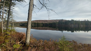
A little over 2 hours for us to break trail. We dropped our packs and noted the solid lake. Glad we brought the shovel as it took a while to cut through the 2+ inches of ice to get water. We made camp, gathered some firewood and relaxed in the cold. Our standard fare for thursday was hot dogs and chili. I only made half of the chili as eric was only using it as dog toppings. Gathered more wood. when the sun set, we could feel the temp dropping quickly. It was expected to get close to zero over night. The moon rise over the lake was stunning; the clear sky a pre-cursor to the coming cold. (When we returned to civilization we would find out it bottomed out at -9°F .)

I was warm with my down quilts, but I never sleep well in lean-tos. I would get a better nights sleep Fri night. Up as the sky turned pink before the rising sun, I restarted the fire and opened the hole in the ice. I heard the lake making ice all night, the hole had an inch of new ice to cut through. As the sun rose, it was directly across the lake. I needed to put on sunglasses due to the brightness and glare as it reflected off the ice.
I made some coffee while Eric slept in and moved my gear to my hammock setup for Fri night. Kalie and her brother Chad would be here around 2 pm, so we had plenty of time to take a day hike to Moon Lake. It was a quick jaunt to the lake and a trail to the lean-to was along some high rock ledges along the shore. Quite pretty. We took a short break at the lean-to, and wrote in the shelter log. Either few people write in the log books, or this area gets very little use. I hope to come back in nicer weather and maybe do some fishing at this trio of lakes.

Back at Wolf Lake we gathered up more firewood in preparation for Kalie and Chad. Across a small "bay" we could see where the trail would come out onto the point. Eric and I kept glancing over knowing we would see our companions a quarter mile before they would arrive. It wasn't long before Eric spotted some movement and our friends made the turn off the point. Their hike in was a solid twenty minutes shorter than ours. With them all set up, our second thanksgiving would begin. Turkey, stuffing, gravy, vegetables from the cans of green beans and carrots someone had left in the lean-to. With key lime pie for dessert. We ate like champs. stoked the fire and relaxed. The winds were picking up, as the temp rose. Odd combination but expected from the forecast. Kalie gave me an update on the Saints game from Thursday. We had a good laugh pretending to be the Wolf Lake Curling team. I shoved the ice wafer from cutting the ice hole, as eric brushed the ice with a broom. Hopefully a photo will surface. I was the first to call it quits and went to my hammock. I fell asleep quickly. It was much warmer this night, even with the winds.

I was not the first one up; Chad was already getting the fire ready to be re-lit. A typical lazy morning of breakfast and packing up. Kalie was the last to emerge from her tent. It would rain today, but not until the later afternoon so we had plenty of time. The hike out was much quicker than coming in. The beaver dam was certainly mushier. The temp was closer to the 40s, a good 30 degrees warmer than on Thursday. Back at the car, we changed out of our hiking clothes and headed to Cook's family diner. Another successful Thanksgiving adventure in the books.

Monday, November 12, 2018

Cold at Lake Colden

This weekend a number of lean2rescue projects were happening concurrently. As I intended to spend the night in the woods, I chose an on-site project. We would be prepping the site for the Beaver Point lean-to at Lake Colden and if time, removing the old roof from the lean-to. There was significant discussion as to the ingress to Lake Colden. Eventually we would plan to hike in from Upper Works.

On Friday afternoon, I recieved a call from Doug that the crew has opted to come in from the loj, and I could still meet them at the sute. This made it easier as I was not sure if I could make the rendezvous at 8am. I would be leaving Roc at 3am as it was. The firrecast called for more snow and freezing temps. I changed my gear load for a winter trip.

Three am arrived and I headed out. I stopped for coffee twice and filled the tank with gas in Long Lake. I was at Upper Works just after 8am, the plow had just come through. I changed into my hiking gear and loaded my pack. I wasn't sure where I would spend the night, or the next but I figured I would stop by the car for my 2nd days food.

I signed in at the register noting only 2 people were before me heading to a nearby location. It was 8:30, so not too far behind schedule. There were a couple inches of powdery snow on the ground. The first couple miles if trail went quickly, even though it was generally gaining elevation. The snow of the trees and deadened the air, so it was very quiet walking. Every once in a while a big wind gust would kick up, blowing snow from the trees on to me. With the snow on the ground, it obscured the muddy spots. The footprints ahead of me provided fair warning for the worst spots. The trail soon began to gain elevation more significantly. I shed a few layers when I stopped for a snack. The last mile or so to flowed lands did not appear to gain elevation on the map, but it certainly did on the ground. While the first 2 miles went relatively quick, these last few were slow.

I took a break at the Calamity lean-to which was occupied by the two ahead of me. I had jyst over a mile left to my destination. This last leg was not easy. Besides being uphill, the terrain was difficult, especially with the powedery snow. I arrived to Beaver Point and dropped my pack. I listened for voices of the crew assuming they were already there. Hearing none, I set up my sleeping area and then went to look (and listen) for them. Figuring I would eventually find their footprints, I continued on the trail. As I rounded the bend I saw flagging tape. I wondered if this was to mark the location for tbe new site. No footprints, no sounds just a quiet brumal day at Lake Colden.

The original plan to start at Upper Works was due to high water levels at Avalanche Lake, making it impassable. Since I was here before the main crew I thought maybe the lake level was still to high for the northern approach. I headed back to my camp to wait and have some lunch. Being in the EHPZ meant no campfire. This was a bummer for a number of reasons, the least of which was I had nothing to do while I waited... usually collecting and prepping firewood takes up a lot of time.

The wind picked up, blowing snow into the lean-to. I was not sure if it was from the trees or new snow. I erected a small tarp to block both from getting on my gear. I added an extra layer and sat down behind my wind/snow break. I was tired, but made sure I did not fall asleep as I knew it was going to be a long night.

A few hikers passed by as they bagged some peaks and returned.By the time 4pm rolled around, I was certain the crew did not make it. I had a cold dinner, and bundled up waiting for the sun to set. Lake Colden was just beginning to freeze up, and with the temperature dropping would certainly be making more ice over the next hours. I was hoping the skies would clear so I would have a chance at the Taurid meteors known for higher than usual fireball activity. As dakness descended, the clouds remained. Unlikely meteor viweing, but it would not get as cold. I lit a tea candle and placed it into my cookpot as a "mini-campfire". I was asleep before the candle burned out.

The next morning was not as cold as expected, but still below freezing. The lake had considerably more ice. I was packed up and on the trail a little after 7am. I paused at one of the other lean-tos on my way back to see the view (not as nice as from Beaver Point) and a group of three were there packing up. They had also come in from Upper Works. I guessed they might have been the voices I heard pass by the previous afternoon. I was given a hug by one of them, he had everybody deserves a hug every day. They were from different areas; Saratoga, Rochester, ...

The hike out was quick as it was generally downhill. The slowest portion was navigating the big rocks as the snow made them quite slippery, so going around them was time consuming. I passed on other hiker on his way in. I was surprised how few cars were in the lot being a long weekend. I suppose folks were dissuaded by tbe weather. Usually this area, and Lake Colden in particular xan be quite busy. I pretty much had it all to myself. And it was pretty.

Needing a campfire, I pondered the indea of stopping at a lean-to on the finger lakes trail or just camping in my own woods. The latter won out. Emily was glad as she hadn't been feeling well.

Sunday, October 21, 2018

Fall ends, winter begins in the West Canadas

A solo trip into the West Canadas to do some trail maintenance and check on the lean-to. A year ago this weekend Justin and I had paddled to the Carry lean-to and then hiked to the Colvin Brook Lean-to to clear a downed tree that fell by the fire-pit. As I pulled in tot he parking area, the sky opened up and it poured for short while. I put on rain gear and pack cover and headed down trail.

I hiked in to the Carry lean-to. Set up my sleeping gear and headed to Colvin Brook. I cleared trail along the way with hand pruners and small saw. There was not much to be done as I had been through the area last June. I crossed the new bridge over the Lamphere Brook. This was the one I had made a temporary bridge for the 2018 NPT hikers.

To get to the Colvin Brook lean-to, I had to cross the Cedar River. I donned water shoes and hiked up my pants. The water was cold. Since our last visit there have been a total of two visitors, both back in July.The lean-to is in need of some care. The other volunteer group to which i belong, lean2rescue is planning on engaging in the west canadas over the next few years. Hopefully we will get to this great spot sooner than later.

I signed in to the register and re-crossed the river. Had some lunch and headed back to camp. I gathered some firewood from a decent distance away. I explored a bit of the area and then made dinner. I knew the sun would set early which was ok as I had to get up before the sun to make it to Long Lake in time for the NPT Chapter meeting. The winds raged in the early morning before the sun rose. I slept rather well mostly in the early part of the night.

I made a quick fire and had some cocoa and breakfast. As I was eating I noticed some ash from the fire land on my wool shirt. I then noticed it melted and more was blowing around. The end of fall and the emergence of winter was here. I packed up and hiked back to my car. I noted in was just under freezing back at the car at 9am

Saturday, October 13, 2018

West Canada Lakes -Raining, Fishing and Leaf-peepin'

It had a few months since Dan and I had hit the trail together. We each had gone our own way on separate adventures over the summer. It would be great to sit around the campfire and tell our stories. While Justin was headed to Metcalf for the weekend, we had three days to spend, so we opted for the W. Canada Lakes wilderness to do some fishing and leaf-peeping. I picked up Dan early Saturday morning and we headed into the woods at the Pillsbury Mtn trailhead. The lot was already filling up, mostly with those hiking to the firetower according to the register. The air was chilly and we expected some rain over the weekend.

We stopped at the Pillsbury Lake lean-to for lunch. It was surprisingly clean. For dessert I had a brownie and traded my second one to Dan for an after dinner beer later that night. We turned off the marked trail and headed to Whitney Lake. We arrived to the main campsite which was already occupied. A tent was set-up as well as a large tarp with a windblock. The occupants were not around; we assumed they were off day hiking or fishing. Instead of staying at the campsite at the old shelter location, we headed to the one on the other side of the lake which Justin and I had stayed at the year prior. The site was in good condition. There were signs it had been used since we had last visited. With camp set up, we went fishing. No hits and no rises for a while. Then Dan spotted a rise in the water. I cast short of it and hit immediately. Not a big fish, but a nice 9.5inch brookie. while I was playing him, Dan a much larger specimen; a 14 incher. We fished that spot a little longer and Dan hauled in a whopper at 15.5 inches. That would be the end of our fishing.

Back at camp, we made dinner and talked. Dan commented how he would probably be asleep soon after dark. I, of course, would also. True to our word we hit the sack early. The rains came over night and into the next morning. Neither of us were in any kind of hurry to get up. Eventually I ventured out of my hammock and restarted the fire. We had set up a large tarp as a communal space in anticipation of the rain. This proved to be worth the effort. It rained a little on/off for the morning. We had fish tacos for breakfast while we discussed our options for the day. According to the lists, Puddle Hole nearby should have trout. So we set off to bushwhack through the wetness to check it out. We split up at the pond to search for a boat. Dan took the north side, and I the south. We met at the far side after 'whacking around the dense shoreline. Neither of us found a boat. The pond was shallow and the shoreline was not even conducive for shore fishing. We took a bearing back to the main trail and then headed back to Whitney. From there we headed to Sampson to also search for a boat.

The lean-to at Sampson is in an unfortunate location perched at a run-off stream. For some reason people also seem to leave a lot of trash here too. A group of beginner backpackers from canada were just packing up after their lunch break. Two ladies were waiting nearby to secure the spot for the night. We told them we were only having a late lunch and would be moving on. We again had no luck finding a boat so we headed back to Whitney and fished our way back to camp with no luck. As the sun was getting low it really illuminated the changing colors.

We again went to bed early. The morning again had rain and fog. We checked out the un-named pond onthe other side of camp before we left. No fish were seen or caught.All packed up, we headed back. As we passed through the occupied site from Saturday morning, the occupants were there and we chatted for a bit. Jim, wearing a "Whitney Lake Woods Rat" ball-cap said he had been coming here for 30 years. He told us some history, and we all swapped stories and fish-tales. Jim and JB offered us a beer, so we stayed a while longer and chatted some more. After a second one, we packed up the empties and headed back to the Pillsbury Lean-to for a late lunch and then to our awaiting car.

We had just that one quick flurry of fishing. Quite a bit of rain and some gorgeous colors of the changing leaves. It was good to be back out on the trail with Dan. Next time we will hit a different part of this Wilderness. We are thinking of heading back to the Quetico next summer. A lot there left to explore. meaning Questico and the West Canadas.

Sunday, September 30, 2018

Boreas Ponds -A simple trip with friends

Justin and I had been trying to figure out when to go back to the W. Branch Sacandaga River for a few years now. This seemed like the perfect weekend. It was all set and my college roommate was joining us. A few days prior I mentioned to Justin the possibility of the Northern Lights (due to a recent coronal discharge). Immediately the plans changed to find a location with a northern view. We settled on the Boreas Ponds with the high peaks backdrop to the north.

I picked up Jeff early in the morning and we made the long drive to the Vanderwhacker Forest and drove along the gravel road to the trailhead. A few cars, including Justin's, were already there. Jeff and I hiked along the rest of the road past the gate the few miles to the dam. Along the way a truck passed us. As we approached the dam we could see a few people gathering having a chat. we stopped to take in the view and down the trail came Bill. He and Justin had come in earlier with their canoes and said they would meet us at the dam. The timing was perfect. I had a rough idea of the campsite location, it shouldn't have been too difficult to find although the trail was not not visible from the main trail/road. So it was great Bill and Justin met us at the dam. We all hiked the remaining way to camp every once in a while on the remnants of an old wagon road in the woods. we made camp, explored a bit, took a short paddle.

While the northern lights did not appear, the sunset did not disappoint. When we returned home, many people from around the Adirondacks has posted photos of the sunset. The next day, Jeff and I hiked out first by bushwhacking back to the main trail and then past the dam.

While this was not an extreme adventure, it was still great to hang out with friends in the woods. The Boreas Ponds are quite pretty. I may return to try some fishing at some point, but I do not think this will be a recurring destination on my list.

Sunday, September 9, 2018

There's bear in dem woods. Watsons East Triangle and Pepperbox Wilderness

Another scouting mission for the NPT-west. This would be to check out an alternative to what I originally envisioned for a small section as well as visit a spot I haven't been to in a while (and never from this direction). I set my sights on Sand Lake via the unmarked path from the west. To add mileage and check out some other trails I started near the Oswegatchie Educational Center on Long Pond Rd at the far western edge of Watsons East Triangle WF. The parking lot was empty and I signed in at the register noting many from the Ed center use this trailhead to go to Trout Falls and Jakes Pond.

A few minutes into my hike along the easement land, a guy (Brandon) and his son (Logan) were fixing a pin on their ATV so I paused and we chatted a bit. They were bringing in a tree stand for the hunting club. They also mentioned their game cameras have picked up quite a bit of bear activity between the footbridges. Also a decent buck. They allowed me to ahead of them and I continued along the recently logged area. I did notice some bear scat along the way.

Soon I was on state land, and crossed the west branch Oswegatchie River, the trail became more closed in, although it was obvious atvs still came through. The forest here was quite pretty. It changed quite a bit both the flora and geology as I passed through. The trail had a few small rises to open rock areas. The air was still a bit chilly, but the sun was warming up the rocks. After about 45 minutes I came to the junction of Keck Trail and Jakes Pond Trail. The map shows a campsite here, but I didn't see anything. It is possible there was a campfire circle hidden among the ferns but without a water source this would be solely a winter camp.

Taking the left fork to the Keck trail, it was more rugged and was even more winding than it showed on the map. The map showed 3 campsites along the next few miles, but were dry and hidden as well. There were a lot of different fungus growing near and on the trail. Even the air was filled with the scent of fungal decomposition.

I passed another open rock area which was perched above a marshy area which had been dammed up by the beavers a long time ago. The overgrown remnant dam provided a was across the deep trickle of muck. The path was not obvious at first. Back in the woods a few muddy sections and atv tracks as well as a few bear prints. As i descended a small rise I came to another marshy section. This was criss-crossed with small rivulets hidden in the tall grass. The grasses themselves would sink underwater when stepped upon. There was no discernible path, no markers to be seen. I spent about half an hour trying to figure out where the trail went. Had I seen a marker or a trail on the other side I would have figured out a way to it. Instead I opted for plan B of my adventure. I would scout from the other side a different time.

I headed back towards the Jakes Pond junction. I spent a extra time looking for some of the other campsites, but could not find them. I did come across a moose shed in a small clearing.

A few minutes later I heard the sound of a motor. I paused on the trail and watched an atv slowly make his way around the bend in the trail and up towards me. I stepped aside as the red honda with 5 gallon buckets strapped all over it passed me by.

I was getting low on water by the time I reached the junction. But I knew I would pass over a bridge soon. Taking the right fork towards Jakes Pond this time I headed to the river which would be the boundary between Watsons East and the Pepperbox Wilderness. I crossed the bridge and filled up my water bottle with the tannin stained water. This trail was obviously and old woods road at one time. I noticed an increasing amount of bear scat. Some newer, but mostly old. At one point I thought to myself there is poop every ten feet. I came over small rise and entered a newer growth forest with a lot of cherry trees. Some motion caught my eye and I stopped. I looked towards a stand of trees and looking back was a bear. She made a quick grunt and then two cubs scurried up the trees. I had happened to have my camera out, so was able to safely snap a few shots before i slowly backed up. As I gave momma more room, she moved into position between me and the cubs. I backed up further and waited. She backed up to her previous position. I took a wide berth around as we watched each other. My arc intersected with the trail well past the bears' foraging area. A couple hundred yards later I came across a beaver flooded section, but a well worn herd path directed me to the dam. I came to another one of these sections a little later on about a half mile from Jake's Pond where the beaver dam was just above a small cascade into a frothy pool.

The old woods road headed uphill slightly to eventually reach what appeared to be a small esker between Jakes Pond and a water filled swamp. The esker made scanning the shoreline on both sides easy. Jakes has a very interesting shape. When I reached the southernmost point, I headed back and then off trail to the northern parts of the pond. No campsite was shown on the map, but sometimes one can be found. No luck and the shoreline was mucky. I took a break under a large white pine before heading back.

Back at my car at 4:30 after about thirteen miles of hiking, I needed to drive up the road a few miles to a different trailhead to get to camp. I parked near the bridge over the W. Branch Oswegatchie and took the dirt road near the private land. At the stat land sign, I headed up to the shore of Mud Lake looking for the campsite which showed on the map. There were two, so I was confident I would find at least one of them in the open pine and hemlock woods, if not at least I would have water. I found a little used site just around dinner time so I made camp. Even with private lands close by, I seemed to have the entire area to myself except for the loons.

It was a chilly night as expected. The morning glow over the lake was too good to pass up.

Sunday, August 26, 2018

The NPT-west. Yeah, it's a thing (maybe).

I have hiked the Northville-Placid Trail (NPT) a few times now. Most recently with my friend Andy in July. while planning for our adventure, I reminded myself of an idea I had been brewing for a few years. The NPT-west. The NPT was the first project of the Adirondack Mountain Club in 1922, and completed in 1924. there have been some changes to it, reroutes and additional sections. But for the most part it is the same 140 mile "straight" trail between Northville and Lake Placid. Being in western, NY I have an affinity for the western regions of the Adirondacks and envisioned a western arc trail also connecting Northville to Lake Placid. In conjunction with the current NPT, this would create a giant loop (or backwards D). The conceptual trail I have put together is approx 260 miles and uses existing trail corridors. It actually has less road walking than the original NPT in 1924. Together with the current NPT, this would be approx 400 miles, from start to finish (start). There is much of it I have not actually walked, so this trip would be my official start of the NPT-west.

I have 5 days in which to fill with miles. What a better way than to start at the beginning, the end of the NPT on Averyville Rd. I coordinated a ride and left my car at the Burntbridge TH in Cranberry Lake. I would hike the first 60 miles of the NPT-west to where it intersected with the CL-50 and then another 15 miles to get to my car. At 11am, Jack from Broadwing Adventures waved goodbye as I began my trek up Averyville Rd away from the NPT proper. I turned down Old Military Rd and then turned again at the railroad. The next few days I would be walking the unused railroad line. Currently the state is trying to rip up the rails and turn the right of way into a multi-use travel corridor; however it is tied up in the courts. The tracks were overgrown with weeds, which at times made walking through them uncomfortable. Often there was a "shoulder" of some sort, whether it was a foot path or ATV tracks which was a more level surface. A lot of the time was spent walking the tracks themselves. If the ground was level with the ties, it wasn't bad. When it wasn't the spacing was not a typical stride so steps were short and quick. Eventually I got used to it. I never did get used to the 6ft tall mullein weeds which showered their seeds when brushed against.

About halfway through my first day, the sky opened up and it poured. It had been overcast and rain was expected, but this front came in and dumped on me before I had a chance to get my rain jacket on (I had prepared my pack with its rain cover). I was drenched walking through the town of Saranac Lake. This all happened just as I had re-found the tracks. There was some bridge construction near the community college and the tracks were all fenced off, so I had to figure out a way around it. Only four hours in and I was dealing with all this already? I supposed it could only get better. The rain subsided soon enough and I continued on past Lake Colby which was my intended camping area to McCauley Pond. There is a small section of state land on McCauley. I found an old campsite, hung my hammock and dried myself out. 14 miles for the day including the drive up. I could hear the camp across the lake as I fell asleep in my hammock before it was even fully dark.

I had sent my itinerary to my buddy Lance whom I have hiked with a few times. There was a chance he would join me for part of this adventure. I also sent him a link to track my progress on google maps as long as I uploaded my position (if a signal was available). In town I could do this every few hours, but it burned up the battery quite fast. My second day of travel would be traversing the St. Regis Canoe Area. A few years ago we had to carry our canoe over these same tracks to get from one pond to another. This time, I would be cutting through the ponds on the tracks. This is a pretty area as the tracks passed by numerous ponds, marshes and lakes. It is also a wilderness area with no cell reception. My last upload for the day would be 10am, after only 6 miles. By 3pm, I had traveled an additional 9 miles to the far end of Rollins Pond. A snowmobile access path led to the water and there were plenty of trees on which to hang my hammock. I spent a little time exploring the shoreline and then headed back to where the tracks were in view. Made dinner and took a woods shower to get rid of the sweat and dust. A sound startled me and I turned around to see someone walking the tracks. He had on a backpack, I called out "Lance?". "Russ?" came the reply. I was not expecting to him until the next day at the earliest. We started to talk and then I said, "go set up your hammock, we have plenty of time to chat". A long quiet evening turned into a welcome chat by the campfire. Unlike the previous night, we stayed up well past dark.

Like usual I was up early, at least I waited until just before day break so I could still watch the sunrise. Lance had been dropped off in Tupper Lake, about 6 miles down the tracks. There is a diner right at the crossing, so we had an easy breakfast and got our giddy-up on to the Lumberjack for a late breakfast. Brenna, our waitress lent me her phone charger so i could get a few extra percents to my battery while we ate. Thank you Brenna! All fueled up, we headed down the tracks. the first mile was really nice, including crossing a significant bridge. After that, it was monotonous. Long stretches of nothing and the walking wasn't easy. Also water was no where to be found. After 9 miles of this (15 for the day) we made it to Mt Arab Rd where Lance's car awaited. I was just about out of water, but the map showed a stream nearby. Lance went to get his car, while I poked around looking for the little stream. Obscured by brush, it was there and flowing nicely. I flagged down Lance as he came by and told him I found the stream and was going to find a place to camp nearby on easement land. After a long break and a full bottle of water, I was restless (it was only 4pm) so I pressed on. The next 7 miles were much easier going. I passed by a few lakes, and some marshes. The tracks made a slight climb as well. Not noticeable while walking, but you could see it if you turned around. A few places the resident beavers had flooded the nearby streams and the water had made its way to the tracks. I did some balancing on the rails a few times to stay out of the wet. A neat thing about the RR is just like highways, they have mile markers so one can easily keep track of pace and location. Before too long Horseshoe Lake was in view and this would be where I would make my third camp. It was after 7pm, so I took a quick bath, ate a cold dinner of trail mix and fig newtons, and went to bed. 22.5 miles, not bad.

I slept great and was up before first light. I packed up and went to the boat launch to watch the fog lift from the lake as the sun rose. I made coffee and breakfast, chatted with a kid who was paddling his kayak and taking pictures. With the RR track portion of my trek behind me, I headed up the dirt rd. A snowmobile trail in winter #36/7A. The map showed quite a few intersections through this area, so I kept my eyes peeled and followed the map closely so as to not make a wrong turn. At one intersection with a gated rd, a couple of ladies were looking for a specific trail they had seen years before. I had never heard of it, but after some discussion, gave them some other information as to where it could possibly be located. For my troubles, they offered me food, water, bug dope... anything. I said jokingly, "I could use a beer". They replied, we got that too. So with my apologies to the Piano Man, it was 9 o'clock on a Saturday and I was hiking with a beer... The best part of it was it was ice-cold. One forgets how refreshing a cold drink can be after a just a few days. The downside was I had to carry an empty beer car for next 20+ miles. A happy price to pay.

The dirt rd soon gave way to a foot trail just after a gate and a bridge. A campsite (#11) was at the end of this road. I was now walking in the woods for the first time in 4 days. of course the trail headed up hill as pretty much all Adirondack trails do; both ways. The trail was an old woods rd so it was easy going. A few miles later I was at the intersection with the CL-50. This would be the end of my first section of the NPT-west, but I still had another 15 miles to get to my car. I passed a few hikers doing the Cl-50, took a break at the dog pond loop junction and headed up that trail away from Cranberry. I headed towards Burntbridge Pond. I had been here once before, but never hiked the this connector trail. This 4.5 mile connector (3.9 on the map) had always intrigued me. It twisted and turned, went up and down as you earned each mile. It passed by some prominent boulders, likely were used as navigation aides in the past. I noticed one tree which had scars from axe blazes on both sides. I arrived at camp at 4 with plenty of time to relax, take a woods shower, and read the shelter log. Soon after the sun set, I watched the moon rise. It was large and bright orange. The photos would look like a rising/setting sun. Soon it was dark, except for the significant moonlight. I do not remember falling asleep.

It was dark when I arose. I had my coffee by headlamp. I waited for the sun to rise before departing. Only 6 miles to my car. Moments after I arrived at 9am, it began to rain. Perfect timing. 75 miles in 94 hours. Time for some well deserved corned beef hash and eggs at the Stone Manor diner in Cranberry Lake.

Thursday, August 2, 2018

A few trips so far this summer in the Adks-NPT and WCLWA

As the summer began, I ventured into the West Canada Lakes for a few days to do trail maintainance on my section of the Northville-Placid Trail. Originally this was scheduled as a lean-to recon trip with George to assess the conditions of the lean-tos for lean2rescue repair efforts but the weather forecast was not looking good. After speaking with George, he opted to stay home.

So I set off solo from Wakely with a quick stop at the Carry lean2, and then spent a good portion of the remaining morning hours constructing a temporary bridge over halfway creek on the NPT out of materials from the collapsed bridge. The new materials had beendelivered, but construction will be in thefall. A little rain fell as I cobbled together the temporary footbridge. I cleared the blowdown which could be cut with a hand saw along the Lamphere Ridge. I then spent the next few days relaxing in the Cedar Lakes. The woods were wet with the on again off again rain, so I did not feel like exploring off-trail. I collected wood and left stashes at the lean-tos for the hikers who would becoming thru, as the kick-off for the NPT hiking seasin has just begun. A day ofvolunteer trail work and three days of Cedar Lakes relaxing.

The following weekend, Jeff and I hiked into Brooktrout Lake in the ungodly heat. We expected to spend 3 days, but it was so hot and humid we could barely sleep even in hammocks. We left the 2nd day, pausing for a long while at a spring fed cascade with moss covered rocks to cool ourselves down.

The last week of July I joined my friend Andy on his SOBO thru-hike of the NPT. Andy struggled with lack of appetite the first 3 days, so we took an extra day to relax and recharge at Catlin Bay. I caught a huge largemouth bass. After that it was just walking for another 8 days. We had rain for some days, including a torrential downpour right after we made camp. Passed by 37 NOBO hikers on our way to finish the 138 mile trail. The last 2 days were great hiking weather, overcast and in the 70s. As we completed the last few miles on the road walk into the town of N'ville a group of bikers gave us some nods of respect knowing what we had accomplished. At the arch, we recognized a pair of fellow hikers we had passed by days earlier. They had finished their NOBO journey that day and were eating celebratory ice-cream. This was #5 NPT completion for me. Although it was a first in some aspects as well. It was my first with a hiking partner the entire way. I am glad to have had the opportunity to join Andy on his journey. SOBO Rules!

Monday, May 28, 2018

Cold River Loop 2018

I have been doing this loop for quite a few years now since the first time with my friend Ian. I have hiked it clockwise, counter-clockwise, as a 3-day trip, as an strenuous over-nighter, as well as using it as part of a figure-8 loop covering 60 miles. This time would be the clockwise loop with the last day as a short 6 miler. Two of the folks from last year were with me, Ryan and Kalie. Also joining us was my friend Andy.

We started a little after 9am, the parking lot for the Seward trailhead was already starting to fill up. We signed in at the register and noted everyone would be concentrated on the peaks, like usual. The black flies were starting to come out, I did not notice if the were the biters as they more or less stayed away from my permethrin treated clothes. As we hiked they were non-existent but would begin to swarm if we stopped for too long. We passed by a few hikers, some of whom were wearing bugnets.

We took a left at the first junction to follow the footpath along the boundary of the Ampersand property. We would pass by Blueberry and Ward Brook lean-tos. Both of which had hikers prepping for their conquest of the Sewards and/or Seymour Mtn. The couple at Ward Brook had day hiked from Duck Hole to climb Seymour, they had come in via Bradley pond. Quite a journey.

We took our first long break at Camp Four, which we had to ourselves. A recon of the thunderbox showed it to be unusable as a tree had fallen on it. We ate a late lunch and discussed the next few miles. A steady uphill followed by a downhill to the Cold River. We were 6 miles in on our 9ish mile day. The bugs seemed to have subsided, but the air felt like rain was coming.

The uphill on the old truck trail seems to be less steep each time I do this loop. Soon we were heading down towards the beaver meadow. The first time I did this loop we had gone counter clockwise and the trail across the meadow was a small beaver dam which we had to pick our way across with mostly dry feet. Since then, it had been dry, with remnants of the dam the only evidence of that first wet crossing. This time, however would be different. Somewhere downstream, the busy little rodents had done a much better job, and the trail was considerably under water. Kalie started to pick her way along the right edge of the trail, and Ryan on the left. Soon Ryan was just walking knee deep in the water and out the other side. I accepted the inevitability of the situation and followed Ryan. Soon we were all on the other side with significant water in our shoes. We only had about a mile or so to camp, and we arrived in the afternoon to both lean-tos vacant. We chose the one closer to the water, and just relaxed for a while as we had plenty of time. George and Tammy had left the Calkins Brook lean-to book for me to deliver. I was already carrying 4 others (Ouluska, Seward, CR-3 & 4. They had written as the first entry into the Calkins book, "Russ, please bring me to the Calkins Brook lean-to". I literally laughed out loud upon reading it.

With our wet socks hanging to dry, we focused on camp chores interspersed with just sitting around. Dinner was eventually made as well as a fire. A couple hiking the NPT southbound stopped over to say hello. They chose to stay at the other lean-to. I was tired. The sound of the river coupled with the fact I was up at 3am had me in bed not long after sunset. I barely remember even lying down in the hammock. I slept great.

I was up rather early as usual even though I tried to sleep in. Ryan was in the lean-to, so I did little to avoid disturbing him. Once he was awake, I restarted the fire to make a quick pot of water for coffee. Not long after everyone else was up. The couple from across the way started down the trail. I half-expected to see them again at Cold River 3 or 4. We were on the trail a little ways after 8am with a big day ahead of us. At least we would be going downstream for a majority.

The NPT between the junction and Rondeau's hermitage is difficult no matter which way you go. Constant up and downs with not easy footing. It is a long few miles with little to see along the way except for the big green tunnel. One earns these miles. The old logging camp is growing in a lot. I remember it being more field-like but the shrubs have given way to small saplings. The old implements can still be seen scattered around.

We paid our respects to Noah John, the Mayor of Cold River and headed the last half mile to the Ouluska Lean-to. A fellow hiker was here taking a break. He was doing the same loop as us counter-clockwise. There was some gear in the lean-to which he said was not his. He also mentioned the couple who was ahead of us. I glanced at the gear in the lean-to and immediately recognized the sit pad as belonging to Tammy; this was George and Tammy. I was hoping to run into them. I signed in to the register, and said "hi" to G&T. A few moments later they came down the trail. We chatted for a bit. They had spent the last two nights here and were on their way back to camp. We also had quite a few miles left for the day. A few sprinkles began to fall, but it never coalesced into a rain.

We stopped again for a longer break at the Seward Lean-to. We had a little scare as Ryan seemed to have misplaced his car keys. He was using them to open his bear canister. With a methodical search, they were found sitting on his pack. The trail between Seward and Big Eddy was a real mess in the years after Irene but has since been cleared. Some new blowdown now exists along the rest of the trail. I dropped of the register as CR-4, and we rested more at CR-3. I somewhat expected we would stay here for the night as it was later in the day than I anticipated. The group opted to press on even with the knowledge we would be climbing steadily to a higher elevation. The trail would be a lot easier though being the old horse trail, and a road in previous times. I had forgotten about the final downhill section immediately before we reached our destination, Calkins Brook. This was longer than I remembered. It was early evening when we arrived to the two lean-to's finding them both unoccupied. We were all tired as this was about a 14 mile day, and the tough miles in the beginning. I gathered a small amount of wood even though a decent amount was already there. I try to not use what others have collected without at least doing my part. Dinner was made. I strung up my hammock. Kalie went to hang her bear bag. It wasn't completely dark before I wandered off to my hammock. The three of them would crash in the lean-tos. It was a little colder this night. Partially due to the wind.

Again I was up before the rest. I quietly made a fire and had some coffee before anyone else even stirred. We only had 6 miles to go, but it would be mostly uphill. Plans were already made for lunch at the Lumberjack diner. The hike out was quiet as everyone was tired. We were finishing the last few miles of a 30-mile trip and I was already contemplating the next iteration for next year. Gotta love Cold River Country.

Saturday, May 19, 2018

Very remote Adirondack Lake

It had been a few years since Justin and I had visited this remote lake in the West Canada Lakes Wilderness. Justin had spent quite some time scouting out the best route. On one of his last trips he exited via a different route. This trip would make the loop in reverse. Our buddy Dan would join us. A remote Adirondack lake with brook trout is too much for him to resist.

The weather had called for rain all day, so we were expecting the hike to be a slog pretty much the entire way until we arrived to camp. Last minute forecast appeared not so bad. The hike in would begin on an old road and then turn off on an unmarked path for a few miles. As we began, the trail was a slow general uphill. As a weekend warrior, these first quarter miles of uphill always seem to remind me I need to be in better shape. Even with a light pack, made 24 oz heavier with a few cans from Justin. It took a few minutes for us to find the unmarked path as it was not so obvious from the old road. I packed a collapsible fishing rod and reel, as did Justin. Dan carried in 3 poles and his canoe paddle. while it was nice to be backpacking in the Adirondacks without snow again, this particular path was not extraordinary; was still pretty enough though. It is always nice to see the trout lilys and trillium in these early days after the snow has gone.

We stopped shortly at the private cabin along the path and spoke with the caretaker briefly. The path would end soon after and our bushwhack would begin. Once off trail, we would be pushing though witchopple and across the edges of marshes. The terrain was not too bad, but the witchopple certainly was a pain. We paused for a snack at the last vly before regaining a trail for the last bit to reach the west end of the lake. An established campsite was here along with a canoe in very good shape. A small jon boat should also be nearby according to Justin. Dan and I took the canoe and began our way down the length of the lake while Justin walked the shore line looking for the other boat. There was a bit of wind but the paddling was easy. We found our campsite, and I began collecting firewood while Dan paddled back for Justin.

When Dan and Justin finally arrived, I had collected some hard wood from quite a distance away as the campsite is in mostly a spruce forest. Justin had walked a bit more than half the shoreline before the found the jon boat soon after Dan had intercepted him. Dan would fish, while Justin and I set up camp. It was early afternoon and we had arrived at camp with no rain for the day. I considered the trip a win at that point. I made a small fire for a cup of coffee. Dan arrived to set up camp and showed off a big brook trout he caught. Was 15 inches or so; a beauty. Dan set up camp and Justin took the jon boat out to fish. Soon after Dan and I were out fishing from the canoe. we paddled the eastern shore and up to the northern inlet. I landed the second brook trout about the same size as Dan's. We fished and paddled and explored the eastern side of the lake. By the time we headed back in we had 4 excellent fish for dinner. Right across form the campsite along the island Dan would hook and land the last fish, largest of all. Justin was on the island and took a quick video of the fight. This fish ended up at 17 inches, 1 lb 14.5 ounces. At camp we cooked up the 3 smallest trout which was almost too much for the 3 of us to eat.

Darkness soon came and my eyes were getting heavy. The early wake-up, the hike, full stomach, and the quiet lullaby of the Adirondack woods was too much. I made my way to my hammock and was asleep in no time. I tried to sleep in, and thought I did as Dan was up before me. As we were getting coffee going Justin remarked from his tent it was only 6am. The woods were bright in the morning glow of the soon to be rising sun. Out by the water, the grasses showed the remaining frost. The chilly morning was sandwhiched between the hot coffee and the warmth of the campfire. I took it all in, while Dan set out for some early morning fishing. The air was still, and the water was glass. I caught a glimpse of the rising sun as it sparkled though the budding branches along the shore.

I made some breakfast and packed up my gear in shifts. Justin did the same. Dan fished the morning with not a single hit. As he packed up his gear, I paddled west to return the canoe to where we found it. By now the winds had picked up a bit. Justin was a short ways behind me with the jon boat to give me a ride back to the campsite. With the canoe back where we found it, we looked around a bit more to see if another boat was around and also to look for the USGS benchmark shown on the map. With no luck, we both entered the jon boat and began our way east. We soon realized that our positioning would not work, so we adjusted and each used an oar as a paddle. It was slow going and the oars were heavy. The boat was also returned to its original location near the garbage pile left from the days when float planes used to be able to fly into the lake. From here we would walk the dense shore line back to camp.

All packed up and ready, we left camp around 11:30 am. Mostly bushwhacking to start but not as thick and marshy as yesterday. Also this route would pass by and along some pretty streams and cascades. It was a quieter hike out. I suppose we were all a bit tired. It seemed to take longer, but looking at the time it was about the same. The last 3 miles would be along the old road bed. Easy walking but muddy, and I was tired. The sun was shining; I had remembered to put on sunscreen but probably not enough. Back at the cars we loaded up and congratulated each other on another fine trip.

Thursday, April 5, 2018

Winter's Last Gasp on the FLT

We made plan A, B and C for this week's trip. April 1st is the beginning of trout season so Plan A was fishing. We knew the water was still hard in the Adks so as to not be made the fool, we looked at our next options. Plans B and C were both in the Adirondacks as well. The weather forecast was not looking favorable and the trails would be a combination of melting snow and mush so we opted for another plan, the FLT.

It had been a few years since I had done any serious mileage on the FLT and many more years for Dan. We had 4 days in which to fill. We already had our menu set, so it was just a matter of route. I drove to Dan's house early Monday AM and over coffee and a muffin we opted to hike west on Map 18 and into Map 17. This would allow us to pass through a number of State Forests and minimal road walks. We cached bear canisters at road crossings a mile before our planned campsite. These caches were mostly of the barley and hops variety.

Monday's hiking started out brilliantly. It was a bit chilly if one was just standing around, but perfect for hiking. Dan left his pack with the first cache but I carried mine. We started on the main road and then turned off to a dirt one.This eventually became an abandoned section. As we talked and chatted we noticed the blazes were no longer apparent and the junction ahead was past our turn-off. We followed a ski trail for a few hundred feet before it started swing the wrong way, so we stepped off to head towards where our footpath should be. Soon we stumbled upon a large cistern of rocks holding water. Probably from an old CCC camp as these were common. I love finding old foundations and these structures are even more impressive. We intersected with footprints that we had seen earlier and found the maker's stealth campsite fire pit. We turned to head towards the microwave tower which we knew was on the trail. Within minutes we intersected the FLT again. we reminded ourselves to pay attention to the blazes as the man made paths and old roadways were numerous throughout these forests.

We stopped for lunch briefly and continued on past the tower. We signed in at the register and found a pair of polarized ray-ban sunglasses. Winding our way around the hilltop and then down the other side along a series of old woods roads and foot paths we again lost the blazes as the main road came into view. Instead of heading back up hill we figured to walk the road the extra few hundred feet to where we should have exited the woods and to Dan's awaiting pack and our food/drink for the evening.

We re-entered the woods and headed towards the Kimmie lean-to. The trail went up and down slightly as we crossed a number of small streams cascading down the hillside into the larger stream below. The far side of the stream, we noted was quite steep. As it bent around the hill we traversed our side began to level out slightly. A campsite came into view at the stream's edge. Consulting the map the lean-to should be a tenth of mile off the trail following blue blazes. heading downstream a bit more, we crossed paths with two women looking for a place to cross the stream. We said hi and they told us the lean-to was just ahead and they were just our day hiking. At the elan-to a young lad named Alex was there. We asked if it was ok to share the lean-to. He shrugged acquiescence apparently not enamored with the concept.

The front of the lean-to was a muddy mess and the follor seemed to be falling in. Another csmpsite with a decent fire ring and picnic table was just 50 yards away in a hemlock grove so we took that instead. Dan set up his tent, and I my tarp. It was early, only 3:30 or so and we had done a 7 mile day starting just before noon. We gathered wood and and did other camp chores. Dinner came late; venison, sweet potatoes and peas.

I stayed up as late as I could but it was still earlier than at home when I went to bed. I awoke before Dan, got the fire re-started and took down the bear bag. Breakfast was cheddar grits with salsa and of course coffee. The weather forecast was rain so we didn't dawdle to get started on the 10 miles. We waved goodbye to Alex. The first time we had seen him since we arrived. We had invited him to join us at our fire when we left the lean-to but apparently he was just happy being by himself. The rains came as expected. we spent the day hiking slowly through the wet trail. A brief stop for lunch and then pressing on. we retrieved our next cache of food with a short mile downhill to our campsite.

This lean-to was situated up hill from a larger stream with a numerous waterfalls. It was beautiful, and loud. we were wet and glad the rain seems to have slowed to basically just a mist. It was early, just past 2pm. The miles go quickly when all one does is hike and not stop every few minutes to chat. The idea of a cup of soup sounded great so we fired up the stove and as we discussed which soup flavor to put on, I remembered I had cocoa so we chose the chocolate soup to start. We set up our sleep gear inside the lean-to and took off our wet stuff to start the drying process. We laid down for a few minutes to rest. When I realized it wasn't raining anymore and the trees were not even dripping, I got up to collect firewood.

There were quite a few satellite campsite scattered throughout. Even so, it was not difficult to find a large amount of wood. None of the winter fall had been collected yet. The wood was wet, but this wasn't our fist rodeo. dan joined me in the wood collection and I opted to try to get the fire going without "cheating" just for practice in these conditions. I should have had at least twice the amount of tinder but I still managed to get it going. It took some coaxing. Better to be practicing in these conditions now then when it is necessary with no back up.

The fire helped us dry our some clothes and warm us up. The rains did not return. We had some leftover venison, plus the bratwust w/peppers and onions and the adult beverages conveniently left with our food cache. Like usual I was in bed early. It got warmer over night. I awoke in the middle needing to shed layers. It also rained a bit. The fire pit still had some coals the next morning which I coaxed back to life with the wood we dried the night before and set under the lean-to overhang. Made lunch first, and packed it up and then breakfast.

We expected some rain today, but not like the previous and also tonight was to get cold. The trail was to include at least 3 big climbs the last of which would be a 600 ft climb the last mile. we did get a little rain early on and overall the trail was great. A lot of variety including an old rail bed for a short time. The climbs definitely got our heart rate going but weren't that bad. We found it curious that the trail would often crisscross and old woods road at an even steeper grade. Apparently the trail makers didn't want to use the old road. Perhaps because it is snowmobile path in winter? We filled up with water on the backside of the hill from a seep in ground. Only a tiny bit of sediment in mine.

Our last cache retrieved we started up the hill. The pack was heavier but not unbearable in the least. With the added weight it became a typical overnight pack weight. While it wasn't that cold, the winds were picking up and it was biting through a single a layer. The lean-to came into view looking up hill. The trail swung around to the right and then followed the contour towards the lean-to situated among the giant tamaracks, which the lean-to is named. Again wood was plentiful and as the winds really began to pick up more wood became available nearby literally falling from the sky. We watched quite a few branches crack and break off and a couple of trees topple. The large tamaracks were swaying and bending a great deal with the large gusts. We jokingly imagined what it must be like for the squirrels in the nests at those highest reaches.

The temp started to drop as the winds continued. The heat from the fire was intense, stoked by the wind. I made a windbreak in the lean-to with my tarp to mitigate some heat loss from the intense winds. It did get as cold as expected overnight, below freezing. We awoke with a solid dusting of snow and our water bottles with ice forming. Only 5 miles for the day to our awaiting car, mostly downhill. It was chilly. I guess winter wasn't quite done with us yet. A half mile to go, we passed by the trails coordinator of the Cayuga Hiking club. he was scouting the loop for flooding issues. We wold him about a washed out bridge a few miles back and of the almost floating bog bridging the previous day. We chatted about trail and lean-to maintenance and went on our way. On the gentleman's car, Dan left his contact info on a slip of paper to volunteer to help if needed. We then retrieved our bear canisters/trash and headed to Ithaca for some pizza. This 32+ mile trip allowed me to sleep in 2 more lean-tos to put me at 59, and backpacked just under 25% of the FLT.

Sunday, March 18, 2018

Minus 14 F. Yep, still winter at Johns Pond.

For many years I organized a group trip to the Adirondacks on St. Patricks Day weekend. It has been quite a few years though. I remember some of them with very mild temperatures; almost spring like. Some quite cold.

This year I didn't have set plans and as I was trying to figure out where to go on a solo trip I received a call from my friend Dan. He had plans to go skiing on Sunday but was looking to camp over Saturday night. Something easy so he could get back to the car to meet others at the slopes on Sunday. We opted for Johns Pond in the Siamese Ponds Wilderness as it had a lean-to and was just over 2 miles in.

I left home around 6am and met Dan at our usual rendezvous point. We caravanned to the parking area which already had a single car. The trail was broken out likely by the car's occupant. At the register we noted the hiker was only out for the day. The temp was in the mid 20s and the sun was shining. We took the hike slow as we had only a short ways to go. We stopped periodically to enjoy the scenery through the woods.

As the trail swung away from the big brook, the day hiker came bounding down the trail. We exchanged hellos and he commented on how nice it was at the lean-to spot at Johns Pond. Passing by the side trails to Puffer and Clear Ponds we arrived to our home a little after noon.

Dan checked out the pond, I snacked on some cheese and went looking for firewood. We both gathered a quite a bit, had lunch and went for more. We joked a few times that our giant pile was a good start. We ended up leaving about 50% of the wood we gathered in a nice pile for the next group.

We had dinner and even before the sun set we could feel the temperature falling. The clear skies were hinting at the significant mercury drop. Stars appeared, fire was stoked and my eyes were closing. I might have made it to 9pm before I climbed into my bag.

I was warm in my bag until early morning. I fought the need to exit the warmth and empty my bladder. I eventually capitulated. It was cold out as we anticipated. After returning to my bag it took a while to get warm again. I might have fallen asleep for a short while after, but Dan's alarm rang out at 6am. It was still dark, but the early morning glow was just beginning. We packed up by headlamp and were heading down the trail before sunrise. But by now the woods were bright enough. The snow squeaked beneath our snowshoes as the air stung any exposed skin.

I traveled over a mile before I dropped a layer and my toes still hadn't completely warmed yet in my semi-frozen boots. I signed us out at the register and we loaded up our vehicles. Mine struggled to start as it was still minus 8. I am not sure what was more of a challenge this morning, the car starting or me. Always good to be out in the woods. I would find out later it was minus 14 over night.

Saturday, February 3, 2018

Ice on the Lizard

This past summer I spent backpacking the Wind River Range in Wyoming. While traversing Lizard Pass, Dan and I were caught in a hailstorm. Last weekend Dan and I decided to visit Lizard Pond in the Adirondacks. My friend Justin visited this spot last winter. Since Dan had spent Thurs and Friday in the eastern adks, we planned on meeting at the trail register on Garnet Lake. As I made my way from Rt8 along the dirt rds, I came to an unplowed seasonal road. I had to backtrack and take a different approach. This made me about 20 minutes late. I saw Dan out on the ice as I approached. He had brought his skates and was making good use of the extra time waiting for me.

We unloaded our gear from the cars and loaded up the pulks. The sun was shining and felt warm as we made our way across the frozen lake. Out in the open a slight breeze reminded us it was still cold out regardless of the sun's warmth on our face. Mt Blue, our goal to climb after we made camp towered over us. Across the lake and to the narrows, the ice showed traces of snowmobile activity and led us straight to the trail to Lizard Pond.

Once in the tree cover, the sun was partially obscured and the wind blocked. The sign gave us 1.3 miles to our destination. There was a little snow left, and a lot of ice on the trail. We made our way generally uphill. Near Lizard Pond the wetland area provided a better approach and the snow machines agreed. We followed their path avross the frozen swampy area to the Eastern edge of Lizard. Like Garnet, the windswept ice would make for good skating.

At the lean-to we made camp and I collected wood while Dan made use of the ice with his skates before the warming sun degraded the conditions. Dan joined me to collect more wood and then we made plans to climb Mt Blue.

With map, compass and day packs we crossed the icy lizard pond and made our way up to a ridge we would follow to the top. It started off steep, and then the snow disappeared on the southern facing hill. We removed our microspikes for a while but put them back on as the snow returned. Some steep sections with lots of deer sign. We reached a false summit and found a few overlooks. The true summit was farther than we thought as it was obstructed from our view on Lizard. As we neared it, a few drops of rain (or sleet) began. We were both thinking of the storm atop the Lizard Trail in Wyoming. At the summit, a decent sized cairn had been erected to mark it. We didnt stay long as the weather was eventually going to go against our favor.

Took a general bearing and we followed the ridge down for a while until we turned more south to head back to Lizard. We arrived without much left to do except cook up dinner. I made jambalaya. Might have been a tad spicy for Dan. The rains began soon after it got dark.

I awoke first like usual and restarted the fire. We stashed kindling in the lean-to, and put a tarp over the woodpile. The rains had atopped in the middle of the night. The warming fire soon brought forth coffee and breakfast. The hike out was fast as it was mostly down hill on the trail and level on the icy lake.