"There’s a whisper on the night-wind,
there’s a star agleam to guide us,
And the Wild is calling, calling. . .let us go." -from "The Call of the Wild" by Robert Service
It has been a number of years since I have been to Bear Lake. Most of the trips had been to either prepare the location for the lean-to build, or to visit the lean-to traveling different routes. This time would be the short way in as an "Intro to Backpacking" for the local meetup group. In the days leading up to the trip all but two dropped out. This is typical, unfortunately. The two who would join me did not need any Intro lessons, although one did ask if I would show her how to hang a bear bag. She spent this past summer hiking the PCT and always just slept with her food.
When we arrived at the trailhead in McKeever, the few parking spots were already taken. I found a spot a few yards away to back into for easy exit. The trail in was just as I remembered. I chuckled to myself as certain memories came back to me. We passed by a family hiking the opposite direction. One car down, 2 to go. The lake was upon us quite soon. We still had to hike about a half mile to the lean-to side. At the lake side, a solo hiker approached us. He looked towards me and said, "You're duct tape, right? I know you from Rob's videos". I said I was. He told us there were two guys at the lean-to bu the other campsite was free. We thanked him and continued on. We turned off the main trail and headed up to the lean-to.
The two gentleman and I talked a bit about the lean-to. I gave them a bit of its history. They invited us to share with them, but I deferred to the others who opted for the campsite. We set up camp and went to gather some firewood. Since the hike in was short, we just relaxed. It was unseasonably warm and I had not put on sunscreen. I would pay for this oversight later. I took a short walk around our side of the lake looking for the old rowboat. I didn't find it, nor any other boat or canoe. In front of our campsite, near the inlet I saw some smaller brook trout rising for the insects. I wandered back up to the lean-to to let the two guys know about the rising trout.
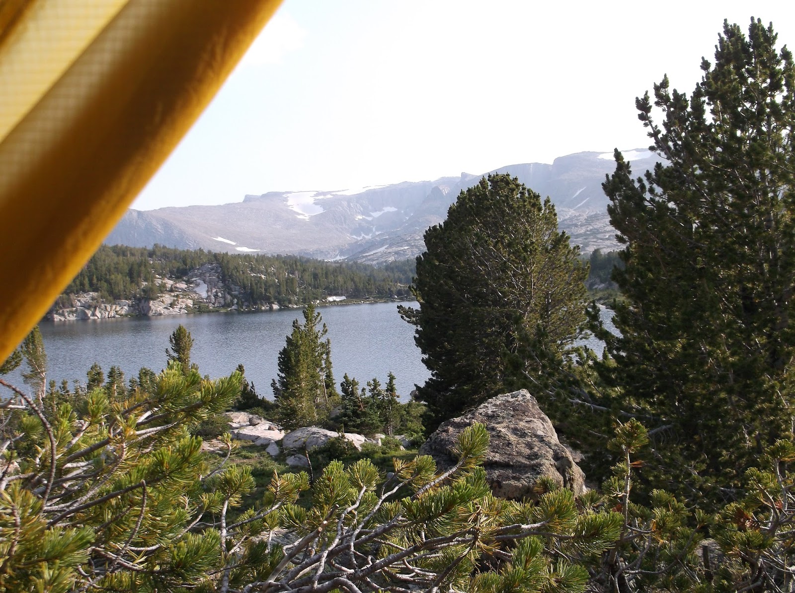
The rest of the trip was uneventful. We went to bed at hiker midnight and I slept quite well. didn't even need my quilt. As usual I was up before the sunrise. I was looking forward to watching the sun hit the trees on the other side as they were just starting to change. I snapped a few photos as the sun began to burn away the fog and illuminate the far side of the lake. The girls were soon awake as well and we packed up and headed back to the car. A stop at the diner for a late breakfast is always a great way to end the trip.
It has been a few years since Chris and I have canoed together. We planned the dates for this trip back in the Spring, but left the final destination to the last minute. As we got closer to the trip dates, we decided to return to the Whitney Wilderness, specifically Little Tupper Lake and also the Round Lake Wilderness. we have used basically the same menu for the last few canoe trips so I modified one of our old ones and sent it to Chris to review. Once the destination was chosen, menu planned and all other logistics worked out we met for dinner and to put the canoe rack extender on my car.
I picked up Chris around 8am and we arrived at the Whitney Wilderness HQ and were met with a full parking lot. The side road parking for the Round Lake Wilderness was also quite busy. With the wind swept lake we needed to go to Round Lake and hoped to find an unoccupied campsite. Paddling East on Little Tupper was easy although I had a difficult time keeping up with Chris and his double blade kayak paddle with my single stick. I could close the gap, but it took effort. As we made our way through the connecting creek, the water and wind was against us though the weeds showed the current was with us. We stopped to check out campsite #1 as it was unoccupied. The waves made the landing difficult. Chris went up on shore and I struggled to hold his canoe (and myself) from crashing into the rocks or drifting away. I opted to drift away and then paddle back when Chris returned. Next time I suggested he bring his boat onshore as there was no way to hold it in these waves.
The site was ok, "a 6" according to Chris. I downgraded it in my mind due to the landing. The next site was taken and the one after than had been "closed". The other sites were at the northern part of the lake, so we continued to paddle up against the waves. The number of boats and people did not seem to match the number of vehicles fortunately. We eventually found a pretty good site with a pebble beach landing in a protected cove. The site was up the hill as is the new design by the DEC. It doesn't make sense as these designated sites are set back far enough than they do not need to designate them to be legal (150' setback from water). Camp was set up and we went for an evening paddle. The lake had begun to calm down. I fished a little and caught a couple tiny perch. Back at camp, dinner was later than usual and included dessert. We each brought "extra" items so going hungry was not going to be a problem. It felt great to climb into my hammock, I expected to sleep well.
Chris was up first. I did not sleep as well as I thought I would. Not sure why. Chris was building the fire. He wasn't sure if he was doing it right. I told him I would let him try and learn. He struggled getting it lit and asked me to intervene. I gave him some tips and showed him how to get it going. After breakfast we paddled back the way we came to Little Tupper. The plan was to paddle the length and head to Rock Lake and camp on the island. we had all day to get there so we weren't rushing. I fished along the islands as we passed by them. Got one real nice sized bass. No picture, but Chris said he would be my witness. Stopped for a break at the beach on Eagle Point and for lunch at one of the island campsites. While we were eating it was decided that we would stay there. The landing had a small sandy beach and was protected. After setting up camp, we went for a paddle and fished a bit. I was tired and could have easily taken a nap, but I resisted knowing I would not be able to fall asleep later if I did. after a big dinner, we watched the sunset over the lake and I went to bed early.
Our last morning and the lake was glass. We had about half the distance to paddle then we planned so we took it slow and just enjoyed the gliding across the water. I changed to my to my other paddle and was surprised at just how much more water I could catch with it, and the control. Chris said it was probably because I was used to that paddle. That would explain my control with it, but the ease at which I could keep pace was more a result of the paddle blade shape. The other paddle was designed for use with a faster cadence, it certainly excelled at that, but was inferior with a relaxed solo cadence. The beavertail shape was also much quieter slicing through the water. The paddle back to the put in was a joy. This is what canoeing is all about.
I slept in until it was fully light out. I must have been quite tired. Not surprising after the last few days. After a quick breakfast we spent time drying out the condensation from the tents. On trail a bit after 9am. The trail started off downhill to the river where we would have to ford it again. Only up to my knees this time and not so much current. It was marshy for about 50m before and after the river. The goal for the day was the Stough Creek Lakes about 6 miles away (map distance). Along the trail we crossed paths with 3 other groups. Most people we have seen in quite a while. Snack break was against a nice sitting log overlooking a meadow. With the heavier packs and the last few days distance and climbs, I was hiking slow I thought. The entire trip I struggled to keep pace with Dan with his much longer stride (and being 10x in better shape than me). At the next trail junction the sign had us 3 miles from the Stough Creek Lakes. Like most days we seemed to be climbing. To be expected in the mountains. At a high point on a meadow not long after we stopped for a break. Dan stepped a few few away from where we stopped and exclaimed, "the lake is right there". I didn't believe him as there was no way we had come close to the 3 miles from the last junction, but there it was. The lake was just down the hill. We loaded up again, remembering our fishing and hiking poles. "Poles" was always the last thing we would say to each other as we began hiking. Like a pre-flight check to ensure we didn't forget them.
As we approached the lake, we dropped our packs to search for campsites. West for me, and East for Dan. Up on the hill I found a good site used by people with stock animals. It was large, nice firepit and they stabled the animals far enough away from the main campsite. Dan located a few sites. Some seemed like sattelite sites from when the area was busy, but we were the only people here today. The farthest site was fantastic. A giant boulder the size of a small house provided an overhang and a backdrop for the firepit. We didn't have to walk up/downhill to get water. Our tents would be at higher ground. I found a spot on a ledge about 30' up which had a great view of the lake. Hoping to see a good sunset. It was only 1pm when we arrived. After a few hours of setting up camp and doing chores, Dan is off fishing and I am boiling some water and then fishing. Stough has some decent brook trout which one can watch hit the lure. Both of us were to keep 2 trout for the next meal. Within minutes I landed a pretty 8" brookie. Knowing there are bigger ones, he was set free. A 9" took the hook in the tongue, so I kept him. Soon after a 10" hit the lure, but I didn't set it. I could see him, so i cast about 5ft past him and brought the spinner right back to him which he attacked. I had my two, so I continued to catch and release a few more. I am sure Dan would be returning with at least 2, and likely larger ones. He brought back 3, so we had plenty. All were saved for breakfast since our soup dinner would be too much to finish anyway. A storm began brewing in the distance. We were able to get everything stowed and into our tents before the rains hit. It was over rather quickly, but the winds continued all night.
Day 12. Mental Preparation
Fish and bread for breakfast. One of our staple meals. Today was set aside as a short day to explore, fish and to rest in preparation for tomorrows adventure. We dropped our packs after crossing a small outlet. It took a while to find a place to cross; slightly easier for Dan with his longer stride. We day hiked up to one of the lakes which was situated just below a huge cliff with a chasm cut into it. The hike up required some more boulder scrambling some of which really tested me especially as we neared the lake. It was an eerie blue color, and the snow pack on the other side continued into the water. Obviously quite cold. We were sitting on a boulder about 15' up from the water. Both of us had left our cameras in our packs. Too bad, as it was neat to be so close to the mountain with the crack right in front of us. It was massive. The next stop would be to find a place to camp up one one of the knolls just before the the uppermost lake set beside the rocky steep section we would be climbing tomorrow. It took a while to find a decent spot as there were no established sites in this area. What started out as a make-do spot turned out quite well. As we set up our tents trying to get the most shelter among the small trees, black flies swarmed us. Hundreds made it inside the tent but they all stayed in the one corner. Later in the evening I had to sweep them out. The climb tomorrow was weighing heavy on my mind. Just looking at the ridge we would have to climb up to, it was steep. I was mostly concerned with what would come after, which I could not yet see. Dan tried to calm my nerves reiterating the ridge was wide open and not a knife edge. The map confirmed this, but still I was uneasy. My camera is signalling the battery is almost dead. I will have to rely on Dan's pictures for the last few days when he returns. I might be able to sneak in a couple more.
Day 13. Where do we go from here?
My sleep cycle has settled into a routine. Very sound until about 3-4am, and then toss and turn and am awake every hour or so. The hammock is so much better. I regret not bringing it. I was awake at first light, knowing we needed to get an early start I quickly sat up. Moments later Dan was at my tent getting the dry firewood from the vestibule. After a quick breakfast we headed to the lake to find away around the cliff to begin our climb. we found a way up and around the cliff, the final step down was almost a jump for me. We then began our climb up the steep rocky slope with grassy areas interspersed and accented by alpine flowers. It was pretty, but a grueling climb. It took us about an hour to ascend the 1200'. From there we would take the open ridge (and gain more elevation at a much gentler grade)to the next Canyon to look for a way to get down. It was quite windy up on the exposed ridge. As the other canyon came into view, we tried to determine which lakes we could see and then cross reference with the map to determine a suitable climb down. Some of the lakes shapes didn't seem to jive with the map so we spent extra time to determine our exact location and the safest route down. Dan went to check out a possible route while I sat behind some rocks out of the wind.
He returned with a plan. We had to climb a bit more and circle around one of the peaks to descend into Saddlebag lake. As we began our descent all I could think of was "this is crazy". I am climbing down, over, between boulders at an almost vertical pitch. I thought I was tested earlier, holy crap this was insane. I didn't even have an opportunity to get nervous, I was just going, climbing down a crack and at the same time trying to figure out which way to go next. I put myself into some rather precarious positions by way of my route. My only choice was to figure a way out or climb back up; which wasn't going to happen. I was smart to have have disassembled my hiking poles as I needed both hands most of the way. By now Dan was much farther down the boulder scramble where the ground began to level out (a little). It would take me some time to get there, as I still had about 200' to drop down. I am not sure how I made it, but soon I was at the gentler grade and saw Dan waiting at the shore of Saddlebag Lake. Dan had lunch waiting for me. I turned around to look back at the 800' drop I just descended and shook my head in disbelief. From the base of the lake it looked almost straight up (of course it wasn't). I ate my lunch, Dan told me to take as much time as I needed. He would slowly wander ahead and fish the outlet.
We had barely covered any mileage on the map as we were only a half mile from the site where we camped in the other canyon. I was mentally exhausted but surprisingly not physically. I didn't linger to long and made my way to the outlet. Since Saddle bag is a the uppermost lake in this canyon, we had still had to drop down as we checked off each subsequent lake. The next couple of lakes had more boulders and minor cliffs to contend with. Nothing like what we conquered earlier. We stopped at Windy Lake (aptly named) and filtered some water. From here we would continue East through the Atlantic canyon to Calvert Lakes where good campsites were supposedly found. After Windy Lake we criss-crossed a small stream where Dan landed his first true golden trout. What a beautiful fish. Dan caught a few more. And then it started to rain.
we followed the stream for a bit and then hit a gorgeous pond punctuated with rock walls. It looked fishy and was. Big brook trout 14"+, nice and stocky too. 4 of these would make a nice dinner. We followed some game trails around the lake and eventually some cairns which went in our direction. they led us right to Calvert Lakes and an ok campsite. We dropped our packs and went looking for others. We found a fantastic one at the other end of the lake. It was up on the hill and surrounded by massive rocks stacked with some "caves" and overhangs. We went back for our packs as this site was awesome. With potential rains threatening us, we set up tents first. I then got a fire going while Dan fetched water. A few feet behind us was a nice flat rock which made a great platform and bench for our hot baths. The wind was chilly though. Dan caught some more fish to save for breakfast. Fried trout dinner with potato soup. As we ate, Dan reminded me to write in the journal that getting to camp at 5pm makes for a relaxing evening with plenty of time to get everything done. Tomorrow is our last full day which is hard to believe. I am also unsure of how our bear canisters seem to still be completely full. Also need to remember to bring more tortillas in the future and that pre-cooking lunch "for the road" sounds better in theory, but no-cook is much better. Anyway, today was brutal. Not so much because of miles hiked, but the mental fatigue from climbing down off that ridge. I am certain to have a little muscle soreness especially in my arms. Time for bed.
Day 14. Last full Day
I could not fall asleep for the longest time, but I must have eventually. Had strange dreams of which I cannot recall. I wonder if it is knowing the trip is coming to an end. It has been a tough adventure and I think I am ready to head home. I know that within minutes of getting home I will wish I was back in the woods. I was up first, just barely. I restarted the fire and got the bread rising. Dan prepped the fish and it wasn't long before we were passing the frying pan back and forth. The plan for the day was to basically head back close to the campground area so that we could meet our shuttle early tomorrow morning. since we had all day, we would take a roundabout way.
As we left "our" Calvert Lake heading towards the other, I noted a brass plaque on one the rocks. The engraving read:
"CALVERT LAKES"
A Tribute to the Calvert Family
in memory of Charles Calvert
He represented what was right about Wyoming and still is.
From here we started bouldering again. I thought to myself, "I am officially sick of these boulders, my legs cannot take it anymore". We worked our way up towards the trees at an angle gaining elevation to the uppermost Calvert Lake. A semblance of a trail was discernible with infrequent cairns. We followed it for a bit and headed up the drainage to wards the pass. As we approached the more open section the cairns became more frequent showing the way. We hadn't gone very far and already my legs felt like we had done 20 miles. I kept trudging along with many breaks. From the top of the pass we could see Island Lake below us. We took a 10 minute break to enjoy the view. Following the cairns down to the Lake was easier than the way up (600ft gain). As we leveled out, Dan motioned for me to stop. I froze, heard a splash, a young moose appeared and sauntered off into the woods seemingly unaware of our presence.
The main trail through Silas Canyon was just ahead as was a larger hiking group from NOLS. We found a nice point on Island Lake. Dan made lunch and I filtered water. Dan wanted to head west up the canyon to explore and fish. I needed to rest and took the time to sketch the view across the lake. The NOLS group including some learning to fly fish. It was warm in the sun, but would get shilly quickly as the sun moved behind a cloud. Dan was back earlier than I figured with 2 large brook trout for dinner. As we hiked to our final campsite we discussed our plans for dinner with the remaining food. The trail here was well established and we made good time. That is until we came close to one of the lakes and the many braided herd paths caused us some confusion. apparently the main trail headed away from the lake so we we headed uphill (of course) and eventually intersected it. Back to our food discussion. We had leftover salami and cheese wraps from lunch so those would be our appetizer. This trail seemed to take forever. At a stream I filtered some water and we consulted the map. It showed a pond where now a meadow exists. A few feet later and a side trail appeared. This was an old connector trail to the campground where we would meet our shuttle tomorrow. We found a spot to make camp, and our evening routine ensued. Tents, fire, water, bath, dinner. After toasting our lunch wraps we thought it would be neat to make a cheese and salami stuffed bread, like a calzone. Just as I finished cooking it, the rains came. I carried the bread to my tent and am keeping it dry in the vestibule along with the frying pan Dan had just added oil into for the fish. The rain eventually stopped long enough for us to eat. Dan cooked the fish and we packed it away for tomorrow. Raining again as we head to bed.
Day 15. Heading home
We packed up wet tents and hiked the quarter mile to the campground. Made coffee on the stove and Dan had just started on his granola when the shuttle arrived. We expected Christian to be punctual. He expected to be early and wait for us. We loaded up our gear into the van. with ur traveling luggage kept safe at Christians house. Like usual the last thing we said before drove off... "poles".
We drove the winding roads back to Riverton. I took a quick shower at Dan's motel room and the shuttle brought me to the airport. Being early for a delayed flight, I inquired about setting up my tent in the parking lot to dry it out. No one will bother you I was told by security. All my gear is dry and the few people in the airport were called to their flight; a delayed flight from earlier on the same airline as me. With some fast packing and security I was able to jump on this flight. I would much rather hang out in the Denver airport instead of Riverton. Heading to the plane.
Video of still photos taken on trip. Please excuse the date error on title page.
Day 6; Off Trail to High Meadow and down the boulder field
Yesterday was a 7 mile (on the map) day, being on switchback trails certainly made it much longer. Today would be mostly off trail, shortening the mileage but making the inclines that much steeper. We began the day on the High Meadow trail to its namesake lake and then up the draw to the high meadow between the two cirques. But I get ahead of myself. Coffee always starts the day and today was no different, paired with cream of wheat it makes a quick breakfast. The trail climbed a short ways to High Meadow Lake which had numerous boulders surrounding the outlet. Dan tried out a new fly on the brook trout in the outlet with success. I captured one of the hookups and landings on a 25 sec video. From the outlet we could see the draw which we would soon be climbing. Working our way around the lake and then started heading uphill rather steeply. Dan commented that this was the level section. As the pitch increased we began following a game trail which headed in the same direction we wanted to go. Back and forth, we went quickly gaining elevation unlike the long switchbacks on the marked trails. The woods were open, the ground was soft and sandy with pine needles. Not easy to get a good grip with the boots, my hiking poles helped tremendously with this. Dan kept us on a steady pace, but slow enough for me to not fall too far behind. He spotted some fresh scat, and hoped if went went slow enough and stayed quiet into the pass we might catch a glimpse of some wildlife. The rocky areas off to our right looked to be prime wildlife hiding areas. I wondered to myself whether being quiet in grizzly territory was such a good idea.
Sighting of wildlife was not to be, but the view as we approached the opening anf then across the pass, even turning around so see where we had come from was breathtaking. The meadow was gorgeous, spreading out in front of us providing a foreground for the mountains in the distant background. We sat down to rest and had a snack. Just enjoying being there, and taking some pictures. It had taken just about an hour to make the climb. After our break we began our descent. This part would be completely different from the way up. First we had to walk down the meadow's north face which still had patches of snow and what appeared to be sheep prints in the soft soil. We passed through a few trees and entered the boulder field. Like the other day, dan pushed me beyond my comfort zone. Some of this traverse would have been difficult even without a pack. Apparently I survived. As the boulder field ended we entered the woods which still found us descending rapidly. Eventually we made it to Cook Lake. Scouted a few small fish and an OK campsite. Following a compass bearing to Cloverleaf Lake where we had heard the campsites were better. We intersected the marked trail to the lake and followed it to the campsite. The site was quite large, up the hill from the lake with a large firepit. Unlike the previous night, the area where the horses were stabled was far from the camping area. A late lunch of camp bread and fried trout. Dan is off exploring another lake while I finish up camp chores and get caught up in the journal. There is fresh bear scat only a few meters from camp, so we somewhat expect a midnight visitor. Hopefully not.
Day 7; Changing weather
A later rise than usual, but the typical morning routine of restarting the fire, fetching water and retrieving the bear bags. Dan went fishing for breakfast while I started making bread. I finished the bread and started to get my gear packed up when motion out of the corner of my eye made me freeze. I slowly turned to see a mule deer enter camp. He slowly made his way around and I quietly retrieved my camera glad I turned off the sound. I was not sure how long the deer would remain so I started just taking pictures. He continued in his circle and I was able to get a few good shots when I spotted another deer part way up the hill. After they departed I had to go restart the fire. I had hoped Dan would get a chance to see the deer, but the fish were slightly more hesitant to take a fly this morning.
After breakfast we loaded up and made the short hike to Middle Lake which we had seen from up on high meadow the previous day. We made our way around the lake, fishing and checking out the campsites. There were at least two groups here; busier than most other lake we have seen. After Middle Lake we arrived at Cathedral Lake. Dan wanted to hike to Upper Cathedral so he emptied the heavy gear from his pack and I filled up his water bottle. I found a nice log to sit on to sketch and enjoy the magnificent view. After my sketch I was inspired to write down a few thoughts. Not something I usually do.
The steady gurgle of the outlet,
a crow in the distance,
the hum of mosquitoes.
A gentle breeze, clouds drifting and parting.
Occasional warmth on my back from the sun.
I sit in my pew, just a log at the base of Cathedral lake.
Looking, thinking, wondering, dreaming, enjoying.
I gaze in amazement at the awesomeness before me.
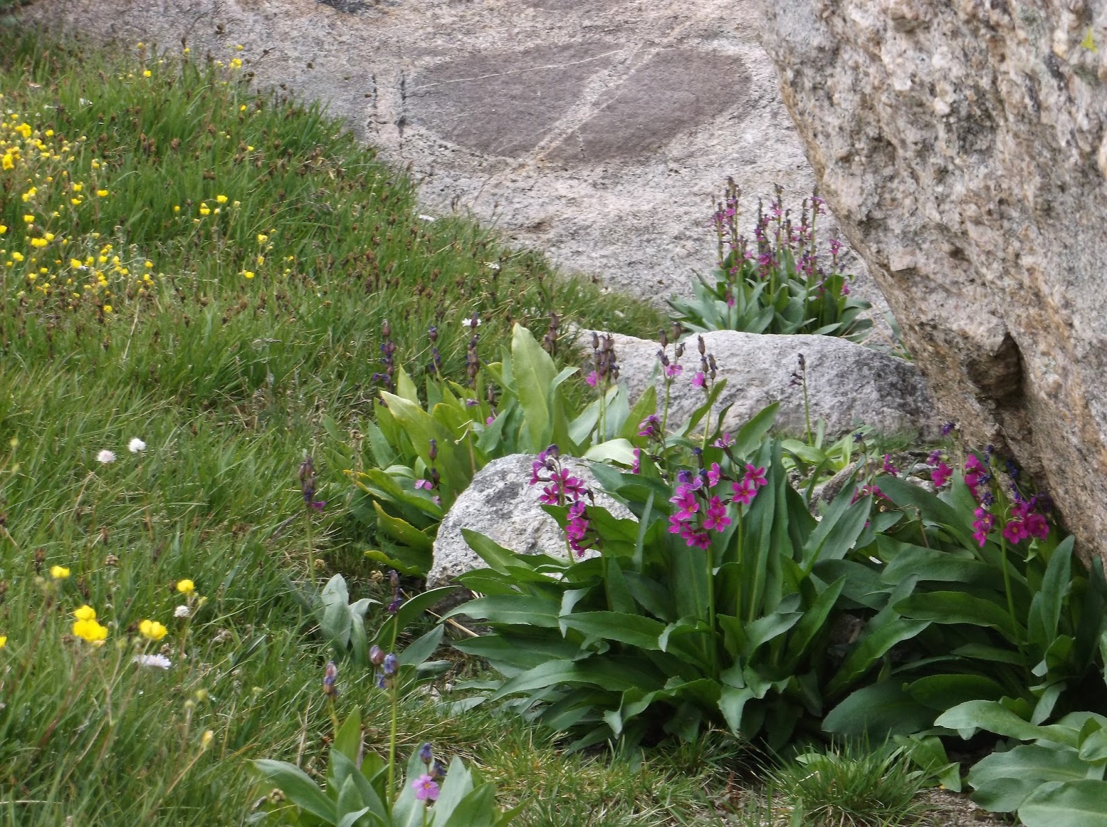
The present calm of the lake's water shines in contrast to the gray violent past of the mountains in its background, as does the annual fragile alpine flowers interspersed with the age old granite boulders.
The sounds, the sights, my thoughts.
Right here, right now all is perfect.
In my catherdral, my church.
The sky turned more gray as the clouds hinted yesterday. Our goal later this morning would be to again go off trail and follow a drainage part way up to Bear's Ears Mtn and then down the other side. Short miles, but plenty of elevation. The rain plan is to stay on trail and go the long way around.
One of the camping groups came by also on their way to upper cathedral. They apologized for disturbing me; even though I had no claim to where I was sitting. A few raindrops fell so I covered Dan's gear with his rainfly and put on my jacket mostly to mitigate the intensifying wind.
The sky continued to threaten but so far no real rain. Dan returned shortly thereafter so we headed back to Middle Lake. The sky seemed less threatening by now so we began our climb up the hill by the stream on the way to Bear's Ears. Like yesterday, it was steep going. We paused for lunch at a meadow about halfway up, we used the stream to fill our water bottles before we angled away from it for the next, steeper section. From the meadow we could see our route to the saddle on the left with more trees. The steepness in the woods gave way to boulders. It was windy as we made it to the pass. From there we could see the bowl below us and the saddle just beyond. We contoured around the bowl to reach the saddle. It was slow going as we neared the other side due to the tree growth seemingly interwoven among the rocks.
Once we got through that obstacle, the saddle opened up with Bear's Ear Peak to our left. We had climbed the 1400ft from Middle Lake and now had to go down to the meadow below. We could see the Bear's Ear Trail from our vantage point. I was glad to see the meadow was not that far down and would be an easy walk. We would need to find a place to camp somewhere among the trees on the other side of the meadow. A large snowfield was on the left of the meadow as a backdrop to the pool of water which sourced the creek running through the meadow. The meadow was covered with willows, but growing more as shrubs. They were wet, apparently this side of the mountains had received more rain. We crossed the creek and went searching for a place to camp. In the trees was remaining hail stones. I guess it wasn't just rain. Dan found a great spot and we set up our tents. While up in the saddle we could hear thunder way off in the distance so we wanted to be ready just in case. It did not take long for the rains to find us. The rain was cold. We got a fire going and made soup for dinner. Fortunately the rain stopped just long enough for us to eat, and clean up. It would get cold over night.
Day 8; Thunder and Hail on the Lizard Head Trail!
Neither of us slept very well last night so we both got up late. We had a big day ahead of us, almost 10 miles involving a lot of elevation change and traversing the Lizard Head Trail; an exposed area. Dan fetched water and food while I prepped the fire. To save some time we had a simple breakfast. After packing up we began our day's trek at the snowfield and followed the Bear's Ears Trail up the slope. This is a horse trail so the switchbacks were long on the steepest sections but then it began to follow a more straight line. In general it was a long slow climb. Overcast and a little chilly with great views of the valley below as well as the Bear's Ears and Mt Chauvenet. at one point we crossed over the actual continental divide. we paused to fill up our water bottles from a small rivulet just before the trail turned South. As we made our way around the bend the Mtn which backdropped Cathedral Lake the previous day came into view. Soon we were looking back towards the outlet of the lake. After consulting the map, the actual Cathedral Mtn is a bit farther back from the lake and not the prominent one in the pictures. also from our vantage point, the junction of the Bear's Ears Trail and Lizard Head trail could be seen in the next valley over. Dan spotted some wild sheep on the hillside across from us. They were so far away one had to wait for movement in order to see them. As we gazed over the valleys, other hikers approached in the distance along the Bear's Ears Trail. We met up with one of them at the junction. He was carrying a fly rod. Dan traded him a fly for some leader. The group of 6 hikers were also heading up the Lizard Head Trail. The sign here said "stock animals not advised"
Our trail led directly into a snow field, and not wanting to trudge through more snow, we stayed below it, and then made our way straight up the rocky hill to intersect the trail. As the sign pointed out this trail is not suitable for stock animals due to its pitch. We came around to the far side of Cathedral Peak and took a lunch respite behind some rocks to block the wind. With lunch barely started, the winds really began to pick up. We donned our rain gear and stowed our remaining lunch. By now the group pf 6 had caught up to us, although they were quite spread out. The next section of trail would be downhill for a short while followed by a significant climb/ All of it on the exposed ridge for the next 6 or so miles before dropping down to the Bear Lakes.
Hardly more than a few steps and the hail began. The quarter inch pellets stung with a direct hit on exposed skin. To go with the hail, thunder in the distance. Both Dan and I increased our pace. It wasn't as though we could outrun the storm. For the most part the lightning kept its distance, but a few flashes and booms were a little unsettling on this exposed ridge. As the hail continued, the ground began to be covered with it. From afar it would look like snow cover, but it was an inch deep of hailstones. Following the cairns we quick stepped our way across the the next few miles. As the hail subsided, we would stop to capture some photos just as the Bear Lakes came into view below us.
The hike on the Lizard Head trail was a grind. Not so enjoyable as we were doing it, a little unnerving at points, but I am glad I did it. The campsite at Bear Lake was not very good, so we explored a bit seeking a better option. It began to rain so we opted to head towards Lizard head Meadow where plenty of campsites should be available as it was on the way to the Cirque of Towers. At the Lizard Head Meadow the weather was kind enough to stop raining as we set up camp and have dinner. As the sun set, the stars emerged. Hopefully tomorrow would be better weather.
Day 9. The Grumps
Must have gotten colder last night as there was frost on the tent. For the second night in a row I did not sleep very well. Not sure why. So I was not in a chipper mood. I mentioned to Dan I had the grumps. he understood as apparently he felt the same yesterday. Our plan for the day is 12 miles, although we could knock off a significant portion by skipping the cirque of towers. Dan allowed me me to make the call since he would be visiting the cirque later in the month when the others join him. After some coffee, map consult, and personal reflection I opted to hike to the cirque. We would just have day packs since we would be coming back this way, having lunch and then moving on. We pre-made lunch so it would be awaiting our return.
The Cirque of Towers is likely the most popular spot in the area were are traveling, for hikers as well as climbers. The trail was wet from all the recent rain. As we approached the cirque I was rather unimpressed with the view. It was beautiful, but some of the others cirques we have seen were also spectacular. I suppose I had expected this one to be "better" due to its popularity. I wondered if its popularity had to do more with ease of access along a straight trail. Anyway, it didn't even crack the top three of what we had already seen. We were not alone at the cirque. The folks from our Lizard Head trail traverse were also there. They had their gear spread out trying to dry it in the morning sun. A few were fishing. We all chatted a bit, laughing about the the craziness of the previous day. From across the lake we could hear climbers on one of the towers. "on belay" clearly carried over the water.
we took a slow hike back to camp. Dan fished in the Popo Agie, the outlet of the lake below the Cirque. A few raindrops fell, so I donned my jacket. These droplets were a harbinger of what was to come. No sooner did Dan make it back up to the trail did the sky open up. We hurried back to camp. I am not sure why our pace increases in bad weather, but we made it in half the time. We packed up our tents and gear from the inside out to keep the dry stuff dry. I kept my rainfly up so we would have a dry space to eat lunch. Just as Dan finished packing up, the rain subsided. Not wanting to tempt fate too much, we sat under a tree overhang which had remained dry to eat. As we ate our prepared lunch, what a smart move by us, the sky cleared. We often joke about Adirondack weather changing quickly, but here in the Winds it is crazy just how fast the weather shifts and also how specific to an area it can be. The next few miles would be a gentle downhill. We should make good time. The canyon had some great views along the entire stretch; mammoth cliffs followed us on the other side of the river.
At the next junction we would head away from the main trail and begin our climb. 600ft over one mile to the next junction. Followed by another 200 ft section over a half-mile. Since it was a horse trail, it would be a long switchback. We had come down this section earlier in the trip and were heading back to Baer and Echo Lakes. While filling water at Lower Baer Lake, we noted signs of horses crossing the outlet. Dan fished a bit while I went to explore for a potential campsite. I reported back, " I found the spot where we will be drinking coffee tomorrow morning". It was a fantastic site up on the hill overlooking Lower Baer to the South with the mountains behind it. It was 5:30pm. Camp set up, hot bath, late dinner. A small amount of rain, possibly some snow mixed in. It all ended before we went to bed. I can hear an airplane high overhead as I write this. Big climb tomorrow.
Day 10. Up, Up and more Up.
Our campsite was very nice. At 6AM the fog and the moon at the breaking of dawn was fantastic. The view from where we had our morning coffee was just as nice as expected. With our coffee we had trout tacos for breakfast. We also pre-made our lunch. some time was spent drying out our gear in the morning sun so we didn't head out until after 10. The trail was a gradual ascent to the Echo Lakes and then the 800ft climb up to Deep Creek Lakes. Even with our light packs (almost no food as we will be picking up our stashed bear canisters at Deep Creek Lakes) it was tiring. Dan was waiting for me at the cached food which had not been disturbed. After re-arranging the gear in our packs to accomodate the canisters we dropped down to the Deep Creek Lake junction with the Ice Lakes Trail. From there it was a short 100ft climb up to the first of the Ice-Lakes where we had lunch. Dan is off fishing now one of the upper lakes. There is thunder in the distance to the SE.
From the Ice lakes we had a long 500ft elevation gain to the the top of the next pass before we would drop down to 9800ft. The first time below 10k in a few days. This climb was the most difficult of the trip, but after the last few days and this mornings mornings climb it felt like it. Oh, and our packs just gained 10+ pounds with the food resupply. Some fisherman passed us going the other way. They provided some info about which of the lakes held fish and which didn't. By the time we finally got to camp a few hours later, both of us were whooped. Dan was starving, I figured the dehydrated black bean stew would be a fast dinner. It wasn't. For some reason the black beans would not rehydrate and remained crunchy. Seeing it was not a large volume fo of food to begin with, dan decided to supplement the meal with a brook trout appetizer. He headed to the stream to catch a pan full of brookies. By now it was much later and the beans had still not fully rehydrated. Very odd since the black beans the other day rehydrated just fine. I added more water to the stew while Dan cooked up the fish. It was dark before we ate. I was bummed the black bean stew was a dismal failure as it is typically one of my favorites. At least we went to bed warm and dry. Clear skies signalling a possible cold night. Even though it felt like we all we did was hike up hill all day, it was actually a net elevation loss of 200ft.
Video of still photos taken on trip. Please excuse the date error on title page.
Emily dropped me off at the airport at 5:30. Received a call from Dan that they were stuck in traffic and would be a few minutes late; we would still have plenty of time to make the 7:40 flight. At the ticket counter we needed to re-arrange items in our luggage to get below the 50# weight limit. Our food for the 2 weeks plus gear! Some of the food needed to be moved into our carry-on bags. At security, my carry-on was flagged for additional screening. It had 10 pounds of food almost all repackaged into ziploc bags. The security agent was friendly, and we joked a bit as he went through it all swabbing bricks of cheese and bags of dehydrated meals. During the conversation he asked us if we knew what the spectrometer was screening for. We replied we didn't and he told us traces of explosives. The joking continued as he just swabbed the bag of chili.
The flight from Roch-Charlotte-Denver was uneventful. The shuttle to our hotel took a long time to show up. It was past midnight before we checked in; 2am Rochester time.
Day 2; Already Behind Schedule
The next morning I checked on our flight to Riverton and the struggle began. The 10am flight had been cancelled and we would now be on the 6pm flight. We looked into all different options including renting a car and driving but all were cost prohibitive. Money vs time. We re-arranged our shuttle pickup for our new arrival time in Riverton. In the meantime, Dan did some "phone shopping" for flies from an outfitter in Lander, WY. Our shuttle driver would pick up the supplies for us to save some time. We eventually arrived in Riverton and were met by Christian of Custom Crusie Control who then drove us first to drop off our traveling luggage and then to Worthen Meadows. We arrived close to 11 pm. Set up tents in the dark and made plans to get up early and try to make up some time. We had hoped to do 4 miles already with our heavy packs leaving only 8 for the next day, but now we would be carrying our full load 12 miles, starting at 8000ft.
Day 3; Legs of Jelly
Up at dawn and all packed up. Boy the pack is heavy with that much food; more than double what I usually carry and we are at elevation. We were on the trail before 8am. 12 miles to go with a net gain of 2000ft, no time to acclimate we jumped into the deep end. This was going to be tough a harbinger of what was to come. signed in at the register 2 people, 12 nights, no stock animals. The trail began uphill, of course. The pack was heavy but not so bad. A lot of people backpack with packs close to 50#, just not me. The trail was called Sheep Meadow and we were heading to the Popo Agie River 3 miles in for our first stop; breakfast. Dan mentioned he liked the idea of starting early to and stopping for breakfast, though this was the only time we would use the technique for the rest of the trip except for the last day. Cream of Wheat and coffee, quick and easy. We set aside of lunch fixins', we chose to use of one heavier lunch options originally scheduled for Day 5 to get it out of our packs and it was a no-cook option. The trail, the elevation gain, the heavy pack, and the altitude was beginning to take its toll. I was still moving, just much slower struggling to keep up the pace. Each step seemed to sap more energy than usual. We took many breaks, but it wasn't enough. Made lunch at 1 pm, and rested for 30 minutes. Each step felt like a burden and we still had 5 miles to go and a significant climb of 600ft right at the end to reach our final elevation of 10,200 ft. Dan slowed down his pace, and I still trailed behind. I stopped numerous times on the uphills, leaning on my poles. Dan kept encouraging me and stayed just enough ahead to pull me along. I pushed myself to take each step deliberately. We eventually made it to Deep Creek Lakes. I do not know how, I could not feel my legs for the last 2 miles.
Snow was visible on the upper slopes and a smaller shelf on the northern shore of the lake. we set up camp. Dan fished, I filtered water and got the fire going. Boiled some water for dinner, but since Dan returned with 2 large cutthroats trout it would be fish for dinner. We adjusted our menu plan for second time and tonight we would have trout tacos. The water would be used for bathing.
Day 4; On the Edge
We adjusted our itinerary to make today a base camp/day hike. Basically we swapped our Day 4 with Day 9 when we would be passing through the Deep Creek Lakes to pick up our food cache. An easy breakfast and pre-made lunch to have it waiting for us when we returned from our morning adventure. The plan was explore the Deep Creek Lakes in the AM and then the Ice Lakes in the afternoon. We started up the trail along the lower deep creek lakes towards its inlet. About halfway to the inlet Dan spotted trout rising. The trail was a good 20-30 ft above the shore of the lake and the steepness provided a good view into the water. He snuck down to the waters edge while I spotted from above. The cut-throat trout (we thought they were golden at the time) were somewhat picky. Often approaching a fly and then turning away at the last second. Dan brought in a few good ones which we stashed in a rock cooler at the shoreline for our return. We put up a small cairn to mark the spot on the trail so we could find it later.
Continuing on to the inlet and the northern slopes. At the inlet a large snow shelf was being undercut by the water. Dan fished the inlet, we could see the trout swimming through the shallows and stacking up in the deep pools. While Dan fished I continued up to the next lake and scouted a location for us to cross the inlet. At the next lake I sat on a rock lining the shore admiring the view and exploring the mountain backdrop with my eyes. As I was finishing my snack, Dan made it to thee lake. We backtracked a bit to the crossing and made our way to the inlet of the middle lake to the south. This inlet was a decent cascade transporting the water from the next lake a few hundred feet up. There was discernible trail at this point, so we picked our way through the boulders, wild-flowered grassy knolls and eventually tothe eastern shore of the largest of the deep creek lakes. A fantastic view greeted us. Using the map, dan would point out the different peaks such as Little El Capitan and Wind River Peak and other geologic formations we could see across the lake and surrounding the lower lakes. The un-named peaks were just as impressive as the named ones. We were now at 10,800 ft. To the SE, up and over the ridge was the Ice-Lakes. After a brief respite we worked our way back a little to the outlet to find a way to cross the cascade. There was knoll on the other side which we were going to use a means to access the uppermost of the lakes. The best spot to cross was jumping a gap at the limits of my stride. I was more concerned with the return, but I would deal with that later. The knoll ahead of us is just shy of 11k ft. we climbed up a ways and made our way clockwise along some of the ledges and dropoffs. These heights would typically cause me concern, but I was glad I was able to enjoy them without anxiety. I did maintain a healthy distance from the steepest cliff at 120' above the waters edge.
Continuing in our clockwise and up direction at one point we had to climb up a crevice to get to the next ledge. Soon the smallest and uppermost of the deep creek lakes came into view. The rock dam holding it back reminded both of us of the shortest portage in the Quetico last year which began the "portaging the rock". Satisfied with just seeing the lake we also decided it would be best to find a different way back/down. We continued in the same direction to either climb down the northern section, or go up and over the top. The next few minutes found us walking north up a grassy meadow towards the other deep creek lakes. "The hills are alive..." rand through my head. Dan climbed up on a rock to visually scout us a route down. It would necessitate us walking along the top of one of the snow fields. As it was August, the snow field has been pulling away from the rock face leaving a narrow but deep crevice between. At first we would lean towards the rock with an out stretched arm and our hand along the rock face, but eventually the gap became to large and we would have to drop into the crevice for a short while. It was a challenge to keep far enough from the crack to not have it collapse, and not so far we would slide down the snow field. At the other side we were able to drop down to the next ledge which we should be able to follow around to the the other side. We rested a bit here and looked out over the lakes with the mountains in the distance. It turned out that this way was not our route out. We came to a drop which was too much. So we backtracked back up to the snow field, and retraced our steps. It was easier the second time as our previous footprints provided more stability. We then headed up and over the top of the knoll. I lost Dan in the trees so I climbed up to the very top to see if I could make out his hat. He soon realized I was not immediately behind him, and called out. By then I had figured out which direction he had gone and was almost caught up. Now on the eastern slopes we swichbacked down the ledges back to the water's edge about 200ft down. The route we had taken both on the ascent and descent had pushed me well beyond my comfort zone. I would later thank Dan for pushing me past my limits. He replied to not thank hom or he just might do it again... little did I know at the time.
We scrambled down the boulder field the way we came to the middle lake. Dan tossed a fly into a hole which had a number of fish stacking up. It didn't take him too long to hook a beauty. From my vantage point I took a number of photos of the fight and landing. Since we had some nice ones already "on ice" this one was spared the frying pan and released. Dan continued to fish and I slowly made my way down and back to the trails. As I closed in on our campsite I passed another with a family setting up. They had packed in with 2 llamas. After chatting a bit and a couple llama photos I returned to camp and began filtering water. I had barely started when Dan returned. It was now 3pm, our morning adventure had taken the good part of the entire day. Our late lunch would be an early dinner and a late supper. Dan is fishing again while I write and relax. After the 12 miler yesterday and todays adventure I could use it.
Day 5. Old McDonalds Farm
So far the both of us have been awakw before sunrise proper around 6am. Today was no different and I being up slightly ahead of Dan restarted the fire from the buried embers in the ash. Dan made coffee and I buckwheat pancakes w/pecans & blueberries. Dan stashed the bear canisters with our food for day 10-15 as we would be coming back through this area on the last leg of our journey. We were on trail by 9am which was our goal. A little uphill before the long descent of 800ft to Echo and Baer Lakes. We would be climbing this stretch on the morning of day 10. At the first Echo Lake, the brook trout were rising so we stopped for 15 minutes as Dan landed a few which were spared the frying pan. While scouting campsites for our return through this valley we were leap-frogged by 2 other backpackers. We caught up them at the next trail junction. They were in the site next to us the previous night and on the last few days of their trip, with today being the Cirque of Towers (our goal for day 8). We headed in the direction of Dickinson Park and had to cross the Popo Agie River. The ford at the crossing is likely more often used by horses with higher clearance than ourselves. With our pants and shoes around our necks Dan went first. At the deepest section with the fastest current the water was mid thigh. For me, it was wetting the bottom portion of my shorts. Dan entertained himself by taking pictures of me crossing the river. I have not seen them yet. Oh, the water was frigid! Later we would cross another stream but this time on a log. A decent step off for Dan, but for me a bit longer than a full stride so my trailing foot just barely hit the water as Dan grabbed me from falling in completely. Thanks buddy.
Heading up the high meadow connector trail which would be about 650 ft elevation gain on winding switchbacks with plenty of equine evidence. These horse trails are long; this one showed relatively recent trail work with shored up side hills and water bars. As we neared the top a great view over the valley was found so we rested a bit. We opted not to have lunch here since both of us were low on water. Soon enough we would find a waterfall and make lunch nearer the next junction with the high meadow trail. After lunch and at the junction we turned left toward Cliff Lake following fresher horse tracks and poop. Wishing out loud, I commented they might be on a day ride. With just under two miles to Cliff Lake, Dan had a little giddy-up in his step, hoping to get to camp before the horses I imagined (and later confirmed). As it became apparent we were not going to catch them, we stopped at a boggy meadow to fill water and look around. I was swarmed by black flies, but they were a minor inconvenience unlike our Adirondack blood suckers. While looking around Dan found some horseshoes in a sandy area of the meadow. It looked like some folks had set up a horseshoe pit at some point in the past. Pressing on we arrived at Cliff Lake with the horses tied up in the campsite. The group was on a guided tour led by two younger guys (20s-30s) all dressed up in the cowboy/dud ranch attire. They certainly looked the part. The one napping at the lakeside confirmed they were on just a day ride and would be heading out soon. Dan gave a show to the kids hooking a large trout on his first cast right from the shore. We explored the other side of the outlet looking for a better campsite nearer the sandy beach. Returning to the other campsite, the group had departed and the campsite was now covered in horse manure. It smelled like a barnyard. We found some tent sites away from the main area with all the manure; ironically closer to the area where the stock are usually tethered away from the human camping area. Using a pince branch we swept walkways through the barnyard for access to/from the firepit, and the trail to the water. Dan fished some more while I readied camp, collected wood, filtered water, heated bathing water and other camp chores.
Cliff Lake is aptly named. Its backdrop is mountains like most here, but the mountain is much closer and more vertical and the cliff face terminates at the waters' edge. A descent cascade also pummels down the cliff, carving into the rock as it descends into the lake. Later we would feast on trout and cream of potato soup. We made it to bed before dark with the scent of manure wafting through the mosquito netting. EIEIO
Video of still photos taken on trip. Please excuse the date error on title page.