1/5/2013
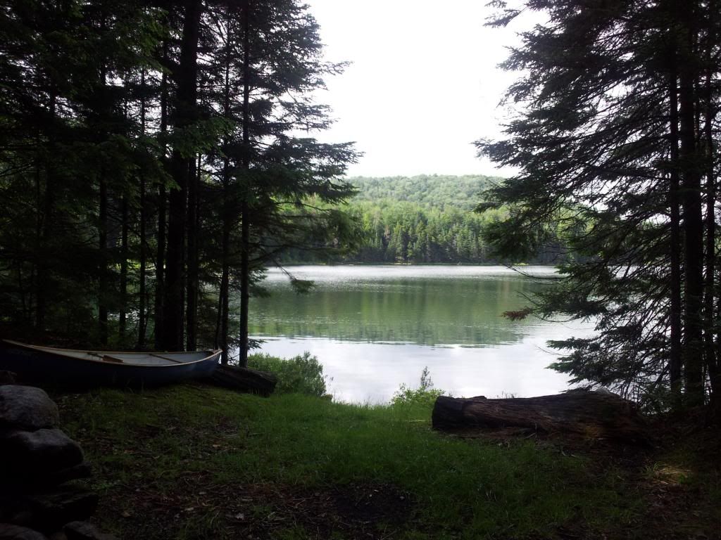
scout trip to Cutler
1 night/2 miles
A
patrol in the troop for which I volunteer wanted to go on an winter
trip and was in need of an additional adult leader. They asked me to
join them. This is a young patrol and they are slowly expanded their
camping experience. Was a nice relaxing trip. The boys had fun.
1/20/2013
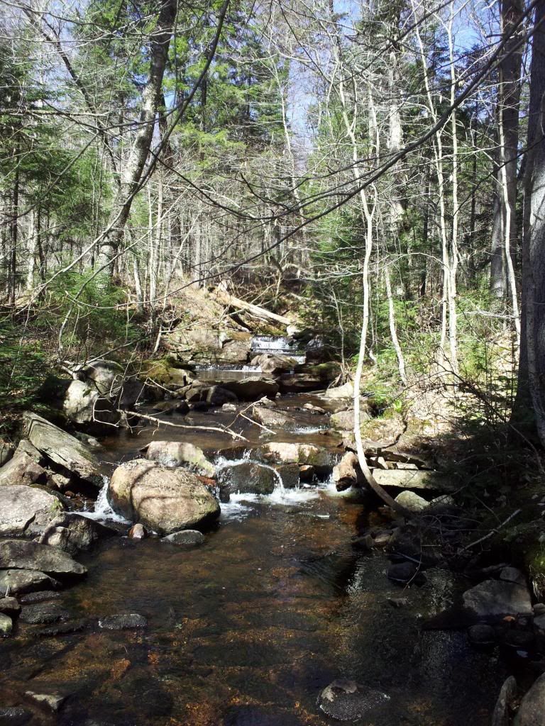
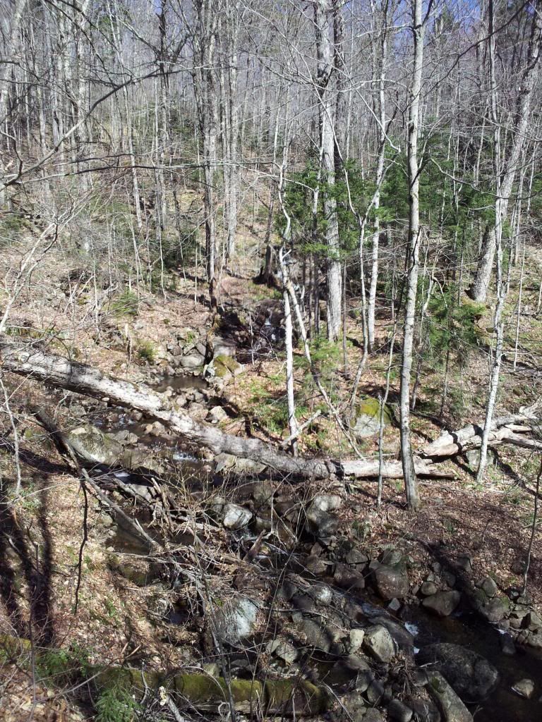
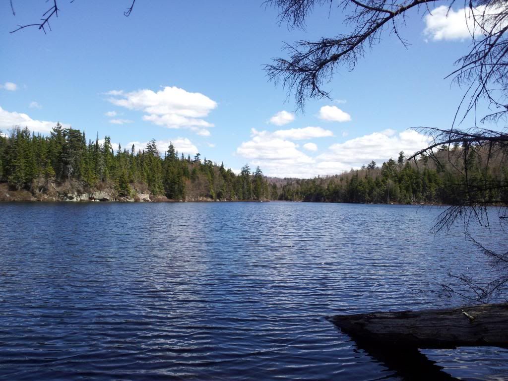
Wolfjaws -Lean2Rescue
1 Night/9 miles
Left
at midnight to get to the garden before the rush. Travel was terrible
and it took me an hour longer. I still beat the rush, but not by
much. Called in the the rest of the crew to give them the parking
situation. They arrived promptly and filled in the few remaining
spots as the sun came up and the masses arrived. We loaded up our
pulks and headed up to the interior outpost where we would meet the
other crew which started Fri. Ont he ay up we passed by the Ranger
who had spent the night with our crew. I guess he couldn't pass up
the food that was offered; both dinner and breakfast. We would see
him again the next AM as we awoke. At the interior outpost, Mark L
greeted us and let us know how the crew had progressed the day
before. We were ahead of schedule but they were unsure about doing
the roof shingles in the cold. Paul was heading to Slant Rock and
Bushnell's leantos to assess what was needed for their rescues, while
Brain and Cindy would assess OreBed leanto. Paul had me and Henry
send a message to the project leader at Wolfjaws, "Do the damn
shingles if you have the crew." We showed up to the Wolfjaws
leanto and the crew was operating as usual. Jumped right in to do
whatever needed to be done as is lean2rescue style. You just do what
is needed and what you are able to do. I went to work clearing ice
from the shiplap for the roof and then helped george with the floor
kit. As the clock neared beer-thirty we had begun putting the tools
away while the roofers were finishing the cap. The decorative logs
and the oakum were put into place and we settled in for a group
photo. Back at the JBL we unloaded the reinforcements we had pulked
in as we had heard they were running low. Beer was opened and dinner
was started. having had gotten up at midnight, I retired earlier than
usual. The next am, I heard voices and soon learned it was the
caretaker and the ranger talking. The ranger had hiked in before
sunrise to try to locate a group which had given him some sketchy
info the previous day. when he checked the sign-in register there was
some discrepancy. Believing the group was not staying separate (HPWA
is max 15 people day, and 8 night) he was tracking them down to
educate them regarding the regulations. As others awoke and the sun
came up, the sky began to drop its moisture. Fiirst rain, which we
were not happy to see. Pulks do not do well with little snow and the
rain would uncover the trail rocks. And we had bundles of old
shingles to bring down, as well as the tools. Soon the rain changed
to snow. We finally got loaded up and were on our way. My pulk hit a
rock at full speed as we crossed feeder creek and promptly exploded
the front. While attempting to salvage it to get the gear and
shingles down, george and tammy caught up to us and tammy only had
her pack in her pulk. we loaded the shingles into hers my
broken pulk was loaded on top and she donned her pack. I
hooked up her pulk to my waist belt and continued on. I guess I now
have an excuse to get a new pulk. Back at the garden we unloaded the
sleds into the trailer, separated tools from trash and headed out.
These trips never cease to amaze me. As paul says, "never
underestimate the power of stupid people in large numbers". He
must be right as we never fail to get the job done and we are "dumber
than a bag of hammers". Who else would carry logs miles into a
forest.<div><br></div><div>photos... not
mine, but I am in them... somewhere :)
http://petedavispictures.zenfolio.com/wolfjaw</div>
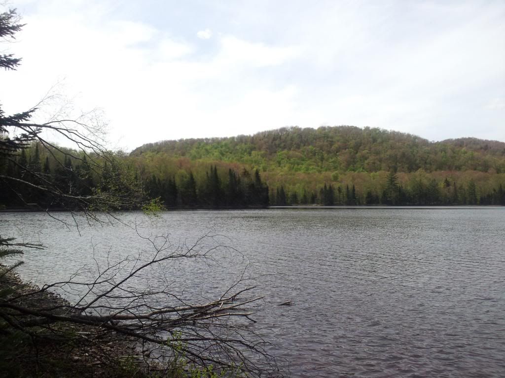
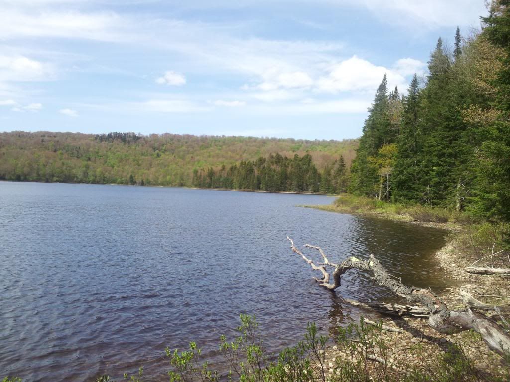
2/24/2013
5th times a charm -Russian Lake
2 nights/16 miles
<font
face="Arial, Verdana" size="2">I was invited
to join this trek which has previously had 4 failed attempts. The
goal was to bushwhack from Russian Lake in the Pigeon Lake Wilderness
to Lower Sister Lake. Since I had the time, I decided to go up early
and spend Thurs nite solo along Bear Creek. Only hiked in about a
mile, set up my hammock and read in the quiet of the woods. Even
though the hike was short, snowshoeing an unbroken trail with 2 feet
of snow dragging a loaded pulk was tiring. This "warmup"
would be a harbinger of what was to come. </font><div
style="font-family: Arial, Verdana; font-size: 10pt; font-style:
normal; font-variant: normal; font-weight: normal; line-height:
normal;"><br></div><div style="font-family:
Arial, Verdana; font-size: 10pt; font-style: normal; font-variant:
normal; font-weight: normal; line-height: normal;">On Friday
AM. I awoke with the sun and retraced my steps back to my car and met
Ian at the diner. After a hearty breakfast we drove up the road to
Big Moose Lake which would be our jumping off point. We loaded up our
pulks and heading across the lake. It was 11:30. Our initial heading
was about 2 miles to the east bay where the trail to Russian Lake
began. Going was slow with the deep snow but at least it was flat. In
the middle of the lake we hit some snowmobile tracks and were able to
move a little quicker and easier in the old tread. As we entered the
East Bay, we crossed a deer path with a nice pile of
droppings. The deer path wandered from cedar to cedar clearing off
any browse that was within reach. The trail to Russian appeared ahead
and we climbed up to the woods.The sign and map showed the trail to
Russian to be 3/4 of a mile. This initial lifting of the pulks
through the deep snow took about 5 minutes and quite a few grunts
ending with a 3 minute break to catch our breath before continuing.
This would be sequence which would repeat for the remainder of the
day. We had about 100 yards to parallel the shore line to where the
trail register was located. The box was open and had 18 inches of
snow piled on top of the book. Ironically the register box had the
following words, "Please register and close door". We
laughed and took a break as those 100 yards took about 10 minutes to
pull through the deep snow. The pulk acted as snowplow and the
breaking trail was slow and tiring. The trail to Russian was typical,
a little windy with lots of little dips and since it was winter
plenty of spruce bent over the trail. The fist half was
spent stopping every few feet to deal with these spruce tollbooths.
We paid dearly with energy and time. Since we would be paralleling
the outlet of Russian Lake, we would need to gain about 70 feet over
the next 7/10 of a mile. Not much, but with the deep snow and pulk,
this would be a chore. We eventually made it to Russian, and it
seemed like we had hiked to Russia itself. The last 3/4 of a mile
took us 3 hours! We collapsed in the leanto, and rested for a few
minutes before the next of our chores was to begin. We dug out the
firepit, uncovered the picnic table and collected wood. We got a fire
started and waited for the rest of the crew. they arrived about 8pm.
What took us 4 hours, they traversed in 1.5. Chuck and Ted were the
first to arrive and since they were part of the previous failed
attempts to Lower Sister were much appreciative of the trail breaking
we had done. We feel asleep earl knowing what was in store the next
day.</div><div style="font-family: Arial, Verdana;
font-size: 10pt; font-style: normal; font-variant: normal;
font-weight: normal; line-height: normal;"><br></div><div><font
face="Arial, Verdana" size="2">6:30 am arrived
and we ate a quick breakfast and loaded up our daypacks. The first
half mile was to cross Russian Lake. It was a beautiful morning the
sun shone on a lone dead tree towering over the lake upon which an
Osprey nest was perched. On the other side of the lake we began our
bushwhack. A few ups and downs and some spruce thickets took us to
the creek which we had to cross. Finding a log and an ice shelf we
made our way to the other side and climbed up to intersect with the
trail to lower sister. While this was a marked trail, the conditions
would be similar to the approach trail to Russian. Fortunately had
day packs and not fully loaded pulks, It was long and slow breaking
trail, but with a larger group different people could take the lead.
We had a 2pm turn around time so as to ensure we could make it back
before too late. With the western finger of the lake in view we left
the trail and heading down to the lake. we still needed to cross the
lake to get to the leanto. We arrived at 1:45. About 5 hours from our
starting time. We had a celebratory lunch and
headed back. 2 hours to get back and dinner was started. We hung out
and bathed in our success. We should have taken real baths as we all
smelled but we didn't care. The night was smiles and
laughter until we all crashed.</font></div><div><font
face="Arial, Verdana" size="2"><br></font></div><div><font
face="Arial, Verdana" size="2">Sunday AM we
slept in mostly due to being too sore to get out of bed. Typical
groans of early awakening were substituted with groans from sore
muscles and aching joints. We had a nice long breakfast and one by
one packed up and headed back. Departed at 10 am and was back at my
car at 11:30, exactly 48 hours from when I left it on
Friday. </font></div>
3/17/2013
St. Paddy's day meetup -Chub Pond
1 night/9 miles
Due
to my upcoming schedule I had to plan the annual hiking meetup group
backpacking trip for a little earlier this year. As soon as it was
announced, it was full and a waiting list ensued. By the time of
trip, many had dropped out, and only 4 showed up. I am sure this was
weather related. The forecast called for single digits at night. It
was close to zero. We were on the trail early and due to there still
being considerable snow, both Sheldon and I dragged our pulks. This
allowed us to take a little extra beer. We took the trail slow as
there was no rush to cover the 4.4 miles to the pond. When we finally
arrived and opened up a beer we noticed that there was already
considerable amount of wood collected. Just some kindling was needed
so we soon had a nice little fire going. The temp at the lean-to was
18 degrees. We knew it was going to be cold that night. we spent the
rest of the afternoon and evening socializing, eating and having a
grand 'ol time. Emily "the worm" was drifting in and out
and the rest of us soon had heavy eyes. I called it quits and was
soon in my hammock. I awoke once for natures call but didn't emerge
fully until about 6am. I rekindled the fire, made some coffee and
watched the sunrise. It was a couple of hours until the next of our
crew emerged.The temp at 8:30 was 8 deg. Emily was the last at close
to 10 am. We left camp at 11:30 by then the temp was back up to 18
deg. The hike back was quick enough. Except for the initial climb
from the shore of the pond, the remaining miles would be generally
downhill. during the night a snowmobile had come through making a
nice hard path on the new snow for us to follow.I forgot to put on
sunscreen and will pay dearly for that lapse.
4/6/2013
Quick trip to FLNF
1 night/10 miles
<font
face="Arial, Verdana" size="2">The Finger
Lakes National Forest is only about 16,000 and is checkerboarded with
access roads to create sections 1 mile square. The maximum distance
of a half mile to any road doesn't eliminate the possibility of a
decent backpacking trip. For myself, when I get over a hill and down
into a valley by a babbling stream, it doesn't matter if the road is
just over the aforementioned hill a quarter mile away or 100 miles
away. The feeling of seclusion is the same as long as said road isn't
heavily traveled and the noise breaks the suspension of
disbelief. </font><div style="font-family:
Arial, Verdana; font-size: 10pt; font-style: normal; font-variant:
normal; font-weight: normal; line-height: normal;"><br></div><div
style="font-family: Arial, Verdana; font-size: 10pt; font-style:
normal; font-variant: normal; font-weight: normal; line-height:
normal;">Due to unforeseen consequences my planned 4 day trip
to the Adirondacks was changed to an overnighter in the FLNF. I met a
hiking buddy early afternoon on friday and we started along the
Interloken Trail (a branch trail of the FLT). We soon turned off the
trail and followed the Potomac trail through the group campground
which doesn't see much use and the large tracts of pasture land the
local farmers use (with permits) to graze their livestock. We took a
hard turn off the trail into the unbroken wilderness. Actually it was
an unmarked trail probably used by snowmobiles in winter. Our
destination was the confluence of two small creeks and then to locate
a suitable place to camp. We first headed upstream and up a small
spiny ridge. At the top we found a makeshift shelter comprised of
hemlock branches fashioned into a survival lean-to. We headed back
downstream and passed some older campfire circles in the duff. We
finally settled in on an old campsite nestled with a small hemlock
grove. the creek was nearby and would provide water and "white
noise" for sleeping. We set up camp, gathered firewood and
explored the ridge behind us. At the top of the ridge was the
remnants of an old road, now used as an unmarked
trail. </div><div style="font-family: Arial,
Verdana; font-size: 10pt; font-style: normal; font-variant: normal;
font-weight: normal; line-height: normal;"><br></div><div><font
face="Arial, Verdana" size="2">Back at camp we
fixed dinner and enjoyed a relaxing evening. The sun soon set and the
temp began to drop. The fire was warming but soon the warmth of our
sleeping bags would win out. Ted awoke before me and tended to the
fire. I stayed in the warmth of my cocoon until my bladder made the
decision for me to get up. Both Ted and I are habitually early risers
and this AM was no different. Even dallying around we were
on the trail by 8am. We headed back a different route to again
intersect the Interloken trail. We would take this trail back to our
car which we arrived at 10:45. 10 miles in the
FLNF I missed that place, it deserves to be visited
more.</font></div>
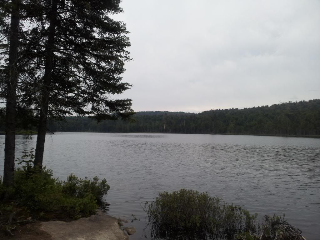
5/5/2013
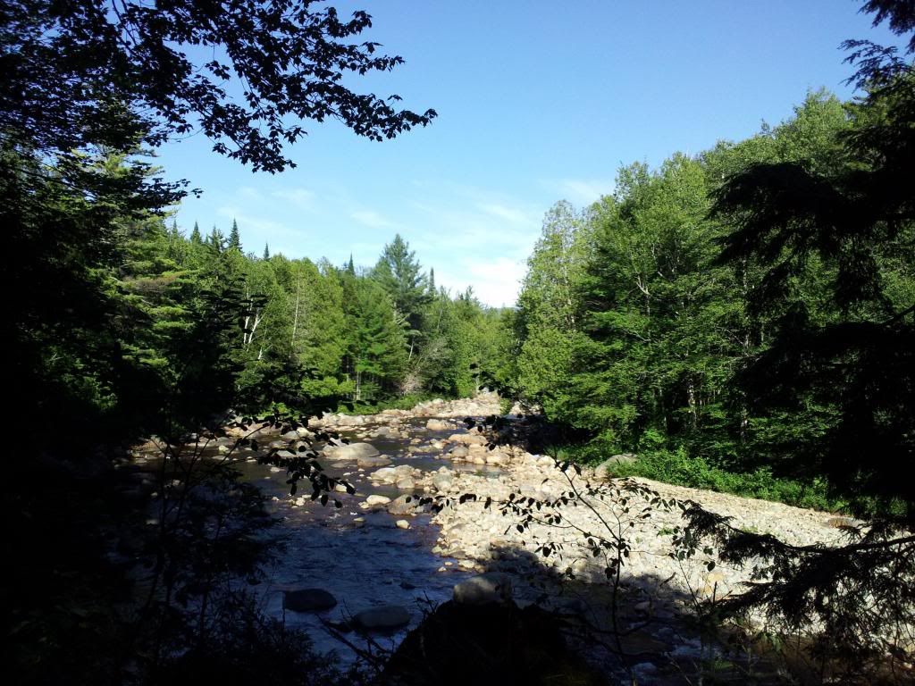
Metcalf Lake bushwhack
1 night/ 16 miles
The
plan was originally to do a little fishing at Brewer Lake with Ian. I
was going to carry the canoe the 2 miles in and he was going to carry
the beer. Mid week I received a message from both Ian and Justin. Ian
had to work unexpectedly and Justin was looking to see if I could
join him on a trip. Sometimes nature just has her
reasons.<div><br></div><div>I met Justin at
the Mad Tom Brook trailhead at 7am. Justin, Jenny and I were soon
headed down the trail paralleling the S. Branch of West Canada Creek.
We crossed numerous feeder streams one of which we would use as a
handrail in a little while. We stopped at the confluence of the trail
and the S.Branch just to take in the view. After a brief discussion
about the stillwater upstream we headed back down the trail to
Calamity Brook. Many maps do not show this small stream. we followed
a faint herd path parallel to the brook passing by a hunters
campsite. We then intersected with the remnants of the old S Branch
trail and followed it till we got to Boundry
Brook.
We
used Beaudry as a handrail as we bushwhacked north trying to save a
little time/distance by not hugging the winding stream. We passed
through a few beaver meadows and some remnants of ancient campsites.
When the brook began turning towards the west, we took a bearing to
climb the shoulder of Buck Pond Mt heading towards jones brook. This
was a relatively easy bushwhack through most open hardwoods though we
had to gain a bit of elevation. As the sounds of jones brook grew
louder we bent a little north and soon the long cascade of jones
brook tumbling down 200 ft came into
view.
So far most of the bushwhacking was relatively easy. The witchhobble hasn't budded out yet and the open forest alllowed us to travel around most of the blowdown. We did have some nasty sections at the lower portions which would be a harbinger to what was to come. We pushed through the spruce lined border of Jones pond to follow its inlet to Buck Pond. Most of this was pushing through spruce and climbing around downed trees. Not fun, but we were approaching our goal. At Buck Pond we hugged its shore till we go to its backside to a spot where Justin and Jay had spent a hailstorm hunkered down a few years back. We pushed north into a draw, took a bearing and followed the draw down to the lake. A spring bubbled out in the middle of the draw which bore some cold quenching water. We followed the draw to the edge of Metcalf Lake. The remnant of an old campsite would be our home for the night.
Since we had started so early it was early in the afternoon. We made camp, relaxed and looked for a boat. many of these remote Adirondack Ponds have boats hidden around them. Artifacts from the days when floatplanes were commonplace in these parts. No boat was found, but our site showed the remains of a cobbled together dock of sorts. It was now underwater preserved for us and others. We took an hour to bushwhack the shore line and then headed back. Circumnavigating this lake would be a day's journey in and of itself. We decided it would have to wait for a 2 night trip. Back at camp we relaxed and chatted. It had been a while since Justin and I had backpacked together. The sunset was incredibly bright, we tried to watch but it was difficult to look towards the sun. Soon night came and my eyes grew heavy. The 8 miles (5 of which we bushwhacked) coupled with me leaving at 3am would be too much for me. </div><div><br></div><div>I awoke as the sky grew light. I stayed in the comforts of my hammock as the morning began to break. Soon Jenny was up and came sniffing around my hammock. Justin arose and called for her. Soon we were breaking camp and heading home. Jenny took the lead for the most part following our path in with her nose to the ground. we shaved off about half an hour on the way out. The weather was in the high 60s and the black flies had yet to emerge. We couldn't have asked for nature to provide much more than that.
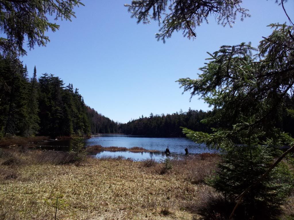
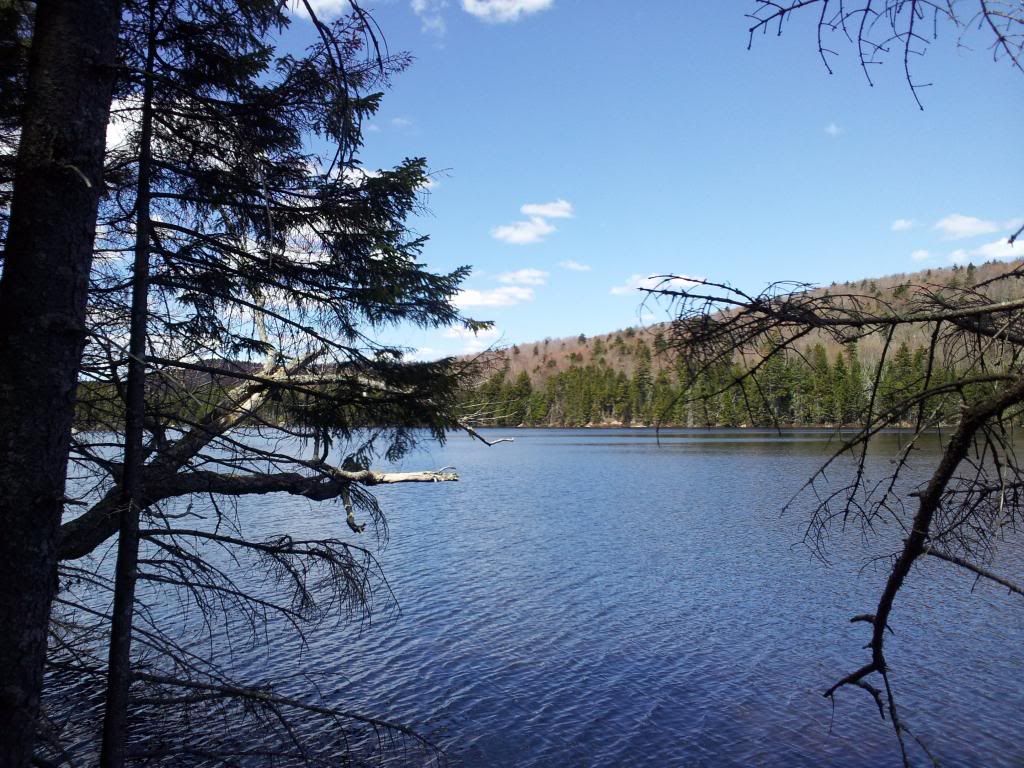
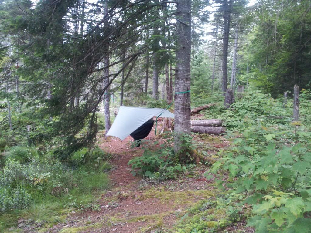
5/19/2013
Solo on Old Blue -Bear Lake
1 night/13 miles
Due
to work changes, Ian had to bail on our arranged adventure. This
provided me the opportunity to check off my list an old trail which I
haven't yet connected end to end. I would also get to visit the Lean2
which has the memorial plaque for departed L2R brother,
Bryan. <div><br></div><div>Starting
at the Bear Creek trailhead amongst a swarm of mosquitos I signed in
at the register pausing only long enough to notice few others had
signed in this weekend. The 1/2 mile along the jeep road passes
quickly and soon I was deep in the woods. I noticed the trail had
been cleared recently. A couple passed by me and we exchanged
pleasantries and again I was alone in the woods. I stopped by the
"driveway" to make some mental notes of the creek at this
spot since this is the take-out for the Bear Lake-Bear Creek canoe
trip from a few decembers ago. Will certainly do it again
hence the need to take notes. Back on the path and stopping to get
water from the plentiful spring fed streams coming out of the hills.
I was on the lookout for the turn off to the old blue trail. I had
taken it as far as coleman dam in a previous attempt, but due to
time, not any farther. part of this portion of the old blue trail is
also a portage route for the Bear lake outlet trip. the take out is
at cloeman dam, the put-in I still haven't found/ I explored a bit
and took and old path to the remnants of an old camp which was near a
nice pool below the rapids of Bear Creek. Obviously a fishing camp as
the water looked "trouty". The rapids also told me the
put-in was further downstream so I must have passed by it. Will have
to do some more recon before I try it with a canoe over my head. Back
to the old blue trail I continued to coleman dam area. The entire way
has been flagged with orange tape. I didn't remember this much in the
past. Nearing the site of the old dam, the portage path heads away
from the contour which the old blue trail follows. With no signs of
the old trail visible, I took a bearing and headed off into the
spring growth of witchobble. The going was pretty easy considering. I
did try to keep a lookout for where a trail "could have been"
and more importantly paid attention to the ground as the compactness
is often a telltale sign of old trails. Periodically I would find
myself on the old trail. Faded blue paint on the trees and an
occasional DEC marker cast away all
doubt.
I
found myself in a wet area which was familiar from my neejer hill
ascent/descent a few years ago, however I was running perpendicular
to that hike. I followed my bearing to a draw and decided to get up a
little away from the wetness. I soon found a few markers and blazes.
The terrain and blowdown kept pulling me into the draw so I followed
that out and up to where it intersected the new blue trail. I was
about 30 meters south of my intended intersection. Had I stayed up
and away from the draw, i would have been on the old blue trail for a
wee bit longer and hit my goal dead nuts. Someday I will try this
trail from the other direction. I turned North and headed towards
Bear Lake.</div><div><br></div><div>When
the lake came into view near the site of the old lumber camp, I
departed the trail and made a beeline to the water. The first
view of the lake after a long hike is like
crack.
>Last year was a dry winter and the lake level had dropped significantly. I was able to walk almost the entire perimeter of the lake last August. I noticed it hadn't yet returned to pre-drought levels. After snapping a few photos of the lake I proceeded to follow its shoreline a bit to where I would again rejoin the blue trail. I was soon at the new bridge and checked out the old lakeside campsites.
Up at the leanto, the black
flies had replaced the mosquitos. Most were just annoyed but a few
were biters. The season has begun.</span></div><div><br></div><div>I
started a quick twiggy fire to get some smoke for smudge and set up
camp and noted the condition of the leanto. I am still amazed that
after all these years we still have a clean, graffitteeless leanto.
It was early afternoon so I had lunch and read the shelter log. Not
many visitors since I was here last. With the onset of black flies, I
retired to confines of my mosquito netting until sundown when the
temp cooled enough to scare them away. A small fire for evening
entertainment as it drew to a close the sky began to illuminate with
glow from the crescent moon. My eyes grew heavy and I was soon
asleep. I woke once during the night but not again until
the sky was light. A half hour later I had eaten and was packed up. I
wanted to get moving in the coolness of the AM before the bugs arose.
Taking the easy, albeit more distance hikte out was very quick. I
noted the southbound trail didn't seem to get much use. I wonder if
the Bear Lake destination has leveled off now that the newness is
gone. I know many had complained about its location away from the
lake, but it wasn't our choice. The DEC has chosen the location
consistent with their distance from water requirements. On my hike
out I contemplated my next visit with the canoe.</div>
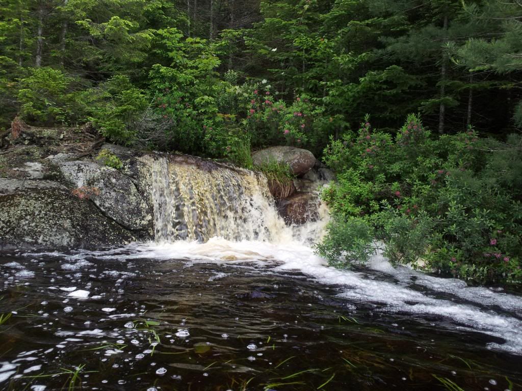
6/09/2013
Little wet, but little bugs!
-HaDeRonDah Loop
1 night/22 miles
There
are few significant loop trips which can be done in the Adirondacks
without walking along some roads. The HaDeRonDak wilderness area
contains a network of trails which allows for a few of these "loops".
Having already done the northern and southern loops, I set my sights
on the Middle loop. This would take me along some familiar trails,
(which are also part of ther loops) but I would also get a chance to
see a few new ponds and walk along some unfamiliar trails as well.
The plan soon involved a few more people willing to join me, Ian,
Rich, Mustafa, and Rob. In the early am the day of the trip, I an got
called into work and so would meet us at our campsite taking the
short way in. Rob was a no show, so Rich, Mustafa and I set out for a
16.5 miles day. The trail begins along an old "jeep road",
long since abandoned when the firetower was decommissioned. Nature is
quick to reclaim these old dirt roads, though the path is wide and
flat. The first 5 miles passed quickly, the ground was wet and the
air was damp. Fortunately the temperature was barely in the 60's so
the mosquitos and black flies were virtually non-existent. As we
passed the junction towards the campsite, we made an arrow for Ian to
follow as the sign had been demolished. We continued for another hour
and at my suggestion, left the trail to go to a waterfall/flume I had
found last year. The water was raging and we had lunch. Someday I
will need to bring a rod/reel here as the pool below the falls
certainly has fish. After lunch I was feeling pretty light on my
feet, my companions not so much. We changed up the pace but soon the
length of the trail would begin to takes its toll on Mustafa.We were
now along the boundary between the wilderness area and the wild
forest. This area often gets illegal atv use, but there was little
sign of it at present. probably too early in the season. The trail
and ponds through here are nice, but the others in the northen
section I think are nicer. At about mile 10, we stopped for a break.
Mustafa was moving slow and we still had more than 6 miles to go, and
it was the tough wet section. After our break, we slowed down and
took many small rests. Eventually we made it to Middle Settlement and
took a nice long breather in front of the gorgeous lake. Some campers
were here recently as the ashes in the fire were still hot and a dry
footprint from their tent was visible.We had 4 miles to go, I figured
we would get there around 6 pm. Hopefully Ian would be there with
some firewood already collected and a few beers. These last few miles
would go slow, compounded by Mustafa rolling an ankle as we crossed
one of the streams. He kept telling us to go ahead and he would catch
up; we reassured him the pace was fine and we were in no hurry. We
eventually arrived at camp; Ian was there though he took a different
route than the one we expected. It was his foot prints we were
following from Middle Settlement. This would mean he would be hiking
back out the same way and we would be on a different trail completing
our loop. I set up camp and got a fire going. We were all tired and
after dinner we didn;t stay up long. Most of us were in our hammocks
well before 10pm, Rich stayed in the leanto. In the AM, due to
schedules, we all got up at different times and headed out. Ian
first, then Rich and I and Mustafa last. I was worried about Mustafa
being alone, but he reassured me the few miles out along the old tote
rd would be fine. He would go slow and text me when he got to his
car. The almost 6 miles out went quickly as it was generally a net
elevation loss and a majority of it would be back on the old tote rd.
we made it back to the car before the temp started rising and the
bugs emerged. Got the text from Mustafa a few hours later. All is
well. I need a shower.
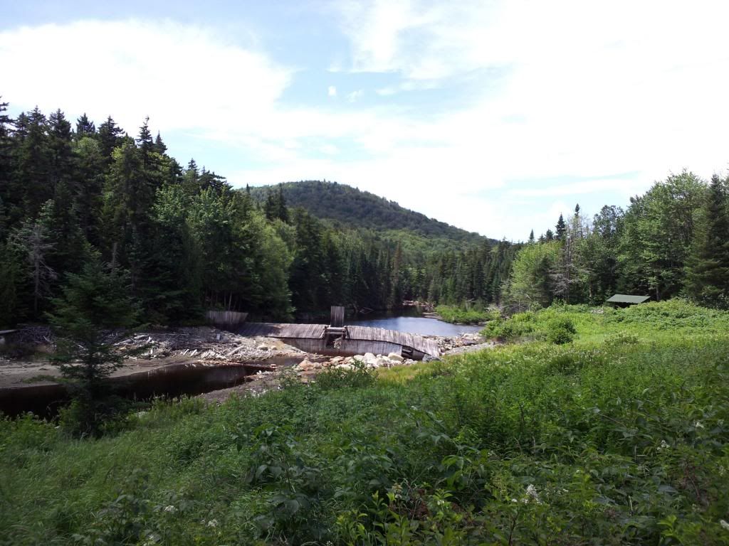
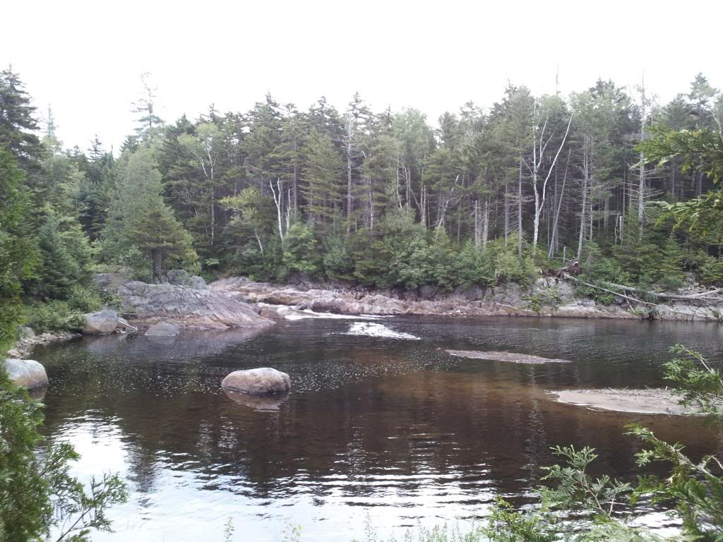
6/30/2013
Paddling and Portaging in Pigeon
Lake Wilderness
3 Nights/25 miles
<font
face="Arial, Verdana" size="2"
style="font-family: Arial, Verdana; font-size: 10pt; font-style:
normal; font-variant: normal; font-weight: normal; line-height:
normal;">The weather forecast was not looking good. Big storm
heading potentially our way. Even without the cell hitting us, we
were expecting significant rain. Paddling trips are usually a wet
endeavor anyway. We arrived at the put in on Big Moose Lake around
noon. Only a short couple miles to paddle until the carry to Russian
Lake. Met a nice fellow at the put in who told us of muddy
conditions.I am fairly certain we differed on our definitions of
muddy. At the beginning of the carry we spotted 3 aluminum canoes.
Not a surprsie as many people on BML will paddle over and day hike to
Russian. As we were getting out of our canoes a group of teenage
girls from some summer camp were returning from Russian. They told us
they were the only ones and the bugs were bad. Bad from our
standpoint or from a teenage girl's? This first carry of the trip was
uneventful, only 3/4 of a mile. It was much faster carrying a canoe
this summer than it was on snowshoes with a pulk this past winter.
Russian greeted us with blue skies and a few scattered
clouds.
Considering the impending storm we figured we
should get a nice paddle in first. We paddled around the lake, caught
a few small perch and explored the tiny waterfall which is one of the
sources for the lake. Back at our site, we set up camp, made dinner
(bratwurst with peppers and onions) and awaited the
storm.
We
heard thunder to our south but our skies were still rather clear. we
surmised the storm was missing us but expected rain any minute. The
rain eventually came overnight and continued until 9am. We had a lazy
morning, eating french toast and sausage for breakfast waiting to see
if the weather would change. As soon as the rain subsided, we donned
our canoes as "hats" and carried back to Big Moose. Our
next goal was either Lower Sister or Andy's Creek.</span></div><div
style="font-family: Arial, Verdana; font-size: 10pt; font-style:
normal; font-variant: normal; font-weight: normal; line-height:
normal;"><div style="font-family: Arial, Verdana;
font-size: 10pt; font-style: normal; font-variant: normal;
font-weight: normal; line-height: normal;"><br></div><div
style="font-family: Arial, Verdana; font-size: 10pt; font-style:
normal; font-variant: normal; font-weight: normal; line-height:
normal;">The inlet to Big Moose is an ecological treasure
with all kinds of birds and plants. The inlet is formed by three
creeks all converging creating the larger body of water. Andy's
Creek, Gull Lake Outlet and some other creek. We paddled to the mouth
of Andy's creek at which a beaver had created a system of many small
dams enlarging the mouth. From here we would carry about a quarter
mile to the trail junction and go check out the Andy's without our
canoes. The campsite is located around the bend of the Creek which
must be crossed on a bridge. The trail was soggy leading up to the
bridge's steps but our feet have gotten used to it by
now.

We had
lunch at Andy's (our lunches are always the same... some cheese,
sausage, dried fruit and nuts) and decided to take day packs and
attempt to carry the canoes the 3-4 miles to Lower Sister Lake.
Carrying the boats without most of our other gear was much easier.
Lower Sister came into view just shy of two hours. We bushwhacked
down the hill the few hundred yards to relieve our shoulders of their
burden. Once on the water we each took different routes exploring.
Chris checked out both the inlet and outlet while I explored a
massive waterfall on the southern shore.
I tried to
fish a little. No luck, but I guess that is why it is called fishing
and not catching. At 5 pm we headed back to our campsite. We either
caught a second wind or were just anticipated dinner because we made
it back 20 minutes faster. Along the trail to the bridgee, I thought
I missed a turn because all of a sudden the trail disappeared into
Andy'd creek. When the water got hip deep, we moved to
higher ground and bushwhacked to the bridge. <span
style="font-size: 10pt;">Turns out we didn't lose the
trail, the creek had since overflowed its banks due to all the rain
the previous night/day. The first step of the bridge was now under
water. </span><span style="font-size:
10pt;">Dry clothes and dinner were soon had. While we ate our
dinner (bean and rice burrittos) we figured we portaged more than we
paddled today. The GPS will verify or disprove. The waterfall at the
campsite had significantly more volume of water flowing through it
than just 6 hours before.

We
wondered if it would lessen overnight. Knowing the next day would be
much easier than today we figured we could sleep in and have another
lazy morning. We fell asleep to campfire TV and soon the AM
broke
After
a nice breakfast of sausage, hash browns and eggs (we used the
leftover tortillas to make wraps) we headed back to the mouth of
Andy's Creek and made our way back down the inlet to the Gull Lake
carry.
We carried the mile up to Lower Gull Lake and after managing a series
of beaver dams at the outlet we paddled around exploring. This lake
had an interesting shoreline and one of its fingers came considerably
close to Upper Gull Lake. I figured there had to be an unmarked
portage. While looking for it, I noticed obvious cutting of logs
around the perimeter of one of the coves. Investigating further, blue
trail marker appeared in some spots; some were on trees 5 feet from
shore. I spotted a take out near one of the markers and explored
inland. The trail went up hill and then leveled out in the direction
of Upper Gull. Chris finally found me and we told each other what we
had found. Him... nothing. Since I didn't get to paddle the
circumference yet, Chris went to our landing to get lunch out while I
paddled and looked for another carry trail. A little rain came, but
nothing to bad. I found two old take outs but no obvious trail
leading from them. I reported back to Chris as we ate lunch. He had
walked up the trail a bit and found it was rerouted in 2012. The
markers and cuttings I had found were the old trail. Since the old
trail would shorten our carry considerably and the new trail was. in
Chris' words, not canoe friendly. We opted for the old trail. This
turned out to be the smart choice. Since it was only recently
abandoned, it was easy to follow and soon the new trail's reroute
converged with it. At Upper Gull we made a smokey fire to
ward off the bugs and paddled around a bit. The Lake was an odd
turquoise and quite deep. No fish either. According to the log book,
those who visit enjoy swimming here. There was a nice rock to jump
off from to facilitate the fun.
There
is also a survey post made from railroad iron larking the county
line. One side was a plaque fro Herkimer County and the other side
Hamilton with the date 1900.

Rain
again came while we were preparing dinner and continued on and off
throughout the night. We would be leaving early in the AM as Chris
has to work tomorrow. I awoke soon after Chris and we immediately
began packing up. As we retrieved the bear canister and ursack we
noticed they had been "attacked". The ursack had tons of
teeth marks all over it. Some punctured between fibers, but no
damage. Whatever it was eventually gave up. My guess was a raccoon or
possum. We were loaded up and back on trail by 6:30 and back at our
cars a little before 8. A quick change out of our wet stinky clothes
and breakfast at a local diner and we headed
home. </span></div></div>
7/20/2013
NPT
7 nights/120 miles
July
20-27, Thru Hike of the Northville Placid Trail. 120 miles, 6 days 21
hrs. I am tired and my feet are damaged. No stories, just some
photos:

8/26/2013
Next Generation Backpacking -Brewer Pond
2 Nights/ 7 miles
The
BSA Troop at which I volunteer is quite young; the scouts that is.
the troop itself is 100 years old this year. Few of the boys have
done any camping where the gear wasn't trucked in for them. To help
move the troop to a more adventuresome group, I invited the
Scoutmaster and his son to explore an area of the Adirondacks with
me. The SM has the desire for the troop to expand its horizons, but
the boys don't seem to ready yet (they don't know what they are
missing). I chose a location which was not too difficult and with the
reward a young boy would want to return to with his friends in
tow. <div><br></div><div>The trail
to the lake was about a mile and a half. In winter it is used as a
snowmobile trail so it is easy going all the way to the lake's edge.
Later that day, the SM's son would call that section
"boring". <span style="font-size:
10pt;">The site at this side of the lake was uninspiring
except to an avid trout fisherman.</span><span
style="font-size: 10pt;"> </span><span
style="font-size: 10pt;">At the lake we then needed to
bushwhack around to the other side. After another half mile of not to
difficult bushwhacking (half was on a herd path), we arrived at our
destination. A very nice campsite set away from the lack with a very
interesting collection of glacial erratics. "This is cool"
said the boy. He immediately dropped his pack and started to explore
all the "caves" and climbed up onto the largest of the
rocks. </span></div><div><br></div><div>We
set up camp and collected some firewood. Dinner was soon had,
followed by sunset, moonrise and the emergence of the first few
stars. We retired to our respective beds and awoke early. Well, the
SM and I were up early. We watched a few beavers swim around the lake
until his son finally emerged. After breakfast I gave my map to the
scout and asked him where he wanted to go explore. he chose east as
there was a group of ponds about a mile away. Using the map, he took
a bearing and we followed. He carefully sighted checkpoints and made
his way to them while I kept track of our course from behind. He
consulted the map and looked around the forest to estimate his (our)
position. As with all young adventurers, he overestimated the
distance we had traveled and began to doubt himself. I reassured him
he had taken a good bearing and was keeping true. I told him to trust
his compass and skill. With the reassurance came regained energy and
we again were following our young scout. We arrived at the base of a
hill of which he took his bearing. Upon closer inspection the hill
also included some significant rock faces of which we could not
climb. Unsure of what to do since we couldn't follow our bearing to
the ponds on the other side of the hill, he turned to me. A brief
conversation ensued and with a few alternatives discussed he decided
we would work our way to the top of the hill "to see what we
could see". He made his way scrambling up the hill and we
followed. some interesting rock formations and flat areas with ferns
and moss made climbing the 150 ft hill a joy. At approximately the
summit he took a bearing for us and said the ponds were just down the
hill. So we followed him down the other side. All I could think of
was "The bear went over the mountain" and a smile came over
my face. The ponds soon came into view and we rested a bit. I
congratulated our scout on a job well done. Done he was. With a smile
and a sigh of relief he said, someone else can lead now. I agreed and
hinted as to how he could use what we had just done as a way to help
his patrol mates grow as scouts.</div><div><br></div><div>I
asked the SM whether he wanted to lead or not. He chose to lead but
wanted to take a slightly different route back. I was happy with his
choice as I had never explored the route he chose so it would be very
new to to me. We circled around the hill, instead of climbing again
and followed a stream for a while until it turned away from our
preferred route. At this point we took a bearing straight back to
camp. It was getting close to lunch time and all of use were getting
hungry. We soon were back at camp and began to eat
lunch. </div><div><br></div><div>After
lunch we rested and rested. The slightly more than two mile adventure
along with the sun had really sapped our energy. We decided to have a
relaxing afternoon. Our scout climbed atop his rock a few more times.
Some other explorers were heard on the other side of the lake but
don't think they knew we were there. We collected more wood and I
overheard the SM ask his son what he thought so far. The scout was
already planning how to get his patrol to the site. The scout and SM
had dinner. Since I wasn;t hungry I just nibbled on some cheese. The
scout built up his fire and we all enjoyed the TV for a while. After
the sun set we soon retired to our
sacks.</div><div><br></div><div>Early
AM, a quick breakfast and we broke camp. I led us back around the
lake and at the other side the scout asked if we could see where the
other group was sunbathing. With assurance he wandered ahead. We soon
followed to keep him in view. He was beginning to trust
himself to wander around off a well-defined marked trail <span
style="font-size: 10pt;">(though he was headed down a
peninsula there was no where else he could go)</span><span
style="font-size: 10pt;">. At the sunning rock we caught
up with him. On the way back I remarked about a rock structure we
passed by. He immediately detoured to walk through the "cavern".
I thought aloud how cool it would be to put a tarp over the 6-ft wide
gap and have a cave to sleep in. I could see the wheels turning in
his head. Back to the "boring trail" and we were soon back
to the car. The scout led the way keeping up quite a brisk pace. He
would sleep in the car ride home. he checked us out at the trail
register and I asked him what his favorite part of the trip was. His
response was not surprising, "climbing on the rocks". I
almost forgot the large bear poop we almost stepped in on the way
around the lake.</span></div><div><br></div><div>On
the drive up the SM has lamented the boys in the troop didn't seem
interested in hiking and backpacking. I listened knowing what would
likely transpire on the this trip with his son. On the ride home I
gave my response to his lament. I said most boys are not interested
in hiking or backpacking as a sport. However, climbing on rocks is
something they enjoy and they will walk a few miles to do it.
Sleeping in a fort they constructed with a tarp over a crevice in the
rocks is an adventure they would choose to do. Hiking and backpacking
are means to the ends. Now our young scout has some ideas to present
to his patrol. I can almost guarantee he won't say, "hey guys
lets go on a 3 mile hike". Instead he will say, "hey
guys I know this really cool rock place we can climb on and explore."
I said Scouting at its core is the spirit of adventure. Giving the
boys the tools and opportunities to explore is at the core of our
job. As a wise old scoutmaster once said to me... train them, trust
them, and let them be.</div>
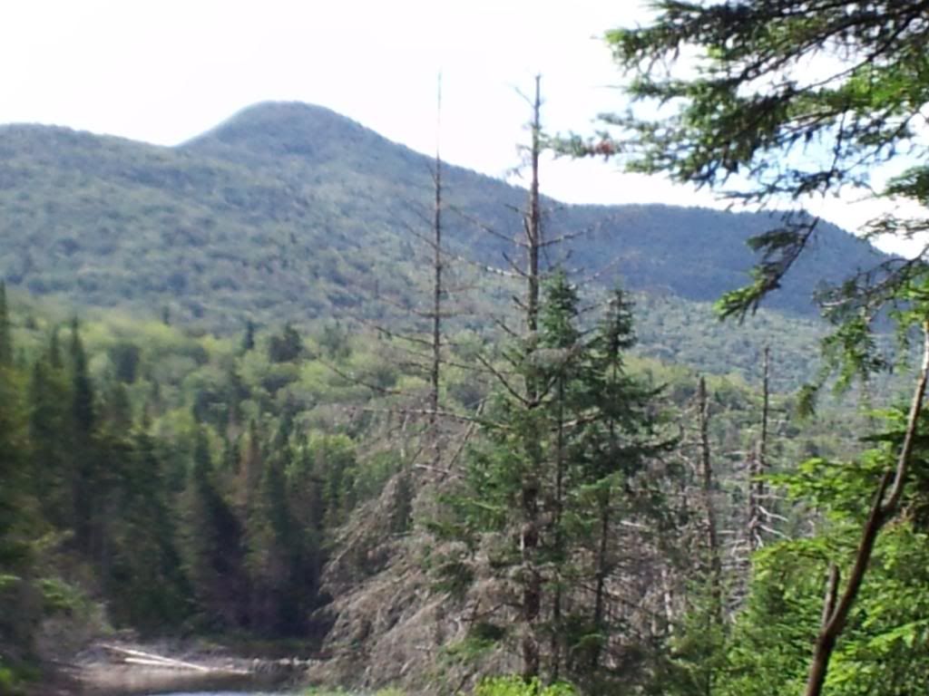
8/24/2013
Spruce Lake Mountain
-failure
2 nights/10.2 miles
The
goal was to bushwhack to the south face of Spruce Lake Mtn where the
Indian River bent close to the base. The maps and aerial recon hints
at a stillwater here. Area looks "trouty" especially
knowing the river downstream and the lake upstream maintain a
population of native brookies. Spruce Lake proper would be the base
camp for the operation. It was a relatively easy 3.1 mile hike in
with good food and refreshments. The evening was shared with two
other backpackers and a pair of fisherman. <div><br></div><div>I
awoke early the next AM as did the two backpackers. I bid them adieu
and waited for the rest the arise. We loaded up and wandered off
trail. The plan was to follow the water as a handrail and only
leaving its edge when necessary. The first portion of the trip was
easy as it followed an old path. It was obvious it was still in minor
use but only by the most adventuresome. We crossed the creek and then
began a full out bushwhack through thick spruce, witchhopple, you
name it. The going was slow. We came to a bend where a marshy area
was ahead, we decided to cross the stream to avoid and then recross.
This portion was the easiest of the journey. we re-entered the thick
and tried a higher contour line while keeping the river in
sight/sound. The going was slow and ironically the spruce bogs were
the easiest portion of the 'whack. This was likely due to the lack of
much recent rain. The spruce thickets were doing a number on my
partner not to mention the witchhopple... which he cursed every time
we entered it. As the river bent to the est, I took a bearing to the
SW to a point where the river would return flowing in the direction
we desired. In fact it would turn due west towards the base of our
target mountain. At this point the woods opened up for the most part.
It was an older stand of spruce and walking was easier. We soon
intercepted the river and began following it westward from
interchanging hi-low contours. I could see my partner was getting
weary. At around 12:30 we found a nice spot for lunch. It was a rock
jutting out into the creek. The water was calm here, thanks to the
local beavers. Many minnows and salamanders were about. Looking at
the time and the condition of my partners legs and his demeanor. I
called the operation. We would turn around here and head back for
dinner. Hopefully our fisherman friends would have trout for
us. </div><div><span style="font-size:
10pt;"><br></span></div><div><span
style="font-size: 10pt;">This wouldn't be the first time
an operation would end in temporary failure. In fact, failure is too
strong a word. While we didn't reach our ultimate goal, the boots on
the ground intel gave us much needed info for our return. it would
save us time and agaony. In fact it already served useful as our
return to camp was much easier.</span><span
style="font-size: 10pt;"> As we approached the
lake, we saw our friends on the other side. we made our way along the
old path, which was quite obvious after a few hours of bushwhacking.
They had caught a couple of nice native brookies. Beautiful spots and
some dark streaks on the skin with bright orange flesh inside. I
could almost taste them.</span></div><div><span
style="font-size: 10pt;"><br></span></div><div><span
style="font-size: 10pt;">The evening continued late into
the night as we ate well. Every time I eat some native brook trout I
am transported back in time to the early days of the great guides of
the Adirondacks and the early explorers whose footpaths gave rise to
the marked trails we enjoy today. Those old timers were hardcore and
the woods was their church. I am humbled to walk in their
footsteps.</span></div><div><div><br></div><div><br></div></div>
9/22/2013
Adirondack Leaf-Peeping -Burntbridge
Pond
1 night/14 miles
Fall
is upon the North Country and the waning full moon would provide the
backdrop for a nice excursion to the woods. The plan was to be three
of us to hike the 7 miles into Cranberry Lake Wild Forest. Turned out
to be just two and the weather called for a potential thunderstorm
later in the day/evening. Due to the weather, we chose our
destination to be a pond with a lean-to. I hadn't been to this one
yet, so this was great. The hike in went quickly as it was a wide
open level trail. In winter it is used as a snowmobile trail. We saw
no one and arrived to an empty site. We gathered wood before the
weather turned. The wind was already starting to pick up. After
setting up camp and getting a decent woodpile started, the wind
subsided. we wondered out loud weather it was the proverbial calm
before. Oddly the weather turned nice so we explored a bit, but not
too far in case the clouds started to roll in. The lake itself is
typical Adirondacks. Marshy shore and some derelict beaver lodges.
This was also a protected trout water; signage reminded fisherman
that baitfish was prohibited. Across the lake the palette of colors
provided the panoramic backdrop. I have always loved the deep reds of
the sugar maple leaves as they turn. They are very quick to fall, so
seeing them as part of the landscape requires some lucky timing. We
were lucky. Dinner time came and we started the fire. While
cooking our bratwurst a few sprinkles came and went. The slight rain
would come and go throughout the evening. We shared a few beers which
I carried in and soon the sun set. Soon we retired to our hammocks.
during the night the rains and winds came but not to extent as
predicted. As the moon began her departure the morning sun emerged.
The forest was quiet except for the night's rain dripping from the
leaves. After a slow AM packing up and nice cup of coffee
we were on the trail back. The dripping trees gave way to some real
rain but it was just an annoying drizzle. We expected to be wet
anyway as the trail went through some beautiful fern meadows which
were sure to share their wetness as we pushed through. We stopped at
some of the marked campsites along the flow as we took a leaisurely
pace back to the car. even so , we were back before noon. A change of
dry clothes awaited in our car. While I enjoy my solo trips,
sometimes sharing the views with others makes them just a wee better.
10/20/2013
MSL and it rained
again!
1 night/7.4 miles
The
old crew was getting back together. We decided on MSL since many seem
to like the location and it would entice them to come along. The plan
worked and a number of the old crew initially committed to the trip.
In the end it was just Jerry and I. The weather forecasted rain, but
as the date moved closer, the rain forecast slowly pushed later and
later. Jerry and I ended up hiking in on a beautiful fall day. The
woods were cool and quiet. The trail was a little damp due to rain a
few days before. We arrived at the lake and found it secluded. Many
times in the past we would arrive to the site and find it occupied.
The last time we had to mosey on another few miles to a different
lake in the rain as the two at the site didn't seem like the sharing
type. We made camp and gathered wood. We ate lunch and rested a bit.
A group showed up and also had lunch on the point across the cove
from us. A short while later they came on through. It appeared to be
a scout patrol on a hike around the lakes environs. After we gathered
some more wood, we embarked on our plan to bushwhack to the other
side of the lake. we followed the trail across the outlet, though we
missed the newly constructed bridge up stream. I missed the bridge
going the other direction a year ago too. We came to the trail
junction and headed south. When the path began to lead away from the
lake we began our exploration of the shoreline. The witchobble was
dying back so it wasn't too bad in the generally open hardwoods. We
meandered around the shoreline until we were opposite of our
campsite. I was looking for a stashed boat, who was I kidding. I have
wanted to paddle and fish this lake for years. Since no boat was to
be found (trout season had ended so this would have been recon only),
I figured I was going to have to carry in my canoe the next time.
That first climb was sure to be fun with the canoe hat. I should plan
on a few days to paddle and fish to make it worth my while. Jerry and
I headed back to camp and we grabbed some wood as we got closer. We
started a fire and made dinner. I was tired for some reason and we
began to talk about going to bed close to 7pm. I turned in soon after
just as the rains came. The rains continued with some significant
wind all through the night. I awoke at one point and the rain had
subsided. A beaver slapped his tail not far away and I fell back
asleep. At my next awakening, the rain was back. I would conitue in
and out of deep sleep until the pre-dawn light. It was still raining
but we both agreed to get a head start and grab breakfast at the
local diner. A quick pack up and we were on the trail. The rain
continued lightly on and off until we were back at the car. A change
of clothes and we were on our way. A day hiking in the rain is still
better than a day at home doing chores. Oh, I must remember the
smoked andouille sausage split and grilled was fantastic!
11/09/2013
W.Branch Sacandaga Gorge(ous)
-Silver Lake Wilderness
1 night/9 miles
Met
Justin at Whitehouse Sat AM. The trail began along part of the NPT. I
have this section plenty before and have seen the side trail to get
to Big Eddy along the W. Branch of the Cacandaga river. I have never
explored off the NPT in this area before. Justin had done some
earlier recon, but our goal was to push farther beyond the extent of
the short trail to a campsite we have only read about at the top end
of the gorge. The NPT portion went quickly and we soon were at the
side trail I have seen before. We came to the ford across Hamilton
Lake Stream. There was a well used campsite here. We donned water
shoes and made the crossing. The water was frigid and we happy to
replace our wool socks and warm/dry boots. The trail here would
parallel the w. Branch for a about a mile until it petered out. Since
we left the NPT, there were no trail markers. The trail is marked on
the maps only but is easily discernible in the field. we passed by a
few more campsites until we reached Cold Brook. There is a campsite
at the top of the waterfall here as well. Soon the trail petered out,
though travel was still relatively easy. We passed by where Justin
had camped on a previous trip and then some flagging tape and pressed
on to the gorge. We were soon at the base of the first of four
cascades. The terrain pressed in close to the gorge and travel was
soon limited. We would either have to scale a cliff, or head back to
find a different approach to the higher ground. The flagging tape was
near a draw, so we decided to use that approach. It was steep, but we
finally made it to the top of the rise. we were now about 300' above
the river. We continued along this contour on a SW heading. The
sounds of the river changed to let us know we found the succeeding
cascades. The goal was the fourth. the woods was easy going here as
it was open hardwoods and we tried to stay on the same contour. We
would know when we approached our goal as the terrain would level out
as the river joined our elevation. The campsite location was easily
seen from afar to the trained eye. We headed downhill to the waters
edge and found the remnants of the old campsite. A cooking grate was
hanging from the tree. The firepit was overgrown and covered in
leaves. A spring was nearby, as is common in these parts. We made
camp and collected wood. a quick snack and we began exploring. We
continued upriver towards the outlet of Owl Pond. We had
hoped to make it to Owl and then back before sunset. within a quarter
mile of Owl and we came across fresh tracks. Since it was hunting
season, we didn't want to disturb the likely hunter, nor put
ourselves in danger. We reluctantly turned back. We checked out the
eddy upstream a bit instead and then headed back to camp. It was only
a few miles and walking along the river was easy here. we filled our
water bottles from a spring that was pouring out of the river bank
like a faucet. Back at camp, we started the fire and made dinner. I
was asleep soon after the sun. Some rain and snow came during the
night and a little the next morning. After breakfast we took some
time to enjoy the gorge right in the area of the campsite. The
cascade here was tremndous. The rapids right in front of the campsite
were dwarfed by the flume and drop just below. The river would drop
about 100' over about 100yds. With a few 20ft drops. we
found a neat campsite near ours with an elevated fire pit. we then
headed back knowing to stay high away from the river. I took the
point and stayed higher than before, soon the river noise was blocked
by a knoll. On the way in we stayed on the other side of the knoll,
but this was a nice section. We came across the remnants of an old
path. we followed it for a bit as it was heading in our direction but
it soon petered out. We refound it, or another old path a few times.
We heaed around the knoll towards the river and we found a drainage
which we followed the rest of the way. The drainage entered the river
near "the island". this would make a great landmark for a
future trip as this return route was very easy with little steep
climbs, just a gradual incline the entire way. We stopped at the Cold
Brook for a drink and some photos. We were now back on the trail and
travel went quick. We came across a resting hunter and conversed for
a bit. Back at Hamilton Lake Stream , we froze our toes. We both
agreed the water was colder today than yesterday. It wasn't just
cold. It was painful. Saw a brook trout swim downstream right in
front of us so it was worth it. Dry socks never felt so good. The
rest of the trail back to the cars was like a superhighway after
spending the day with little/no trails. We can hardly wait to get
back there.
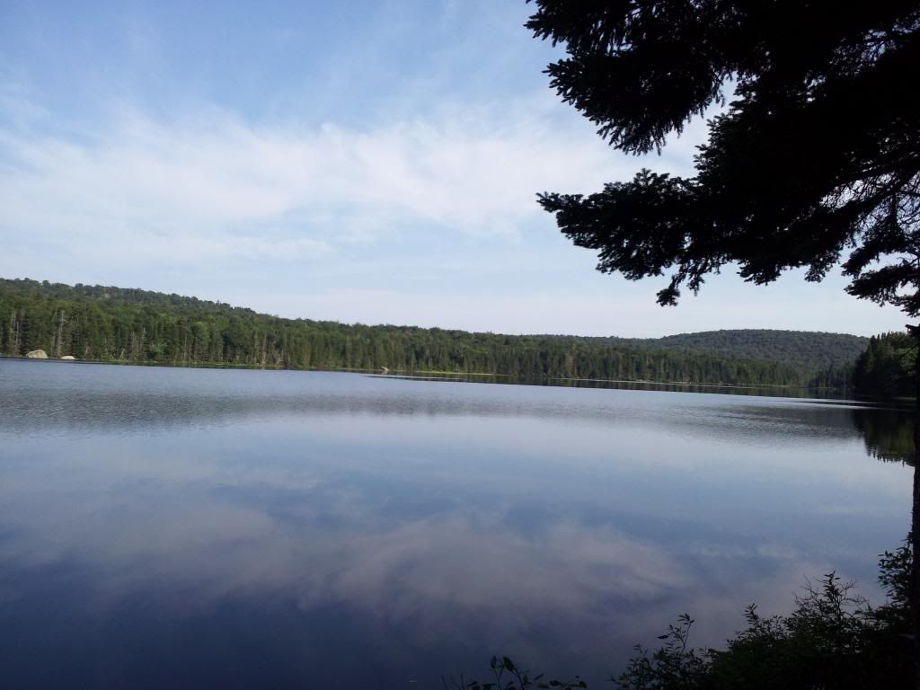
12/01/2013
Pigeon for Thanksgiving
-Queer lake
2 Night/7 miles
The
original plan for Thanksgiving was the Operation ADK Gobbler edition
for Thursday and then to the Pigeon Lake Wilderness to meet Ian et al
for our annual Tgiving trip to Queer Lake. Due to the storm, the
Gobbler edition was cancelled, so I ate leftover at home and left
bright an early Fri AM. Originally I was to meet Ian at noon, but he
was layed up in the hospital so I ventured out on my own. There was a
possibility of Chuck or Eric joining me on Saturday. The day was cold
and there were no cars in the lot. The trail register showed a day
hiker the previous day. His snowshoes circled back after a mile when
he encountered some blowdown and the trail ahead wasn't
obvious.<div><img
src="http://i250.photobucket.com/albums/gg247/allthenamesweretaken/Queer%20Lake%20Thanksgiving%202013/2013-11-29114001_zps5499e623.jpg"></div><div>I
pressed on remembering to put on sunscreen;. I often forget on my
first snowy trip.The trail in had 2-4 inches of snow and due to the
cold the typical wet spots were mostly solid. I arrived to Queer Lake
landing and had lunch. I was plenty warm from the hiking but by the
end of lunch, the air began to chill me.I had about a mile to go to
the other side of the oddly shaped lake. I arrived to an
empty leanto and rested. I had a few hours still before the sun would
set and due to the clear sky, I knew it would be cold. I gathered
some firewood, set up my sleeping pad and bag and read the shelter
log. I had realized a few days before I hadn't yet spent the night in
this lean-to as I am typically in my hammock. I figured this would be
a good trip to check off Queer from the list. As the sun hit the top
of the ridge, I started the fire. I knew I would light for a little
while longer bu the temp would begin to drop
quickly. </div><div><img
src="http://i250.photobucket.com/albums/gg247/allthenamesweretaken/Queer%20Lake%20Thanksgiving%202013/2013-11-30115059_zps0a61650e.jpg"></div><div>I
also prepared my gear for dinner. I put on an extra warm layer and
started dinner. Red beans and rice. Warm and filling and would
provide fuel for the cold night. After the sun set properly Venus
made her appearance. As expected the temp dropped considerably. I
watched some campfire tv for a while and soon found myself in my bag.
The night was cold, but I was quite warm, though not as comfortable
as i would have been in my hammock. I awoke before first light and
waited as long as I could before exited the coziness of my down
cocoon. When the sun finally crested the ridge and at my bladder's
insistence, I crawled out. The sun was reflecting off the bits of
snow atop the frozen lake. Over the night I was awoken a few times by
the sounds of the lake making new ice. The hole I had cut the
previous day through about a quarter inch of ice had since frozen
over again with about a half inch of ice. the area surrounding the
hole had almost an inch. Anyway, the morning sun shining on the lake
was gorgeous. I doubt the photos would do it justice as I just have
my phone's camera.</div><div><img
src="http://i250.photobucket.com/albums/gg247/allthenamesweretaken/Queer%20Lake%20Thanksgiving%202013/2013-11-30080209_zpsa5ee7c23.jpg"></div><div><br></div><div><img
src="http://i250.photobucket.com/albums/gg247/allthenamesweretaken/Queer%20Lake%20Thanksgiving%202013/2013-11-30084130_zps4621794e.jpg"></div><div><br></div><div>The
day soon warmed up as did I. Coffee and some oatmeal with berries
helped a lot. I decided to explore a little bit of the peninsula. I
walked a ways and didn't find anything exceptional to report. The
campsite in the area isn't used much to due the lean-to's proximity
and with the snow, the circle of rocks would not be visible. I soon
found myself heading back with some more firewood. I spent the rest
of the day, getting more wood, eating lunch and writing in the
shelter log. By late afternoon, I figured neither Chuck nor Eric were
going to make it. I had an early dinner mixing up some cous cous,
black beans and dried hamburger. Tasted like chili, sort of. After
cleaning up and sitting around, defrosting a beer by the fire I heard
a sound fromt he side of the lean-to and there appeared The Rev Yukon
Jack, and he brought supplies.</div><div><img
src="http://i250.photobucket.com/albums/gg247/allthenamesweretaken/Queer%20Lake%20Thanksgiving%202013/2013-11-30150154_zpsc067c297.jpg"></div><div>A
package of Hebrew National hot dogs, (it was Hanukhah after all) and
a mini-keg of beer. Well the company was great as was the resupply of
beer. We toasted each others company and the Rev ate some hot dogs.
We collected some more wood and then talked like usual. At the
trailhead, the Rev saw a couple of people who were considering coming
into Queer, but were reconsidering. Apparently they knew me, or knew
of me. Anyway, they ended up not showing. The Rev and I would have to
down the 5 L else we'd have to carry it out. Even though i had
already eaten dinner, I had a couple dogs so we wouldn't have to
carry those out either. The day had been getting warmer and with the
overcast sky, we guessed it wouldn't get very cold at night. At one
point a breeze came through and then the temp warmed even more. We
fed the fire and killed the keg and crawled into our bags. I awoke
int he middle of the night too warm, I had to unzip my bag. The air
even felt warmer than before we went to bed. I wondered if my mind
was playing tricks on me. When I finally did get up and
restarted the fire it was considerably warmer than the previous day.
The now unfrozen butter in my food bag told me it was warmer than
when we went to bed. I guess my mind was kidding. We poked around
camp for a while not being in any hurry. Slowly packing up as we
talked. Back on the trail with a lighter load and mostly downhill the
hike back would go quickly. Unfortunately when we got to the diner,
it was after noon so they were onto the lunch menu. I was looking
forward to their homemade corned beef hash. Next time.</div>
12/15/2013
Meteors w/The Meetup
-Chub Pond
1 Night/9 miles
Arrived
at the trailhead w/Chris. Kim and Pat would be arriving later as Kim
was running a 5k. Temp was hovering around 11*F at
noon. The area had gotten over 2 feet of snow the
past few days so we donned our snowshoes. Oddly the
snowmobile trail hasn't been used yet. We broke trail all the way to
the pond taking multiple breaks as the going was slow in that deep
snow. Arrived at the lean-to a little after 2 pm. We spent some time
collecting wood and digging out a hole in the pond to get water.
After spending some time relaxing we eventually lit the fire and had
some cocoa. Dinner soon ensued, me with bratwurst and Chris with
mac&cheese w/hot dogs. After dinner we each enjoyed the one
beer we carried in. By this time we assumed Kim and Pat would be no
shows. The sun set and as the temp began to drop we added fuel to the
fire. Soon after a light appeared in the woods. It was Kim on skis.
She dropped her pack and went back to get Pat. They set up their
tents and made dinner. The winds began to pick up, so we put a tarp
on to the front of the lean-to. A tea light candle and a make shift
lantern from an empty beer can provided some nice light. I was curled
up in my bag and was soon asleep. The winds came strong and flapped
the tarp all night long. The winds ended with the rise of the sun. We
had received additional snow covering the tracks we made in. After a
quick breakfast we headed back. breaking trail both ways will
certainly leave me sore tomorrow. I had hoped to see the Geminid
Meteor shower, but the overcast skies and storm changed those plans.
The woods sure were pretty though.
12/29/2013
Will the Real Slim Pond
please Stand Up.
1 night/4.6 miles
Was
hoping to do at least part of the #operationadks rescheduled trip,
but alas my schedule only allowed for a single night. My friend
Justin also was only available for a quick overnight so we we thought
about something we could hit quick and easy. After perusing some old
maps I suggested a small pond about 2 miles in for which there is no
marked path, at least not marked by the DEC. Slim Pond and the nearby
Bear Pond had been on my list to explore for a while and on Justin's,
so it was a go. we met up Sat AM and loaded up our packs and pulks.
The unmarked path followed an old logging rd for at least part of the
journey. It was obvious this path was maintained in the past and the
travel was relatively easy for the first mile. Then it got rogh. Lots
of blowdown with little snow made us curse bringing in our pulks. The
only good thing was someone had marked the path with green paint and
orange flagging. As we got closer to Slim, we lost the path and began
to follow a stream to the Pond. It started to head in the wrong
direction, so we back tracked and refound the markings. Up and over a
small rise and then a push through some spruce and Slim Pond appeared
before us. Crossing the frozen pond made us remember the conditions
pulks were built for; the frozen lakes not pseudo-bushwhacks. We
found the campsite at the far end of the Pond. Had a nice firepit and
plenty of downed nearby. We collected plenty and set up camp, We
found another marked trail (red paint) heading in the direction of
Bear Pond. We followed it and within ten minutes were at the shore of
Bear. We walked across the pond and looked for potential future
campsites. Didn't find any, but commented on how the fishing might be
in the Spring. Will have to return to both Slim and Bear with tackle.
Back at camp, I went to be early. Justin soon after. I slept like a
log and didn't get up until after first light. Justin was already up.
We poked around a bit and eventually packed up and headed back. The
trip out was quicker mostly due to wearing our packs to lighten the
sleds and also following our own tracks. Was good to get out although
I wish I was sill there climbing Seymour today. Was nice to check off
some other ponds from my list. Will definitely return to fish.


