With spring still a few weeks away int he Adirondacks, Shannon and I opted to hike the the FLT to get back in shape after the the low mileage winter. The plan was to start where Dan, Wil and I had left off at the Otselic River. With no overnight parking at the fishing access lot and the start of trout season we would park on the shoulder of a side road nearby. Just prior, I picked up Shannon at our end point. Oddly when I made the turn off and drove by the RR tracks I knew I had "been here before". In 2015, Dan and I had spent 3 days on the Chenango River and this was our take out location. So I arrived a few minuted before Shannon and found a shoulder near the FLT access point to park. When Shannon arrived she transferred her pack to my car and I pulled forward for her to have my spot. As we started leaving she could not locate her phone. She went back to her car to look and then to her pack to no avail. We figured it had either fallen between car seats or was sonewhere in her pack.
Along the 40 minute drive to our starting point we lost cell service anyway which would be true for the majority of the trip. Not a bad thing. Shannaon mentioned sha has had a tough week and the woods therapy away from it all would be good. I agreed. So we turned down a small road just past the fishing access and parked on a shoulder away from the main road view. We hiked the extra tenth of a mile to the access point. The sign which had said 'no overnight parking" was broken off with that prohibition missing. A few cars were in the lot already and the fisherman were on the banks of the Otselic.
We started up the hill, of course. Today would be a shorter day but quite hilly. This made for a tiring day compouded by the remnant snow in this area. It was slippery and just deep enough to be an energy suck. At least it wasn't raining. We expected to get some rain today and later in the afternoon a big weather system was moving through. The goal was to get to camp before it hit.
Nearing lunch time we were both getting tired and still had half our miles to do. Our late lunch spot along a creek was pretty but we needed to cross it. The recent rains and snow melt had this stream flowing fast. Scouting both up and downstream we would have to get wet. At least it wasn't too cold, yet. The crossing wasn't deep but the water volume would ride up quite high. Water proof boot and high gaiters were cinched up. We both made it across safely with only very damp feet. Across the road and then along a field into the State Wildlife area, more uphill. Then another creek crossing with a bridge. Followed by some steep rocky, snowy trail with another wet creek crossing. I was able to use a log to cross (not sure how I managed my height fear, but I did.). Shannon crossed below, wading the shallows. Some more uphill and then winding trails. We reached the turn-off to the lean-to about a half mile away. We were both exhausted, the trail to the lean-to started through a swampy mess. Our feet were already wet, but we still did our best to avoid the deepest of the flooded areas.
At the lean-to we both collapsed. It was 3pm, it had taken us 5 hours to travel the 8 miles. There was some split wood next to the lean-to but we did not use it. We did not even make a fire. I was not too hungry so I ate a protein bar. We both laid down before 5 pm. The winds, rain and snow came through in the late evening and throughout the night. The temperature dropped to well below freezing. Our water bottles and boots were frozen in the morning.
Day 2, another shorter day which we were thankful for as were both were still tired from yesterday. I forced myself to eat breakfast, and we put on our frozen boots hoping they would thaw soon. The expected weather was to eventually warm up over the course of the day. Soon we passed a group of hikers from the Bullthistle Hiking Club. The apparent leader was the maintainer for the area and helped with the bridge we would cross later in the day. We mentioned the two streams we needed to cross without bridges but needed them for the higher water. We also mentioned the logging through the private land which made route finding slightly difficult, not to mention the mud from the skidder tracks. It was caked on our gaiters. Even the raging streams didn't wash it all away.After our chat he mentioned a "moonlight hike" group was planning on the Pharsalia Lean-to which was our destination. We would be able to use the hikers tracks to make our going a little easier for the next couple miles.
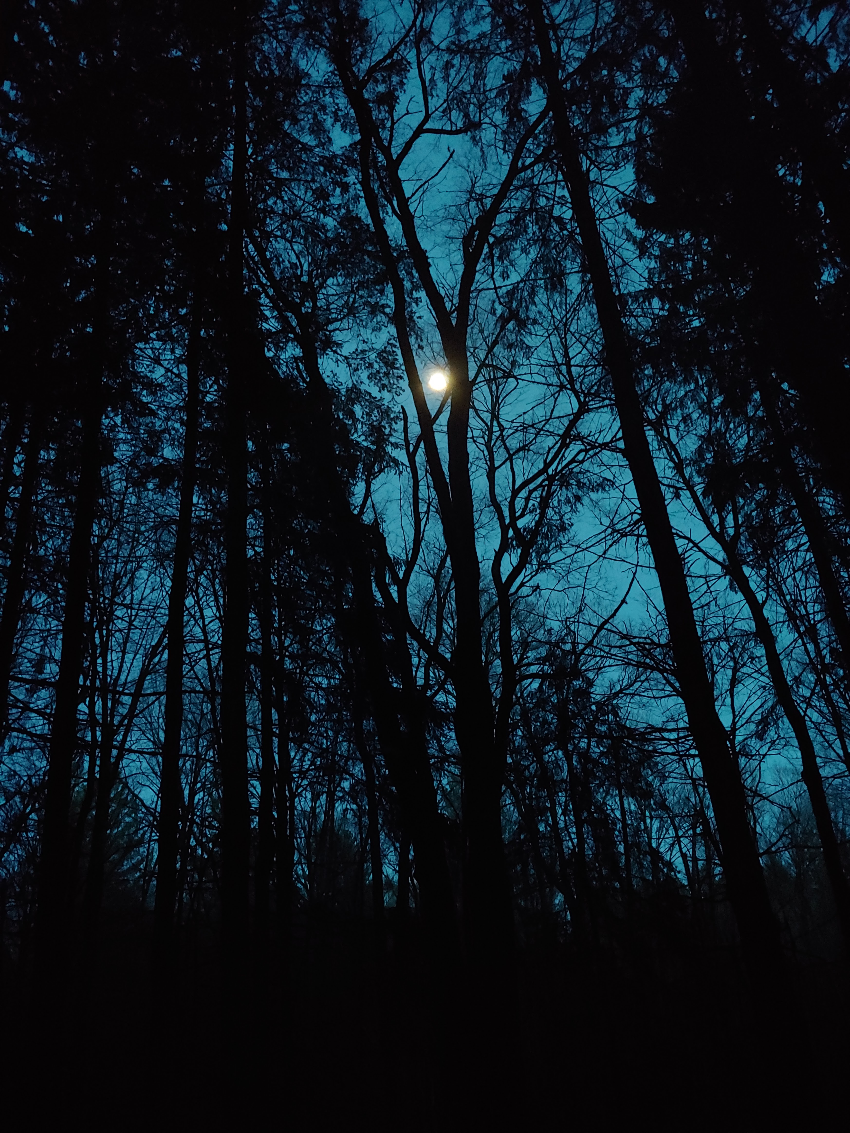
The bridge was indeed very nice. With benches, a register box and a thermometer. It was 29*F at 11am as we crossed the bridge. It was a bit warmer and our boots were at least flexible now. We crossed the bridge and then a busy road. A very steep uphill to a long stretch of welcoming easy grade. I was not as tired as yesterday, but Shannon was feeling it still. Her pack is significantly heavier than mine by her choice. In the Pharsalia woods we would reach trail familiar to me from a short trip a few years ago. The map indicated no water at the lean-to but I recalled water the last time I was there and there was enough snow around I did not feel the need to carry water a half mile to the lean-to. We arrived around 2 pm. Plenty of time to relax, and recharge. No impending storm to worry about. Fire wood was gathered, made easier by the bow saw left at the lean-to. We got a fire going to begin drying out our boots; I made a cup of soup too. After dinner we wondered about the hiking group and what time they might arrive. If it was the middle of the nigh Shannon said she would not be happy unless they brought s'mores. The group actually arrived before dark. Led by the Forester from the Sherburne office, Chris Sprague. He and I chatted a bit. He knew my DEC contact in Northville as Jon had started in the Sherburne office. I would later pass along regards.
The group headed out by headlamp just as the moon was making its show. We made it past hiker midnight at least.
Day 3. Our long day is upon us, though it supposed to be relatively flat. It again dropped below freezing over night, but just slightly. Enough to put some ice in the water bottles. With the long day ahead of us we got on the trail a little earlier than usual.I was hoping to get to Bowman Lake State Park by lunch time as that would give us plenty of time. The trail was easier with less snow and some road walking which made the mileage go quicker. The road is also where we gained elevation towards Tower Rd. With the tower in sight, I switch on my phone to send an "all is well text" and quickly turned it off to save battery. The trail re-entered the woods off Tower rd through a very nice section of woods. It corsses the road again and followed old woods roads through the McDonogh SF and Bowman State Park. The trail was dropping from almost 2000' to under 1000' for the rest of the day. Before we got to the park, I filled up with some water from a well running spring. We reached the beach at 11am. so well ahead of schedule. We took a long break here sitting in the sun. The wind was chilly though.
After our break we followed the blazes through the park and down some roads. The trail was easy going and the mileage peeled off. I was glad my pack was slightly lighter than the start too. We arrived at camp with plenty of time to gather firewood. A pretty spot with a nice waterfall and swimming hole. Sadly it was too cold for a swim. While prepping for dinner a family showed up just taking a hike. They asked about our journey and showed the young boy all our gear in the lean-to asking him if he wanted to carry all that. After dinner and cleanup we didn't stay up too late, it was a long day.

Day 4. Our earliest wake-up yet. We did not rush but were still on the trail quite early. It rained over night. The lean-to had a roof leak which caused some drips top splash onto me. After I moved right up against the wall it was far enough away. The night's rain had wet the leaves enough to make walking quiet. The trail followed some woods roads and private atv trails, the latter which was a slow uphill through private land (or maybve this portion was the previous day, alot begins to blend together). We followed a road for a bit past another tower so I turned on my phone. Emelu had sent a text that tyhe Greece Police had stopped by due my car. She then called me and told me the story as we walked down the road. Some people had notice my car on the side of the road had been there for a few days so they called the police. The State Troopers then contacted our local police who checked in with Emily. She showed them my text from the previous day and the email with my itinerary. The officer relayed the info back to the troopers to know I was not missing. I mentioend to Emily it was good that people "said something whne they saw something" and that the authorities followed up. Also that our communication protocols including the itinerary email did its job. We had about 5 miles to go, so I turned off the phone.
After a nice parking area we climbed up a hill. We were then dropping elevation quickly from the height of land. A few times the sky tried to rain on us, but it was ever so slight it did not warrant rain gear. It was getting warm too. We followed At the bottom of the hill we crossed an intersection used the ladder to climb over the barbed-wire fence. Private property but allows hikers. The trail would follow Bowman Creek with some impressive water falls and scenic views. Near an old mill race site we took a snack break.

We still had some miles to go, but a lot would be roads. After our break we finished our portion along Bowman Creek and then went downhill to the main rd. After crossing this road we would be near the Chenango River where Dan and I had finished aour canoe trip. We still had quite a few miles to go, mostly on roads. It was getting warm. A cyclist went past us and yelled, "FLT!". We made our turn up another road and missed the turn-off to go back into the woods. It was not marked well, fortunately the trail would again hit the same road. Sadly we would miss another scenic overlook. As tired as we were, we probably would not have enjoyed it as much.
After about 2 miles on the road, we paused where the trail intersected. A truck passed by, stopped and backed up. The gentleman's name was Lynn Hart. He recently purchased some land which the FLT ran through. He had some questions most of which I did not know. The next section would pass through his land. After one more mile we returned to Shannon's car. While changing footwear and stowing gear, i walked back along the road a bit and saw her cell phone in the leaves. She must have dropped it while transferring her pack to my car on Saturday. Glad we found it. She then drove me back to my awaiting car. I wondered if the police would have left me a note, but they didn't. I waved towards the house thinking it might have been them who called. Regardless it was nice to know that good people will say something. 4 days, 40 miles, 44% of the FLT complete. I also realized I really do not mind road walking.