Sunday, November 12, 2023

Sheep's Meadow (or Sleep's Meadow) -DeBar Mtn WF

 Solo trip plan with weather looking crappy was to camp at some lean-tos. Original plan was Grass Pond Laan-to in the DeBar Mtn WF. There were a few trucks at the trailhead. At the register, a party of 5 had signed in headed to Grass Pond for 7 days. Apparently a hunting group. I headed that way anyway hoping they either had lean-to space or were just camped at a different site. I noted some footprints in the latent snow headed away from the lean-to and then another set. Figured guys were out hunting different locations. I had on me orange hat, and orange pack cover.


Approaching the lean-to I saw a large tent and carts. My guess as to a hunting group appeared accurate. No one was at the site, and 5 cots were side by side in the lean-to so I called an audible and opted to head to Sheep's Meadow. So far the weather was ok. The mileage on the map and trail signage seems off, or the trail was just easy as I made good time to the lean-to. On my way back I crossed paths with a family day-hiking. One of the hikers had a moose call, I suppose trying to call one in for a look. 

I took the horse trail as it appeared a straight shot than the old road which was likely just a smoother trail. The horse trail was easy to follow and did have some ups & downs but nothing big. I am sure it was a prettier walk than the old roadway. At least that is what I am telling myself. Perhaps I will take it on the way out. Soon after I rejoined the roadway I approached Hay's Brook. Off to the side was an old outhouse. Probably a popular campsite in years past. The bridges over Osgood and Hay's were is very good condition from what I could see.

I was well ahead of schedule approaching Sheep's Meadow. Fist in view was the stable barn to the left. The meadow, as it once was, is now rather overgrown. The temp was in the low 40's and the little bit of snow was dripping off the roof. The areas seems to be mostly conifers but I am sure to be able to scare up a little bit of hardwood for a longer lasting fire.

I made a quick cup of soup for a late lunch, then set up camp in the first lean-to and went to gather wood. I quickly gathered some spruce kindling in case the weather turned. Then I wandered around for a bit finding no hardwood, but pleanty of spruce and hemlock. On the far side of the stable I found a lone piece of maple, a nice large piece which would need to be cut first to transport. Between that and the other smaller bits nearby, I could get by for the nice supplementing with spruce.

I relaxed a bit, and gathered more wood. Grilled some dogs for dinner. The sun would set early and I wanted to eat before it got too dark. Some light snow appeared in the air, not enough to make me wet.

After the sun set, there was still some good light due to the snow reflecting the little that remained. Inside the lean-to was dark of course, the "christmas lights" provided enough to see. I read a bit on my phone, but soon I was in bed.

The temp dropped over night, with it came a dusting of snow. Was in the mid twenties when I awoke with the sun. Slept quite well, as the ten+ hours I was in bed went quickly. While I was well prepared for the cold, I was surprised how unaccustomed I was to these temps. Some soupy oatmeal for breakfast mostly just as a hot sweet drink. Instead of hiking out and driving to a different area for another lean-to, I figured I would stay here and bag the other one. The location was not that special that I would look forward to making another trip here.

So I moved my gear to the other lean-to and spent the day gathering wood. Some more on-off snow dust. While scouting a bit farther away for wood, I spotted some old rotting cherry stumps. Looking around I would find a decent log which could be cut and carried. More exploration I found more dead cherry. between this and spruce I could really get a hot fire going. I set up the largest (and wettest) pieces of cherry as backers and made a small fire with the remnant wood from last night. 

I had also located the stream down the hill behind the stable. Water was quite tannic. Between wood gathering I made some more soup. The day was spent wandering, gathering and cutting wood. Temp was barely above freezing by midday. Thnking it might get even colder in the evening and I had procured a good stash of wood with easy access to spruce at any time, I built up the fire to get a good solid base of cherry coals. 

Did some more reading between wood gathering runs. Found another large cherry which took a number of trips to carry back the pieces. It was wet on the outside so after I cut it to 4 foot lengths it was laid across the fire to dry. Made another early dinner with the possibility of a late one if needed. I had plenty of soup too. As the fire built up a bed of coals the radiant heat was really felt. I wondered if the inside of the lean-to would capture any of it. The temp did rise to 36, but I never moved the thermometer outside of the lean-to.

After sunset, I loaded up the fire with 4 foot logs of cherry and spruce intermixed. The blaze was intense, and the heat radiating from the cherry coals could be felt quite a distance away. I either got sunburned from the reflected uv off the snow, or I slightly cooked my face in the fire. Knowing it was an easy hike out I would forego coffee and just head out when I awoke so I pre-packed most things. I was in bed even earlier this evening. The light from the fire illuminated the lean-to enough that artificial light was not needed. The fire collapsed on itself and re-ignited brightening the lean-to at some point in the night. 

Again I slept well. It was light when I awoke. The temp was 25* but did not feel as cold as yesterday. Body is quick to accustom to the temps? I was packed up and moving just before 7am and was at the car a quarter past 8. 

Sunday, October 8, 2023

Quick Getaway to Evangeline and Another Overnight to the Sacandaga

 The weather was looking crappy, so our 3 day backpacking plan into Cranberry Lake was put on hold. We opted for an easy overnight to a lean-to along the FLT which Andy has been too often. This would be my first time to the Evangeline.

Steep uphill. Rainy all afternoon. We had a fire. Cooked some steak and hung out. 


Another quick overnight to the Simaese Ponds Wilderness with Justin. Another rainy weekend. We met at the 11th Mtn trailhead. Put on our rain gear and hiked the few miles to the Sacandaga River lean-to. There was a couple camped at a nearby tent site.

We spent the afternoon gathering wood and hanging out by the fire. The couple nearby came by to chat for a bit. they were spending a long vacation in the Adirondacks and were looking for good places to see moose. 


Sunday, September 17, 2023

Campout w/Jeff in the Hudson Gorge Wilderness

 It has been a while since Jeff and I have gotten together, so scheduleing a backpacking trip would be a good way to rectify the situation. Having never been to the Hudson Gorge Wilderness this was a perfect time to check it out. The hike in was pleasant though the miles felt long. A lot of little ups & downs with uneven trail. We were in no hurry and no destination in mind although we had options. Crossed paths with some hikers from Switzerland looking for the campground. I think they saw the tent sites on the trailhead map and assumed it was more than just a tent site. 

We made camp at Ross Pond as it seemed very nice and there was a boat. We set up our hammocks and I went to gather wood. After some wood gathering, we shared a beer. Did a little shore fishing and could see some rising just beyond where I could cast. I fashioned a makeshift paddle, Jeff helped me get the boat out into the water. Seemed seaworthy. I started catching 8" brookies immediately. All were excatly the same size so perhaps stocks from the spring? Did not keep any, but may come back sometime with the hornbeck for a dedicated fishing trip since there are more ponds to explore. 

A decent fire and a few more beers and then the sunset. Wow, some neat colors. Went to bed and I tried to sleep in but it is difficult with the sun up and being used to getting up at 5am. Easy hike out and while we thought about checking out the falls, we were whupped so we just headed back to the car. Nice easy trip and great to hang with Jeff again. Will definitely need to do more, even Leanna agreed!


Sunday, August 20, 2023

Wet Wet Wet West Canada Lakes and the French Louie Loop

Day 1 Wednesday

 After the "bat incident", I checked with Emily to see if she wanted me to stay home another day. She said "no", and semi-jokingly "but if another bat got in the house this might be your last". I figured I was safe, how often do bats get in the house. Driving to the trailhead was on & off rain. YTrails are expected to be wet. This has been a really wet summer overall to begin with. While stopped for gar, I called Emily to see how she was regarding the bat incident. We talked for a bit with me re-assurring her that none of us are getting rabies just because a bat flew into the house.

I took it slow down the dirt road into the Perkins Clearing Easement. Last time I was here the final stretch on Old Military Road was washed out. They did a very nice job repairing it with new culverts and stone. I passed a small group of guys backpacking up the road. they appeared to be Scouts. At the trailhead there was another group having lunch, not sure if they were heading in or out. I loaded up my pack with 5 days worth of food and started down the trail. I had forgotten how rocky this old roadway was. I usually come in from the North. A couple passed by as they were going towards the parking lot. They were drenched. Probably caught that morning thunderstorm. They mentioned the re-routes needed re-routing. Probably in reference to the section of the NPT just East of the old ranger station on West Lake. 

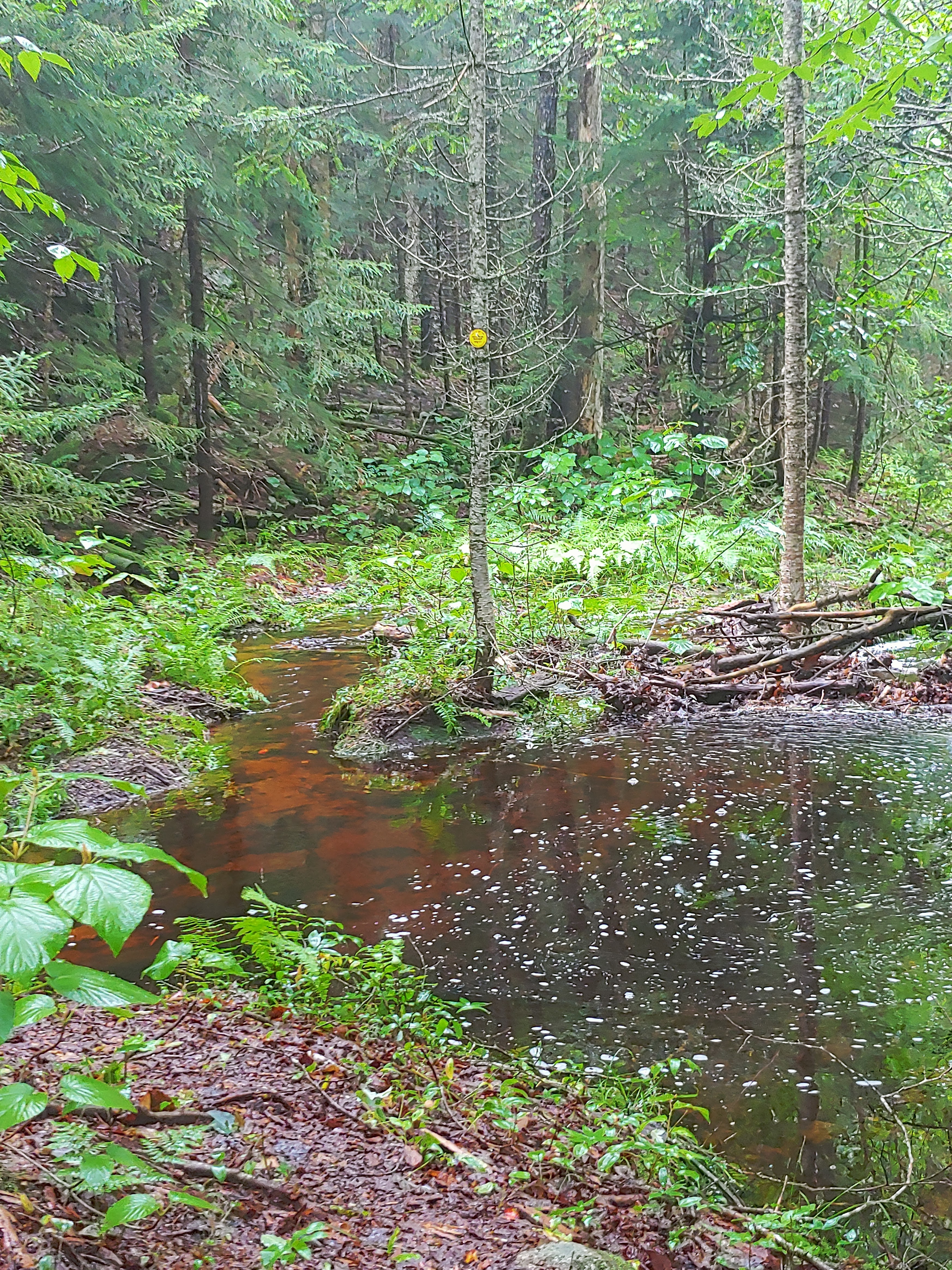
As I made the turn at the the French Louie Trail I recalled my moose encounter from a few years ago. I was not in a rush as my destination was Sampson Lake only 6 miles from the car.. Like usual I kept my eyes peeled for the old jeep trails which traversed the area as recently as the 1970s. Not much left now. Perhaps some day I will spend the time to really explore them and their destinations. As I neared  the beaver dam/pond I saw a group ahead of me. I clicked my poles together to make some noice so I would not startle them as I approached. I soon saw why they were stopped. The beaver dam area was now flooded. They were waiting for their "guides" who were looking for an alternative route. They returned shortly, I told the group the trail was going to be wet and based on their route for the next three days, this would be just one of the flooded areas to content with. I receommended to "embrace the suck" and started walking right into the mess. Calf deep at the most, so not too bad. 

The Pillsbury lean-to was jsut after the flooded part, so I stopped there to wring out my socks and have lunch. The group arrived soon after. They were from Colgate, on a freshman summer orientation adventure. Their guides were juniors from Colgate. We all talked for a while before I headed to Sampson. They had a few different orientation adventures to choose from for their (optional) trip. Backpacking, canoeing, day hikes w/base camping. What an awesome opportunity.

I continued on noting the Whitney Trail is still mostly obscured (nice!). I slipped on a wet rock and although I did not fall, I may have pulled something. Maybe if I just rub some dirt on it and walk it off. The trail was like a stream for quite a bit of it. Close to Sampson, I spotted an open area just off the trail, so I decided to check it out. A small grassy area with a large firepit like what was built in front of the lean-tos with concrete etc... A trail continued South and West towards the Lake. As I followed it it became apparent this was the old trail to the lean-to as shown on the maps. The trail was clear, perhaps kept open by the fisherman.

I set up camp at the lean-to with minutes to spare before the sky opened up. Just a brief shower after which I fished a little. Made a smudge fire and read the shelter log. Step two followed by a small dinner. Watched the sunset down by the rocks with the resident snake as a companion. he did not seem to care about me. I did make it to hiker midnight before I turned in.


Day 2 Thursday 

Tried my best to sleep in but it just wasn't happening. Since it was early, I didn't make or eat breakfast. This is customary for me especially on solo trips. After packing up, I headed straight up the hill behind the lean-to to catch the trail instead of backtracking a bit. Back on the main trail more mud and muck. As I neared the NPT junction I ran into another hiker doing the loop. Apparently I had parked right next to him. We chatted a bit about the NPT. He was doing the trail earlier in the year, but bailed just before the flood storms hit. 

I took a short pause at he bridge over W.Can Creek and as always reminisced about the times I crossed without the bridge due to Irene. Took a longer break at the lean-to and ate my dinner leftovers. Read the log book and recorded my own entry. After a short while I got antsy again to hike so off I went. On my way to West Lake, I took the short detour to check out the newly renovated South Lake lean-to. Looks great although I am not too sure about the location on the hill, that might need some steps built into it. Took another long break at West Lake. Aired out my feet and made some coffee. Always a great view here. A toss up between here and Cold River 3 as to which is best. This lean-to roof is the next one slated for a repair. On the shelf was an old film canister. Inside was a roll of ektachrome film which has seen better days. I wondered if this was found during the South Lake lean-to repair and then left here? I will carry it out and see if it is possible to get this old film developed. 

I was signing in at the trail register when I heard some voices coming down the trail. Soon the Colgate crew was there. They were in good spirits obviously enjoying their trip so far. One asked me about "my section" so I described where it was and about how long until they would traverse it. She also commented on the mud they walked through for the day and repeated the phrase "embrace the suck". I smiled in agreement. We parted ways as they continued on the NPT and into the next muddiest few miles before it became a nice open dry-ish trail. I headed west towards Brooktrout Lake. "See you on the trail" she called out to which I responded in kind. She must have just read my entry at one of the lean-tos and used the line from my signature.

Took another short break at West lake #2 to collect some firewood, kindling and tinder in preparation for a night here later. Big rains are expected the next few days and it would be easier to have this dry wood available either for me or whomever ends up here. I forgot how long the trail was along West Lake before it turned up towards Brooktrout. Easy enough, just longer than it would seem. I checked out the campsite at the end of the lake and spent a few minutes looking for a boat. Some decent hiding spots, but no canoe. Only a short mile left to Brooktrout where I will have a late lunch and relax.

Arrived to an empty lean-to. As I removed my pack I caught the smell of weed inside the lean-to. I went to gather firewood, made a fire and had some lunch. The canoe was full of water, so I emptied it and turned it over so it would not gather more. I had considered taking it out for spin, but went back to the lean-to instead. Every time I poke my head into the lean-to I catch a whiff of the weed.I chuckle recalling the youtuber, "Rank King" taste testing the different beers and commenting each time he sipped a Pabst "yep, tastes like weed". I chilled at the lean-to and gathered more firewood. I was not motivated to take out the canoe and fish. The rocks were nice enough to sit on by lake.


Approaching 5pm the sky turned from just partial clouds to overcast while the temp dropped; winds also picked up. A sure sign of the weather changing and the rains moving in. Glad I had already procured plenty of wood for the evening and morning. I pile up some of the wetter wood onto the fire to keep it smoldering and to begin the drying process. Sat back into the lean-to; yep smells like weed. Shortly thereafter the rains came, then out came the sun.

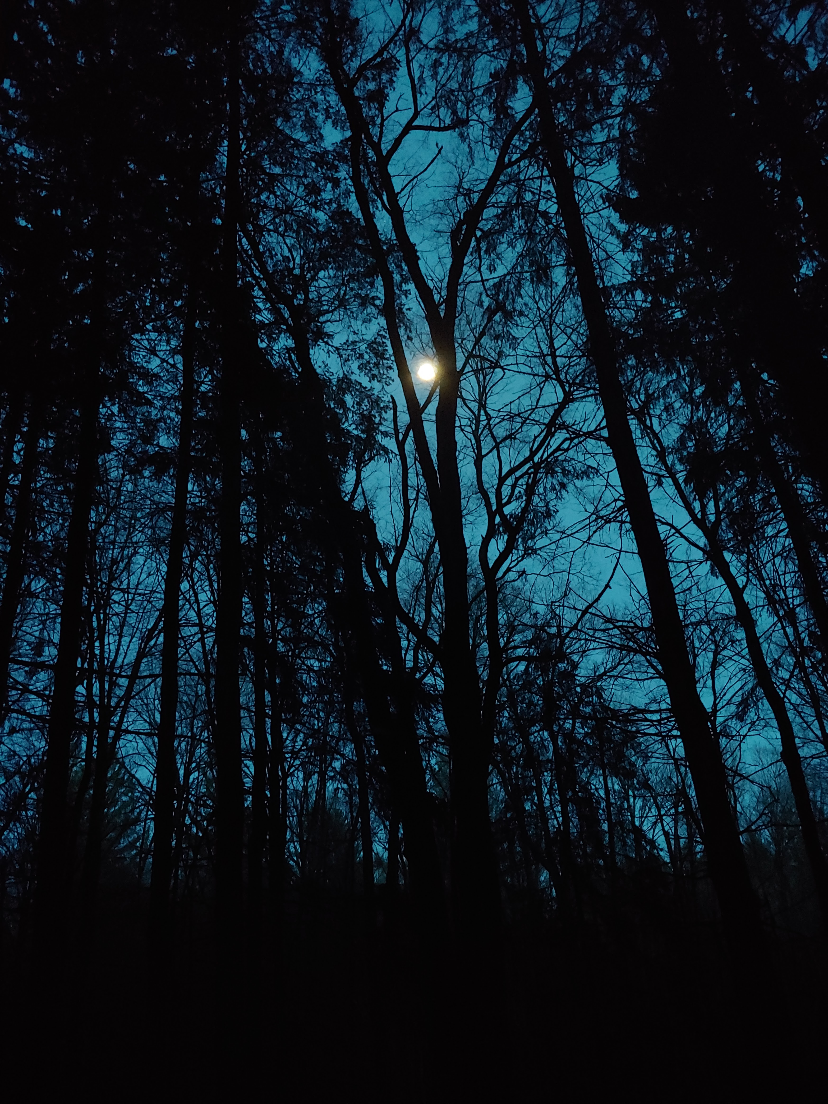
I had made dinner and was enjoying a beverage down by the lake when I heard some noise in the woods around the bend. I waited quitely and soon Keith arrived with his Hornbeck canoe overhead. He was drenched. I moved my gear to one side of the lean-to to give him some extra room. He took a break and then set out into the lake for a paddle. He had carried it in 5 miles for this purpose and didn't want the effort to go to waste. The clouds hinted at a nice sunset, but the colors dissipated early. I did manage an ok photo of Keith out in the canoe. Stayed up a bit later due to the company but still in bed around 9pm.


Day 3 Fri Aug 18th

Boy the rains sure came over night. Thunder too in the distance. During the night I would hear the rains drumming on the canoe down by the lake. I slept ok on the slanted lean-to floor. In the morning the rains would be off and on. Keith went to paddle again while I packed up. He was staying another night but said he might do a day trip to West. We might run into each other again but neither of us were set in our plans for the next three days. 

Wow the trail from Brooktrout to West was underwater. I was basically hiking down a stream bed. As I passed the actual streams and drainages, they were gushing waterfalls. A couple were tricky to cross. being solo I was careful to not try to walk across wet logs. I was already wet, so stepping into deeper water was not that big of a deal, but falling could be. From the campsite at West to the lean-to was relatively dry being on higher ground. I did take a short detour around a marsh looking for any signs of a camp shown on the old maps. No signs but defnitely some neat places to camp if one wanted to be well away from the lake and trail. As I neared the lean-to more springs eminated from the hillside which made the only real wet spots. The piped spring near the lean-to was flowing nicely semi-flooding the trail. 

I spent the day at the lean-to relaxing, collecting firewood and digging out some drainages along the trail starting near the spring. The sun was trying to cut through the clouds all day and a few times the sky would just darken followed by a short rain entertaining us woods dwellers with a weather waltz. Having finished dinner and enjoying a PBR by the fire, the sky opened up with another shower. I wonder how long this would last before the sun returned. I am all set for the night with wood and water regardless. The only difference will be trail conditions tomorrow.


Day 4 (Saturday 8/9)

Awoke at my normal early time, but forced myself back to sleep. Regardless of which direction I head today, I still had plenty of time. An NCT hiker came by at 7:30 am heading in the direction of Btrout. I made myself a large cup of coffee but skipped eating. I packed lunch and a snack in my day bag at the top of my pack for easy access. Temp was 51deg, the woods were wet and drippy. 

I decided upon some off trail exploring (just a little) to see if a reroute around the NPT mudfest was even a possibility. Looking at the map, I figured to head east at the bridge following the stream before turning S. to regain the NPT. Worst case I could stay east a contour above the NPT and hit it where it turns N near Mud Lake. The woods were quite thick at the bridge. I probably should have taken the bearing from the lean-to and stayed in the open hardwoods away from the creek, but I was already this far so I pushed on. It eventually opened up a bit and was easy going. When I turned S. I ran into some cleared trail that led right to the NPT just past the extended beaver pond. The cleared part had left many 3-6inch high "stumps" fromn the cut saplings. These were a danger to walk through, I had to stare at the ground for almost all of it. The rest of the pond came into view on my right. I could see where the "trail" existed in the pond with a marker on a small tree right in the middle.

The next portion was the rocky muddy part not so different from the rest of the NPT in parts. I am sure had I stayed in the hardwoods, I could avoid this too. This part is only really bad after a rain, like we have had the past few days. So yeah, it sucked. I spent a good half hour looking for the old campsite near Mud Lake. I was just about ready to give it up and decided to take one last look at a slightly different spot. I found two potentially old firepits, and the remains of a cut telephone pole. I am sure the pole was from when they ran a line to the ranger station at West Lake. I had seen a few before still standing years ago, but have not seen them since. Later on along the trail near where I had seen them in the past, some steps were put into the trail at a steep section using what appears to be old telephone poles.

Another hiker came along heading the opposite direction. We chatted a bit. His name is Jim and he lives rather close to me. He had started in Durant and was going all the way to Northville. He has hiked the NPT before with his wife in 2011. Jim is also a lean-to adopter in the Pharaoh Lakes region. We exchanged trail condition intel before we parted ways. I soon was passing by King and Cat ponds remembering the time Dan and I searched them for canoes. After a small climb, I was on what I call the "long straight" to Cedar #3; just a section of trail that doesn't turn much. The natural rock cliff wall on my left signalls to me that I am getting close to the junction. I skipped the Fishermans's lean-to and pressed on to Cedars #2 even knowing it had a higher likelyhood of being occupied. I figured a +1 would not put it over capacity and there was also plenty of open space nearby for a tarp set up if needed.

Filled up my water bottle at a trail side spring. These were all running well with the recent rains. The trail was still a soggy mess. Surprisingly #2 was void of people, still early though. I had a snack lunch of pepperoni & cheese. Took off my wet boots and socks. It was well past midday but the temp was still only 55deg with a hint of the sun trying to poke her way through. It was not to last unfortunately.

After my break, I started gathering wood. I went to my usually spot up the hill and found plenty of dead&down. While it was all damp, it was hardwood which meant the inside was dry. I stopped for a bit to read the shelter log, new from June with only a few entries some with larger groups of 8 and even a dozen. The Colgate group had spent the night here when I was at Brooktrout. As the afternoon rolled in it was odd not seeing others here, it was Saturday after all. The weather must have kept most people away. Perhaps by eveing other thru or section hikers will be by. I started the fire to dry out all the wet wood and let it smolder away until dinner.

I went down to the bridge and noticed the beaver dam under it was now quite large, really raising the level of the pond. Briefly considered tossing in a line. A couple hikers stopped by, Wyatt and Smiley. Both were hiking barefoot. They had come from Spruce Lake this morning. They dried out some gear by the fire and asked for recommendations for campsites, and other trail info. They were looking to add an extra day to their itinerary and were trying to see if their food supply was sufficient until their next re-supply. I offered for them to "go shopping" in my food bag since I was hiking out tomorrow and had skipped a number of meals. I held back my coffee and a couple granola bars to get me through the morning. 

They mentioned they were protein starved, living off oatmeal and macaroni for the most part. They added my remaining cheese&pepperoni to their pasta dinner, and graciously accepted some of my dried meals. I gifted them one of my remaining beers as well. The sky cleared up enough to allow a view of the setting sun at the bridge over looking Beaver Pond. Hoping tomorrow would be a nice sunrise over Blue Ridge. As it got close to hiker midnight, I told the guys I would be probably be gone when they got up and would try to be quiet in the AM.

Day 5 Sunday

No entry.

(I must have simply packed up and hiked out).

P.S. This was the first time I saw the new "funhouse bridge" over Grassy Brook. Nice job.


Saturday, July 22, 2023

Seven Days of Summer Solitude -Cold River Country

 Day 1: Kalie & Carla were already at the parking lot when I arrived @9:55. The day was warming up, around 72F. Kalie&Carla are only staying until Wednesday so we signed in seperately in the trail register @ quarter after ten. The trail was only slightly muddier than usual surprisngly since the entirety of the Adirondacks was recently overwhelmed with rain. Many roads washed out and bridges destroyed. Some roads were still closed. We made quick time to the main trail junction where we paused briefly looking at the nearby campsite and the closed horse trail. On an old road now for almost the rest of the way to CR#3, The old roadway showed remnants of the rains running down it, cutting grooves and waves of debris. We were in no rush so we took it slow with a few short breaks. A longer break at the Calkins lean-tos for lunch. While resting, a gentleman and his 2 dogs came by. They were on a day hike to the lean-to and back. 

Carla was off taking pictures of the flowers in the meadow and poking around down the trail towards the river. when she returned she asked which way the trail went. I said just past the bridge. She said she saw the bridge materials but there was no bridge. I replied it was broken and mostly down into the stream bed. She said there was no bridge, just a knee deep stream. Kalie and I were both a little confused and thought perhaps Carla was referring to the other stream. When we headed down the trail, indeed the old broken bridge was gone! The only remnants were the two steel girders used as supports which were down in the rocks. We surmised the bridge must have washed away in the river surge from the massive rains. We forded the river just upstream of the old bridge and continued up the old roadway. Along this path we could see the river had overflowed the banks and not just encroached onto the old road, but the nearby forest. The debris pushed into the woods was considerable and we were at least 8 feet above the current water level. This was some massive storm. The old roadway was considerably eroded as the river gouged out channels in it. Farther up a feeder stream passed under the road through a culvert. This culvert had been unearthed and discarded downstream. Amazing!

After the height of land, heading down the southern slope of the side hill the water damage was significantly less. We stopped again at the "coffee spot". An open viewing area of the Sewards Range where I stopped for coffee many years ago and will still pause and look everytime I pass by. There were ripe blueberries here too. The view had hazy skies accented by the wildfire smoke. 

At the trail junction for Latham I mentioned the possibility of looking for a shortcut from here to CR#3 to avoid the upcoming flooded section. Perhaps tomorrow? The beaver swamp was gross, but not deep. Kalie kept her water shoes on for the remaining half mile to the lean-to; Carla and I switched back to our hiking boots. We arrived at CR#3 @4:30 perfect time for a step 2; I went with a PBR. Carla made an early dinner b/c she only had a snack at Calkins while I set up my hammock and Kalie her tent. A smudge fire was prepared even though the bugs were not that bad. It would make stoking it up later easier for cooking. 


We hung out in the lean-to until about 9:30 when I finally called it quits. It was still very warm when we went to bed. Just below being uncomfortably warm so I eventually fell asleep.

Day 2: I awoke early having slept very well. Even so, I opted for some more.Finally arose at 6:30 and made some coffee. Over breakfast we planned out our day. Opting to check out the old trail to Pine Point. We headed downstream and forded the river just upstream of the old Shattuck bridge. I think I have an old photo of this bridge from almost 100 years ago. 

At the junction with the NPT we headed SOBO. The trail to Pine Point was farther away than I remembered. It was well marked but very overgrown with a lot of blowdown. We were already soaked from the wet brush on the way to the river ford so it didn't make it any worse. After a series of blowdowns to content with we crossed a feeder stream. It was slow going. At this point Kalie opted to turn around and wait for us back at camp. The type 2 fun was not on her list for today. By this point I was committed to getting to Pine Point. Carla and I pressed on. The trail actually got a little better in regards to the bushiness but still a lot fo blowdown. A few tricky sections to navigate including a flooded spruce swamp. Closest to the river was all matted down from the river overflow and the foor tread was easily discernibler as the water had washed away all the debris on the path. While it was mostly a bushwhack, there were still some really pretty sections of river. On the other side we spotted what appeared to be rows of red pines? These were a staple of the CCC and I am aware of the CCC having done some work in this area I did not know if it included reforestation. I will have to look into it and possible make my way to that ridge sometime in the future.

About a mile before Pine Point we passed by a small grove of rather large cedars. Seemed like it would be a nice area to camp. We had lunch at Pine Point under the big white pine. 


We did not stay long as the flies and mosquitoes were annoying. The way back to the NPT went much quicker. A combination fo the marked trail and our footprints. Fording the Cold River was a little more work as we angled upstream. BAck at the lean-to we cleaned up and relaxed. A few sounds of thunder in the distance? Not sure. So far we were winning with the weather; we expected today to be on/off rain all day. Hoping it isn't just a delay and tomorrow will still be nice. We did get a few sprinkles right after dinner but it didn't seem to last. Ok if it pours over night though.

Day 3: The temperature dropped a bit last night. Not cold, just a nice sleeping temperature under the quilt. I slept solid until 4am. Tried to get more to no avail. I finally headed over to the lean-to around 5:30. Carla was already packing up some stuff as she had a long drive to NH to make. Made some coffee and watched the river come to full light. I made a note to remember to track the sunrise here to find out exactly when it will rise straight out over the river view. Carla soon headed out and I was alone with the river until Kalie awoke. We ate breakfast and I cleaned up the firepit while she finished packing up. We were both on trail before 9am. I headed upstream and Kalie followed in Carlas footsteps back to the cars. I now had a few days of just me and the Cold River Country. No major plans.

I stopped at Big Eddy, the Seward Camp and explored around. I had brought the mini metal detector to try to located the buried cauldron with no luck. At Miller's Falls I took an short swim and had lunch. I also washed out my hiking clothes. A nice nap while they dried on the sunny rocks. At a little after 1pm I headed to Ouluska just 2 miles away. I would have a decent amount of time to read the shelter log. Gary (the previous adopter) had transcribed the book going back to the 1980s. I hope he kept copies in case the book ever is lost or destroyed. The two miles between Ouluska dn SeWard are very nice. Ironically in the 80's the log book described it as "the worst two miles on the NPT". Since then the trail had been rerouted to higher ground in many spots. A discerning eye can make out the old trail through the mucky areas and mud pit hell. It was an easy rock hop across Seward Brook earlier and according to the log book the bridge was washed out in the 80s too with many hikers complaining about it. I guess some things never change. Duck Hole must have been quite the party place as many entries commented that it was "not the place for solitude" and "very busy". Back then, people could drive all the way to Duck Hole. There were entries ffrom the "Case's 3rd through fifth thru hikes of the the NPT.

Much love and appreciation to Gary for all the years he spent upkeeping this and other lean-tos. Ouluska must have been his favorite as this was the one where he transcribed the books. IIRC, it was because of him all the lean-to now have log books. Many commenters oin the mid 80s complained about the Seward Lean-to. One called it the "Sewer" lean-to. It was one of the older ones with no floor and no front over hang. In 1989 it was re-habbed to its current design with the front sloping overhang and floor. These modifications are obvious add-ons.

About 5pm I started water for dinner. The smoke from the fire should keep away any bugs which decide to stop by in the early evening. So far the day has been relatively bug-free. Sunny and low 70s.

Wow! That ramen soup with the dried cabbage, carrots and jerky was quite good. Will need to remember that brand and flavor. "Sichuan Spicy Stewed Beef". It was just before 6pm and I began to wonder if I would see anyone else today. Only two beers left for the next four nights. I might get lucky with a resupply from George and Mike on Saturday at  Duck Hole. Still leaves me one night short at least. Had one of them on the big rock overlooking the river. 


After I cleaned up from dinner, Gabe, Jeff and Zack crossed the brook. Nice guys, hiking the NPT in Sections. They had seen my name in numerous log books along their journey. They had a lot of questions and I was happy to answer those that I could. Made it well past hiker midnite the guys to talk to.

Day 4: Lazy morning. Slept ok for being in the lean-to. Hammock is always more comfortable. Made some coffee and went back to the overlook rock. Two f the guys joined me. Great conversation. One of them was just stating out his teaching career in middle school (2nd career). The third guy joined us. He had not slept well. He had left his sleeping bag in his car and was making due with a liner only. Last night was the coolest night so far so I am sure he felt it. I finished  (a late for me) breakfast afte they headed out. Their goal was Wanika Falls. Again I had no real plans for the day, just to poke around some old trails and Rondeaus hermitage a bit.

As I approached the hermitage, instead of making the turn I stayed straight along the river and came right up to the "Big Dam". I had never stopped here before since I was always just passing through. The log making the dam was immense and had been here for a long time. It made a very nice pool both above and below it. The hermitage is just above me on the little rise. The map shows an old trail continuing upstream, then corniering the swamp before swinging back North. If the trail was here it would have been just along the river bank and any remnants have sionce washed away. Just inside the woods was a lot of small dead spruce; very "pokey". Not fun walking through especially with a full pack. I cut back up the hill to the hermitage and I think I found the tree that both George and Bob told me about. Nothing special just a spot where someone had their ashes buried. I was then back on the NPT for a bit looking to explore some more spur trails. I took an obvious one which was definitely an old roadway. I had seen this path many times before. I thiought it might be the one heading toward Emmons, but it quickly swung back around to the hermitage. Must have been the secondary trail encircling the area shown on the old maps. 


I spent some time trying to find the Petty Cutoff trail. I did not see any path, so I took a shot off trail towards a drainage and the next contour down to see if I could feel anything. For a short bit I thought I might have found something but it disappeared into a drainage and I could not pick it up again. I followed the drainage up and around hoping to find any trace. I gave up and headed up back to the NPT righ about where the two trees were groing in the rock. Nearby was tree w/wire Bob mentioned. No evedent path and it didn't match anything on my old map. I will have ask Bob again what was the significance of the wire. I continued ont he NPT and took a long break at the Mountain Pond drainage as it was nice and cool there. I was a little bummed I didn't find the cutoff, partly because I think I gave up a bit early. I should have just taken a bearing and headed to the river crossing instead of trying to find old trail remnants specifically.I figured I would now just head to Cold River #2 lean-to and figure out plans for the next few days there. Possibly the Northern lean-tos tomorrow? I will need to be at Duck Hole on Sat to meet George and Mike and the Northern L2s are only about 3 miles from Duck Hole. This afternoon the sky was changing between suna nd clouds, I wonder if a system is moving in. I have the lean-to in case in storms. And someone left a book, so I can read that if I get socked in. I have wood all prepped for today and tomorrow just in case. Now just relaxing. Perhaps I will check out the book.

I had skipped lunch since my dehydrated breakfast (eggs, potatoes, cheese and salsa) really packed a punch. Will need to remember that recipe.So now a late lunch/early dinner. Teriyaki noodles with jery and cabbage (next time remember shitake too). Hammock is all set up. Time for a step 2. Last one of the trip unless the guys hook me up tomorrow. Blue skies right now with the sun preparing for its setting. The river makes a strange echo inside the lean-to; sounds like someone is behind it running a jet boil stove. Have not seen anyone since the 3 guys this morning. The small fire will be my company for the evening.

Day 5: Woke up at 3am to thunderstorms. Big bright flashes and rolling thunder in the distance. No more rain when I awoke at 6:30. Another short day so will try to go back to sleep. Able to steal another hour. A quick water for coffee and organize my food.. Will be interesting to see how much extra I return with. I can easily get a weeks worth in the Ursack. The ferns and brush were soaked with the night's rain so I put on my rain pants. I checked out Cold River lean-to #1; a tree had fallen and punched a small hole in the roof. Another future lean2rescue fix unless the DEC just decommissions it as it is just across from CR#2 and both get little use. 

Made another stop at the old "new" Duck Hole lean-to. The meadow is grown in making the only wau to the lean-to from behind it in the woods. Remembering my first time here before Irene finished off the dam. Ran into George on that trip. Ended up staying the night instead of going to Moose Pond. Also recollections of "the artist" on another thru hike. Made my way to the new "new" Duck Hole lean-to. It is much easier to just call it Roaring Brook as that is where it is located anyway. While putting up my bugnet in the lean-to a couple guys stopped for a brief snack. They are fast-packing the NPT. Their goal is a 4-day thru hike. I told them they just did the roughest patch. They were headed to Long Lake for the night. A solid 30 mile day.

Had some lunch with company from the sun and the birds. Wondering if the edge of the brook is a muddy mess like last time. As I pondered these thoughts a huge mouse made an appearance in the lean-to. he must eat well. The chance of rain today seems to have lessened. Turned out to be a beautiful day. even sitting near the lean-to was bug free. In the late afternoon a distant rumble of thunder far to the South interupted the quiet of the woods but stayed away. Just some rusting of the tree leaves and the gurgle of the brook below. 

Made a fire with wet wood for dinner. Stacked it up high so the smoke would dry it all out. It was self sufficient for a while so I did not need to attend to it. It took some time, eventually I had a decent coal base and put on some water. Afterwards I put a burnt log atop the coals to dry it out. I did not realize at first the chunk was a piece of cedar. As it began to burn the scent gave it away. Was very pleasant. The wood I stacked near the fire was all dry, so I set it aside for the morning. Thoughts about the crew arrving tomorrow. They would be at Preston at this point. Not sure if they were planning on spending the night here tomorrow or just day-tripping it. If the latter I will re-think my plans for tomorrow night.

Day 6: I went to bed quite early, before it was even fully dark. The "Sleepy Bookshelf" always helps. A slight rain overnight but not much. Coffee and breakfast are done and I am all packed up except for the tarp. George said they planned on arriving later morning or noon depending on how late they arrive to Preston. Nice and cool 60* with overcast skies. I kept the fire smoldering in case it warmed up ebough for the bugs. All is quiet and peaceful this morning.

As the morning closed in on midday, I made plans in my head in case the guys did not make it. Also time and weather were variables. Just less than 5 miles to Camp 4 from here, plus the expected muddy beaver swamp mirroring the one on the western side of the loop. If I went to Camp 4, it would leave just over 6 miles to the car. Or  1.5 miles to CR#1 and leave the flooded section and ten miles for tomorrow. Just some things to consider in my decision making. A little bit of blue sky would occassionaly appear between the generally over cast sky. About 65* as the sun crested noon.

I sat on the "Duck Hole Island rock" where George often stashes his canoe. From here I could see the approach from Preston. As of 1 pm no sign of the guys. Possible something changed their plans. Perhaps the storms I had heard in the distance. My contigency plans had landed me at going to Camp 4 as the weather was favorable. Though I had visions of the flooded section being worse than it really was. I had imagined waist deep water and carrying my pack over my head but it was just knee deep and mostly water not much mud. There was slight breeze too which was nice. The old truck trail is in much better condition than the Calkins trail and only a few blowdowns.

The spring just before Camp 4 needs some attention. The drainage is all plugged up and the cistern is underwater and covered in leaves/muck. I did my best with my hiking pole but I am sure it made little difference. Approaching Camp 4, I scared up a decent size deer. Tracks and scat would then lead the way to Camp. No one else at Camp 4. Still a nice breeze so no need for a smudge fire, but I will need wood for dinner later.

I forgot how much I enjoy my dehydrated pasta dinners. So simple too. Had a few extra squares of dark chocolate for dessert. Water is boiled for tomorrow and cooling in the pot overnight. Not planning on coffee, just a "get up and go" morning. I know Emily will be pleased if I arrive home earlier in the day.

Day 7: Just get up and go. Back to the car in the later morning. Saw quite a few hikers on the way all were heading to climb the Seward Range.  I ended up doing 42 miles over the course of the week. A lot of relaxing and probably a bunch more miles off trail looking for stuff. Suppose I could have done more exploring, perhaps next time. The woods aren't going anywhere any time soon. I did manage to add another 3 lean-tos to my total.

Tuesday, July 11, 2023

Canoeing in St. Regis

 Day 1 (Wednesday June 28th) I arrived at the launch on Little Clear Pond a few minutes early. This would allow me to change my clothes and get my gear all situated before the predicted rainstorm. The parking area was empty, it likely will not be so when we return Sat AM. Dan arrived a few minutes after I finished getting my gear to the water's edge. All I had left was to change into my water shoes. As Dan readied his gear I gave him the deer shed I found in my woods. I fgigured he would be able to make it into a few nice knife handles. He returned my cooler from last summer. Inside he and Carla had gifted me some freeze-dried goodies they put together. As we finished up a woman and her dogs came by just hiking. The dogs to play in the water. She was fascinated that we were heading into the woods to camp for a few days. So far the expected rains have not appeared.

Asd we set out across the pond (note: Little Clear is a DEC fish Hatchery and thus no fishing or camping is allowed) a few sprinkles of rain made their appearance. Not enough to put on raingear in this warm humid weather. It was about a mile paddle to get to the portage trail. The take-out was a nice sandy area and the trail wide and smooth. We double carried it, leaving our packs about halfway before going back for the canoes. The mosquitoes were fierce in the woods when we stopped for even a second. The put-in was at the end of a long boardwalk which became like a dock jutting out into the creek. As we loaded the canoes, Dan stepped into the muck and went almost waist deep. The paddle from here into the pond was calm. 

As we entered the pond there was a decent headwind.Once on St. regis I made a few casts and trolled a bit as we headed to our campsite.  Our goal was the lean-to site on the western peninsula. With the impending rain, the lean-to would provide a gathering place for us to hang out instead of sitting under our own tarps or laying in our hammocks. I needed to spend the night in this lean-to anyway for my "challenge". This would be #143. So far we have not seen any other people. It would appear we had this entire pond to ourselves. We were also quite ahead of the game in regards to weather. We expected to be paddling in significant rain already. With the weather cooperating, except for the wind, we set out to paddle a bit. I fished as the wind pushed me along a small island though the deep water and eventually to the lee side of the next larger island. No hits, but it was nice and relaxing. The water was quite warm, so any fish would be in the deeper cold areas. Maybe tomorrow I will be able to get a little deeper. We paddled into the stiff wind to get back to the lean-to. But not before we stopped at an old beaver lodge to gather some firewood.

Back at camp, we had a few beverages  (Dan carried in a case) dinner and conversation. Before long it was evening and some fish were popping up to the surface. Dan dropped a fly into the area and landed a whopper; an entire 1.5 inch sunfish! 

While air had been on & off misty all afternoon and evening we so far had avoided significant rain. The wind also kept the nugs away. Great first day!


Day 2 (Thursday) Not surprising I was up before the sun. I tried to fall back asleep and may have stolen a few extra minutes of sleep. I did not feel like I slept that great. I will set up the hammock today and hopefully get a better nights sleep. Dan was also up relatively early. We made coffee and lazed around before having breakfast. We had the entire day to fish and explore since we were not moving camp. We eventaully put the canoes in the water and paddled towards the outlet. From our site it was like a small bay on the western side of the pond. I fished along the way. No luck, bit it was very pretty and a gentle paddle. As we approached the outlet the pond shallowed. There was a bidge over the fish barrier dam; built to maintain the fishery by keeping out unwanted species. We apddled back to camp following the far shore. We paused at the campsite across from us with prominent rock ledge. From here it would be a perfect spot to watch both sunrise and sunset. Nice campsite too.


Back at camp we had lunch and st our chairs near the shore. I fell asleep for a bit and apparently Dan did as well. We set out again to explore. This time the inlets to the North and the campsites along that shore. We also stopped at the de-commisioned site on the island. It was really nice but rather close to ours.The other campsites were inferior to the lean-to and the rock ledge campsite. The inlets did not provide any paddling access nor any cooler water to entice fish. While the fishing was a let down, it was a very nice paddle around the islands. Also a couple of canoes have made their way to the pond, we expect a lot more as we get close to the holiday weekend. 

A couple more beverages at camp and dinner, then some sitting in the chairs near the shore. This lasted until the bugs arrived. A small smudge fire extended our evening only slightly as we made our way to the hammocks with the mosquito netting. Hoping for a better nights sleep.

Day 3 (Friday)

Slept like a champ! That was great. This morning the fog on the lake was thick. Could not see the other shore a quarter mile away. The island was also not visible. It reminded me of the one morning on Lake Superior when we had to navigate by compass across the channel from battle island. As the fog lifted, we could see the water was like glass. 


After coffee we packed a day pack with lunch for our day's exploring. There were still quite a few features on this pond we needed to explore. First was thw small tributary which would empty into a small unnamed pond. The paddle across the pond was quiet with only the sounds of our paddles dripping into the water. As we entered the small connector, it was beautiful the way the sun illuminated the flora growing on the logs. Dan was ahead of me, so the I captured a photo of him backlit by the morning sun. The pond itself was serene. So peaceful with the remnant fog still hovering over the water in the shaded areas not yet awakened by the rising sun. We quietly paddled around the outside edge of the pond. Sadly the camera could not capture the full effect of the fog and sunlight. A boat beer would have to suffice. The campsite tucked away in the far corner looked ok, and would have a fantastic view the downside would be the bugs. There was little air movement in here.


We left the small pond and continued around St Regis to the short carry into Green Pond. The pond was aptly named as the water's green tint was remarkable. We would see the quick drop off into the deep. With no obvious inlet, this was likely spring fed. A tried my best to find any fish in the depths to no avail. There were three portage trails eminating from this small pond; the one we used, one from  Little Clear Pond and the last to Little Long Pond. The campsute on the southern shore was nice. Though being set into the woods would be buggy. This would prove true as the skeeters did eventually find us as we explored. Back into the boats and continuing to paddle around the pond. We would save the portage to Little Long and the rest of the area for another trip. 


We carried back to St Regis and chose a lunch spot on the peninsula under the white pine. This was another closed campsite. The landing was sandy with remnants of turtle shells. The ground ws soft under the pine and prided some shade. A few fisherman were trolling the deep area of the pond between us and the island. After lunch we paddled back across to our campsite where we spent the remainder of our day. We saw a few more paddlers today, but not as many as we expected heading into the holiday weekend. After dinner we paddled out again into the calm waters to watch the red sun set created by the smoke from the Canadian wildfires. We were hoping for some more nice colors in the clouds. It was pretty nonetheless and relaxing to sit in the boat on the water. 


Sitting by the campfire, the lightening bugs made their appearance and soon we headed to our hammocks. Rain is expected tomorrow as we head out.

Day 4 (Saturday) Another fantastic nights sleep in the hammock. No rain overnight so I packed up the dry tarp and the rest of my hammock as soon as I arose. The morning sunrise was searing through the overcast skies and the wildfire smoke filled air. I made an extra large cup of coffee and packed up most of my gear. With the impending storm approaching we wanted to get an early start. The water was again peaceful as we set out in the morning. We paddled slowly to enjoy the last few minutes on the pond. Close to the poratge we ran into Mike (Assistant Forest Ranger). He was very nice and professional inquiring if we needed anything or had any questions.


We double carried again from the boardwalk landing to Little Clear. I used the yoke this time which added a few minutes to my carry. The bugs were terrible at the put in so Dan waited for me out in his boat. The wind was beginning to pick up and not long after we pushed off we were paddling directly into a stiff headwind. Dan had the garbage bag on the back on his canoe, so I stayed a bit behind him in case it blew off. Passed a few boats heading the direction from which we came. Hope their trip is as fun and relaxing as ours. We were certainly fortunate with the weather. 

At the take-out a water steward was their to inspect boats and educate paddlers about invasive species. He gave us each a DEC emblazoned micro-fiber towel to "clean & dry" our boats between waters to mitigate any spread of invasives. We loaded up our boats, had a final beverage before heading home.

Great trip. Looking forward to our next one together.


Friday, June 2, 2023

Memorial Day Weekend - Cold River Country


It seems I often go to the Cold River on Memorial Day Weekend. I think the first time was to do the loop with Ian. In the years since I have visited on Memorial Day Weekend for the loop, via Preston Pond, as an out-n-back from CR#3, and a number of variations. This time would be to hike to CR3, then day-trip to Ouluska and deliver brooms to the lean-tos while doing my general cleanup and inspection. There were up to 8 people planning on going, but a few had to cancel. So the crew would be me, Kalie, Shannon, Jim and Jacob. Saturday 10am we met at the Seward lot which was already well past capacity. We parked a bit down the road in front of the long line of cars. Once signed in we were on trail a few minutes past 10.

The start of the hike is generally uphill so it really gets your heart rate going immediately. Our first planned stop is lunch at the Calkins Creek lean-tos about 6 miles away. Like usual we branched off the main trail to take the horse trail. This time Jim was sure to take the correct route. A few muddy spots, but mostly very dry. At the junction we took a short pause before heading down the old roadway. The trail was mostly clear with just a few major blowdowns to content with. We passed the herd path junction, and the Raquette Falls junction and were soon at the lean-tos. It was already getting hot and I needed to fill up my water. I will try to be better on this trip and drink more water. While having lunch two guys came down the trail from the Cold River side. They were doing the loop and climbing the 4 peaks. They had already climbed Seymour and had only 6 miles of the loop plus Seward, Donaldson and Emmons to finish. After talkin they were going to stay at Camp 2, then day hike the 3 peaks and return to camp for an easy last day out. 

We bid them well and set off starting with the big climb. I was going slow already. At least it allowed me time to look around for some of the old trails Bob mentioned. Once we headed downhill, we stopped at the spring for a water fill up. The trail would get brushy further south and then we still had the flooded section to contend with. We paused briefly at the Latham Pond trail. The flooded section is soon to follow. We changed into water shoes and crossed the now longer and deeper flooded trail. The water at least felt good on the feet, except for the few warm spots. Those were kind of gross. About a 1/2 mile left to CR#3.

As we approached I could see the front of my party passing it by. It must be occupied. I stopped to say hi and drop off the first of the brooms. The couple inside was protecting themselves from the skeeters by sitting enclosed in a large bug net. We had expected a lot of black flys, but for the most part they had given way to the mosquitoes. CR#4 was empty so we set up camp. The couple at CR#3 would be leaving the next morning, so we would be able to move over before we start our day trip. It was too hot for a fire, but we built a small one for smudge which worked well.

We had come 11 miles and were tired, at least I was. A few hours of relaxing, dinner, some beers. During which two hikers crossed ther suspension bridge. They were retired LEOs from the Syr area. We invited them to join us and also showed them the satellite campsite just over the rise. They set up their tents in the latter.

I slept great even though it was quite warm. I often forget how well I sleep in the hammock compared to the ground. I was still up before the rest. I had some coffee down by the rocks and waited for the rest to arise. After breakfast we broke down camp and shuttled our gear back to CR#3. Kalie planned on staying for the day and potentially digging the new privy hole while the rest would go with me to Seward and Ouluska lean-tos. A 10.6 mile day with just a day pack would be a lot easier. The trail was generally clear as we did some work on it last year as did the two new maintainers I met. There was still more to do like always. We took a decent break at the Seward lean-to as it was still quite early and left the new broom. The next 2 miles to Ouluska would be the easiset as it mostly follows the river, so nice and flat. Crossing Seward Brook was mostly a rock-hop. Someone had moved one of the boards for the replacement bridge to help. This will wash away with the first major rain storm I am sure. Lunch at Ouluska and then I think I fell asleep for a few minutes.

On the way back I tild the crew I was going to walk slow and will see them at Seward. I was tired. I think it was mostly the heat. I arrived at Seward just a few minutes after the others, and they were taking a break. I continued on ahead. I arrived back at CR#3 about ten minutes before the rest. Kalie had sterted the new privy hole. She got through the hardest part; the first layer of duff. This can be finished later. Another relaxing evening. The view from this spot is my favorite. I mentioned to Jim that every time I visit I get a little more sad each time when I have to leave. I will be back in July.


It was slightly cooler the last night, but comfortably so. We planned on getting on trail by 8am so everyone was up relatively early. After packing up, Kalie headed out early so she sould spend extra time bandaging up her feet after the wet portion. We covered up the starter hole with a downed spruce tree, so hopefully no one leaves a deposit before we finish digging. Before we turned up the horse trail, we checked out the old Shattuck Bridge location and the view up to the conflunce of the Cold River and Moose Creek. At the flooded section, I crossed it with my pack and returned with Jim's water shoes. He loaned them to Jacob so he would not have to go barefoot again.  Jim and I both estimated the length of the growinf beaver pond to be about 100yds. I would cross this 4 times on this trip. 

Continuing up the horse trail and stopping at the spring. The cold water was refreshing. Not long to the top of the saddle, then down to Calkins. A snack/lunch here. It was buggy, really buggy and sun was blazing. 6 miles left which would go quickly on the old road. Jim and Jacob were already changed out of the hiking clothes by the time we arrived at the register. I signed us out and made sure all cars started before I left. We all met up again at the Stewarts in Tupper Lake. Most of us bought milkshakes. A great was to top off another fun trip to the Cold River.

Friday, May 19, 2023

Clearing Trail -NPT to Cedar Lake

 I had originally planned on leading a beginner overnight for those interested in hiking the NPT. A few people were interested, but all eventually had to cancel for different reasons. After speaking with my contact at the DPW, I was infomed that the road to Wakely was open to the ranger station. So plan B was initiated. 

I got a nice early start from home and was at the parking area a little before 10am. I had a little more than a mile of dirt road to walk to my usual starting point on the NPT. There was a nice breeze so it kept the black flys at bay. I signed in to the register and was soon on familiar trail. It was rather dry with only a few wet spots. I stopped at the spring and re-filled my water bottle. I always wonder about the "clearings" in the area from the logging and hunting camp days but since I am always just passing thru, I never stop to poke around. I made it to the Carry lean-to well before my anticipated lunch time. I tossed a line into the pool in front where I have had good luck in the past, but nothing was there. Soon the occupants of the lean-to paddled upstream and we chatted a bit. They had fished all morning with no luck. 

I continued down the trail to the Sucker Brook junction where my section to mainitain began. I had 4.3 miles to Cedar Lake to clear. Some rather decent sized blowdowns since my last time through less than a year ago. I also opened up a number of drainages to help dry out some of the mud holes. I stopped for a later lunch at the woodstove campsite. Still planning on crossing here to check out the old trail at some point, just not this weekend. I had about two more miles to go, and was already getting tired. The constant stopping, taking off the pack and cutting blowdown really saps one's energy. I stopped clearing the last mile and just hiked. I would clear it on my way back through the next day.


At the Cedar Lake lean-to early, but tired. Plenty of firewood around so I would take a break first. I set up my chair and read a little. Between chapters I would gather an armful of wood. There was a nice pile of cut and split wood in the lean-to, but I would leave it for others. I started a small small and tossed on a wet punky log for smudge. The flys were not bothersome, but I did not want them to feel welcome if the breeze settled. I had a later dinner and a few beverages. I was in bed early, but could not immediately sleep so I read a little more. 

The next morning came quickly. I was again up early. I made some coffee and instead of eating, I just started my hike out. I cleared the few blowdowns that I had left and spent the rest putting up new trail markers. I also dug out at least one nice spring. I will need to return to do some sidecutting of the trail. Not my favorite of chores. Since the leaves were not out yet, i tried to watch for signs of the old trail on the other side of the river. There were a few spots which looked like campsites.


I cruised along and was back at the Carry lean-to by 9:30am. The guys from yesterday had already left. I ate a couple of granola bars before pressing on. Stopping again to fill up at the spring. This section of trail is always fast this direction. Then the last bit of road walk to the car. While changing out of my hiking clothes, I decided I would take a different route home to stop at a diner I enjoy.

There were quite a few cars at Chef Darnell's. I needed to stop, my muscles were already beginning to tighten from the drive. The stretch would do me good. Chef had a mother's day buffet going on, which was quite tasty. I ate my money's worth. Part way through the meal, my emotions got the best of me as it was the first mother's day since my mom's passing. I was told that all these "firsts" would be difficult. and this one was. I had escaped to the woods to help, but it just delayed the inevitable.

After the big meal, I headed home. Total hiking 18 miles. Cleared 11 blowdowns, opened 7 drainages and replaced ten trail markers. not bad for the beginning of the season.

Saturday, April 8, 2023

Four Days on the FLT -Call the Police

 With spring still a few weeks away int he Adirondacks, Shannon and I opted to hike the the FLT to get back in shape after the the low mileage winter. The plan was to start where Dan, Wil and I had left off at the Otselic River. With no overnight parking at the fishing access lot and the start of trout season we would park on the shoulder of a side road nearby. Just prior, I picked up Shannon at our end point. Oddly when I made the turn off and drove by the RR tracks I knew I had "been here before". In 2015, Dan and I had spent 3 days on the Chenango River and this was our take out location. So I arrived a few minuted before Shannon and found a shoulder near the FLT access point to park. When Shannon arrived she transferred her pack to my car and I pulled forward for her to have my spot. As we started leaving she could not locate her phone. She went back to her car to look and then to her pack to no avail. We figured it had either fallen between car seats or was sonewhere in her pack.

Along the 40 minute drive to our starting point we lost cell service anyway which would be true for the majority of the trip. Not a bad thing. Shannaon mentioned sha has had a tough week and the woods therapy away from it all would be good. I agreed. So we turned down a small road just past the fishing access and parked on a shoulder away from the main road view. We hiked the extra tenth of a mile to the access point. The sign which had said 'no overnight parking" was broken off with that prohibition missing. A few cars were in the lot already and the fisherman were on the banks of the Otselic.

We started up the hill, of course. Today would be a shorter day but quite hilly. This made for a tiring day compouded by the remnant snow in this area. It was slippery and just deep enough to be an energy suck. At least it wasn't raining. We expected to get some rain today and later in the afternoon a big weather system was moving through. The goal was to get to camp before it hit. 

Nearing lunch time we were both getting tired and still had half our miles to do. Our late lunch spot along a creek was pretty but we needed to cross it. The recent rains and snow melt had this stream flowing fast. Scouting both up and downstream we would have to get wet. At least it wasn't too cold, yet. The crossing wasn't deep but the water volume would ride up quite high. Water proof boot and high gaiters were cinched up. We both made it across safely with only very damp feet. Across the road and then along a field into the State Wildlife area, more uphill. Then another creek crossing with a bridge. Followed by some steep rocky, snowy trail with another wet creek crossing. I was able to use a log to cross (not sure how I managed my height fear, but I did.). Shannon crossed below, wading the shallows. Some more uphill and then winding trails. We reached the turn-off to the lean-to about a half mile away. We were both exhausted, the trail to the lean-to started through a swampy mess. Our feet were already wet, but we still did our best to avoid the deepest of the flooded areas. 

At the lean-to we both collapsed. It was 3pm, it had taken us 5 hours to travel the 8 miles. There was some split wood next to the lean-to but we did not use it. We did not even make a fire. I was not too hungry so I ate a protein bar. We both laid down before 5 pm. The winds, rain and snow came through in the late evening and throughout the night. The temperature dropped to well below freezing. Our water bottles and boots were frozen in the morning.

Day 2, another shorter day which we were thankful for as were both were still tired from yesterday. I forced myself to eat breakfast, and we put on our frozen boots hoping they would thaw soon. The expected weather was to eventually warm up over the course of the day. Soon we passed a group of hikers from the Bullthistle Hiking Club. The apparent leader was the maintainer for the area and helped with the bridge we would cross later in the day. We mentioned the two streams we needed to cross without bridges but needed them for the higher water. We also mentioned the logging through the private land which made route finding slightly difficult, not to mention the mud from the skidder tracks. It was caked on our gaiters. Even the raging streams didn't wash it all away.After our chat he mentioned a "moonlight hike" group was planning on the Pharsalia Lean-to which was our destination. We would be able to use the hikers tracks to make our going a little easier for the next couple miles. 

The bridge was indeed very nice. With benches, a register box and a thermometer. It was 29*F at 11am as we crossed the bridge. It was a bit warmer and our boots were at least flexible now. We crossed the bridge and then a busy road. A very steep uphill to a long stretch of welcoming easy grade. I was not as tired as yesterday, but Shannon was feeling it still. Her pack is significantly heavier than mine by her choice. In the Pharsalia woods we would reach trail familiar to me from a short trip a few years ago. The map indicated no water at the lean-to but I recalled water the last time I was there and there was enough snow around I did not feel the need to carry water a half mile to the lean-to. We arrived around 2 pm. Plenty of time to relax, and recharge. No impending storm to worry about. Fire wood was gathered, made easier by the bow saw left at the lean-to. We got a fire going to begin drying out our boots; I made a cup of soup too. After dinner we wondered about the hiking group and what time they might arrive. If it was the middle of the nigh Shannon said she would not be happy unless they brought s'mores. The group actually arrived before dark. Led by the Forester from the Sherburne office, Chris Sprague. He and I chatted a bit. He knew my DEC contact in Northville as Jon had started in the Sherburne office. I would later pass along regards.

The group headed out by headlamp just as the moon was making its show. We made it past hiker midnight at least.


Day 3. Our long day is upon us, though it supposed to be relatively flat. It again dropped below freezing over night, but just slightly. Enough to put some ice in the water bottles. With the long day ahead of us we got on the trail a little earlier than usual.I was hoping to get to Bowman Lake State Park by lunch time as that would give us plenty of time. The trail was easier with less snow and some road walking which made the mileage go quicker. The road is also where we gained elevation towards Tower Rd. With the tower in sight, I switch on my phone to send an "all is well text" and quickly turned it off to save battery. The trail re-entered the woods off Tower rd through a very nice section of woods. It corsses the road again and followed old woods roads through the McDonogh SF and Bowman State Park. The trail was dropping from almost 2000' to under 1000' for the rest of the day. Before we got to the park, I filled up with some water from a well running spring. We reached the beach at 11am. so well ahead of schedule. We took a long break here sitting in the sun. The wind was chilly though. 

After our break we followed the blazes through the park and down some roads. The trail was easy going and the mileage peeled off. I was glad my pack was slightly lighter than the start too. We arrived at camp with plenty of time to gather firewood. A pretty spot with a nice waterfall and swimming hole. Sadly it was too cold for a swim. While prepping for dinner a family showed up just taking a hike. They asked about our journey and showed the young boy all our gear in the lean-to asking him if he wanted to carry all that. After dinner and cleanup we didn't stay up too late, it was a long day.


Day 4. Our earliest wake-up yet. We did not rush but were still on the trail quite early. It rained over night. The lean-to had a roof leak which caused some drips top splash onto me. After I moved right up against the wall it was far enough away. The night's rain had wet the leaves enough to make walking quiet. The trail followed some woods roads and private atv trails, the latter which was a slow uphill through private land (or maybve this portion was the previous day, alot begins to blend together). We followed a road for a bit past another tower so I turned on my phone. Emelu had sent a text that tyhe Greece Police had stopped by due my car. She then called me and told me the story as we walked down the road. Some people had notice my car on the side of the road had been there for a few days so they called the police. The State Troopers then contacted our local police who checked in with Emily. She showed them my text from the previous day and the email with my itinerary. The officer relayed the info back to the troopers to know I was not missing. I mentioend to Emily it was good that people "said something whne they saw something" and that the authorities followed up. Also that our communication protocols including the itinerary email did its job. We had about 5 miles to go, so I turned off the phone.

 After a nice parking area we climbed up a hill. We were then dropping elevation quickly from the height of land. A few times the sky tried to rain on us, but it was ever so slight it did not warrant rain gear. It was getting warm too. We followed At the bottom of the hill we crossed an intersection used the ladder to climb over the barbed-wire fence. Private property but allows hikers. The trail would follow Bowman Creek with some impressive water falls and scenic views. Near an old mill race site we took a snack break.


 We still had some miles to go, but a lot would be roads. After our break we finished our portion along Bowman Creek and then went downhill to the main rd. After crossing this road we would be near the Chenango River where Dan and I had finished aour canoe trip. We still had quite a few miles to go, mostly on roads. It was getting warm. A cyclist went past us and yelled, "FLT!". We made our turn up another road and missed the turn-off to go back into the woods. It was not marked well, fortunately the trail would again hit the same road. Sadly we would miss another scenic overlook. As tired as we were, we probably would not have enjoyed it as much. 

After about 2 miles on the road, we paused where the trail intersected. A truck passed by, stopped and backed up. The gentleman's name was Lynn Hart. He recently purchased some land which the FLT ran through. He had some questions most of which I did not know. The next section would pass through his land. After one more mile we returned to Shannon's car. While changing footwear and stowing gear, i walked back along the road a bit and saw her cell phone in the leaves. She must have dropped it while transferring her pack to my car on Saturday. Glad we found it. She then drove me back to my awaiting car. I wondered if the police would have left me a note, but they didn't. I waved towards the house thinking it might have been them who called. Regardless it was nice to know that good people will say something. 4 days, 40 miles, 44% of the FLT complete. I also realized I really do not mind road walking.